Elevation: 9,968 ft
Prominence: 748
Climbing and access information for this peak is on Pages 130-131 of the book. Updated October 2023
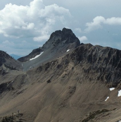
Cabin Creek Peak is of one Idaho’s true hidden treasures, This spectacular summit is located NNE of Stanley, Idaho on a ridge line that is sometimes identified as the Tango Peaks. This knife blade-shaped peak is composed of fine grained slabs granite that mostly aligned vertically. Cabin Creek Peak has only two known ascents. The first was in 1988 by Paul Bellamy, Dana Hanson and myself. The second was on October 8, 2023 by Kaden Platt, Stephen Schott and Brandon Powell. USGS Knapp Lakes
Cabin Creek Peak as viewed from Mount Loening.
Access
There are two access routes. Both are long and involved. The western access is the shorter approach and the recommended approach for both known routes.
The eastern approach is via Crimson Lake Trail, FST-202. [(F)(3.1)(a) Page 141]. This is a long approach. It is 9.2 miles with 2,365 feet of elevation gain just to reach Crimson Lake. To access the east face from the lake climb crosscountry southwest to the north shoulder of Cabin Creek Peak. Turn southeast and climb to the saddle at just under 9,400 feet and then descend to the base of the east face. This is by far the most scenic approach.
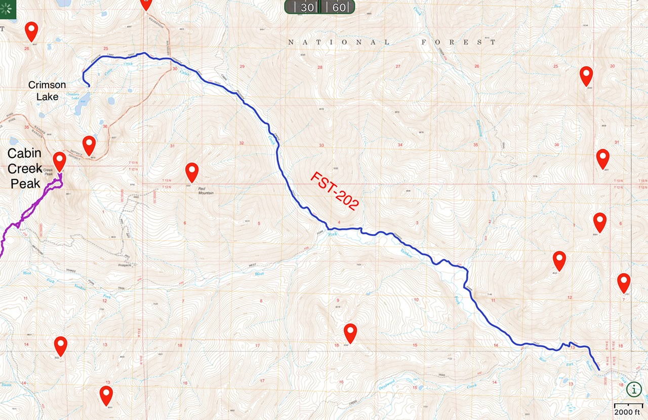
Crimson Lake Access
As noted above western approach is via the FST-032, Basin Butte Road, FS-032 [(F)(2) Page 141] is the recommended as the best approach both to the east face and the south ridge routes. Follow FS-032 from ID-21 past Basin Butte to a roughly 8,100 foot saddle NNE of Basin Butte in 11.4 miles. Kaden Platt got to this point in a Honda CRV. He notes that “if one had a high clearance 4×4, they could easily drive to Hindman Lake or closer towards Red Mountain.” Driving farther will, of course, shorten the self propelled distance covered by Platt, Schott and Powell that is described below.
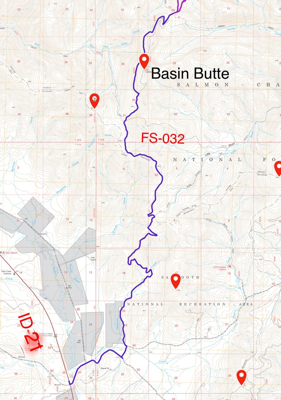
Basin Butte Access
East Face, Class 5.3
As noted above Paul Bellamy, Dana Hanson and I made the first ascent of the peak on August 8, 1988 via the East Face. This face is cut by three crack systems. With Paul leading, we climbed the southernmost crack. The route started out to the right of the gully on a small buttress and then moved up and to the left for one and a half pitches. The rock on this face is fine-grained granite with cracks that took small and mid-sized protection.
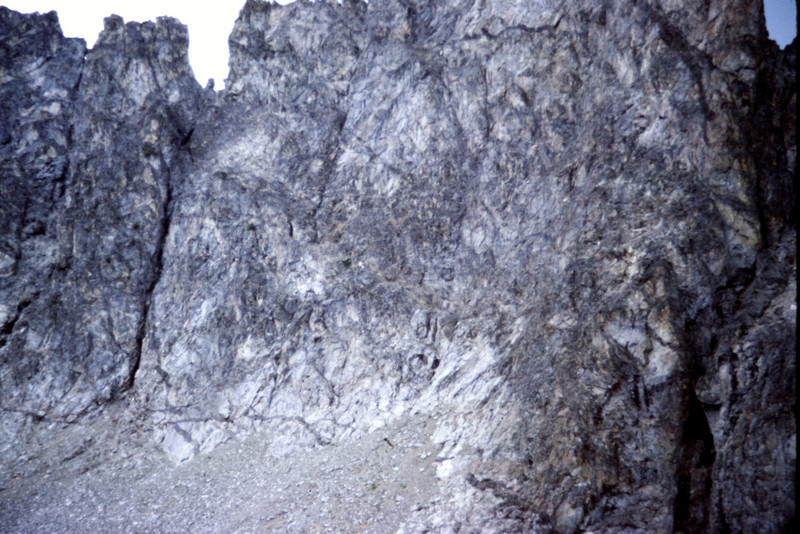
The lower East Face of Cabin Creek Peak. The first ascent starts just to the right of the southernmost gully on the face.
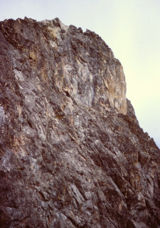
The mid and upper portion of the East Face.
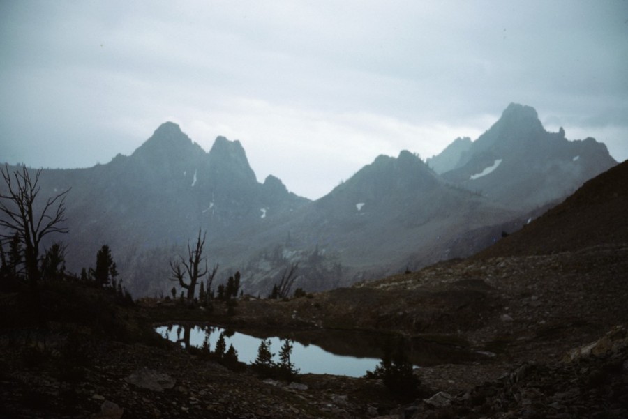
The Cabin Creek area on a rainy afternoon.
South Ridge, Class 4+
This route is 14.4 miles round trip and gains 3,700 feet of elevation round trip. From the end of FS-032 follow the trail as it meanders generally northeast to a junction with FST-155. (See the map below showing Kaden’s GPS track.) From this point climb northeast to the base of the south ridge. Kaden reports that “our route was mostly on Class 3 terrain with a few class 4 moves. Once the route reaches the crest of the south ridge, it moves out onto the east side of the ridge. From this point the climbing involves mainly side hilling and scrambling across the east side of the south ridge all the way to the summit.” See the following three photos.
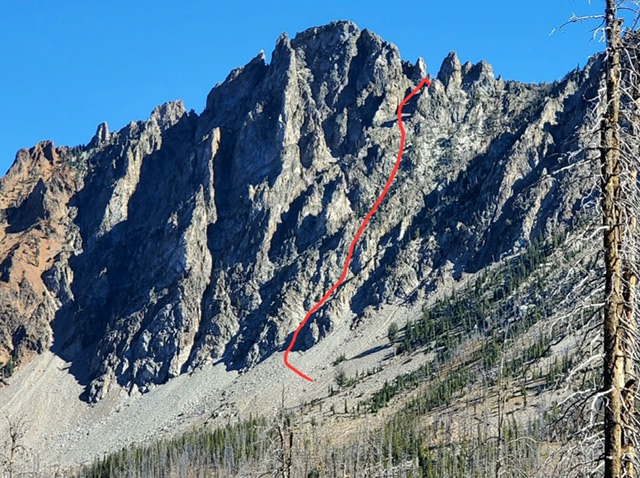
The route climbs up this line to reach the top of the south ridge and then crosses over to the east side of the ridge. Kaden Platt Photo
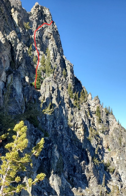
Kaden reports that the red line shows a rough estimate of the route took east side of the ridge, and goes around the false summit (highest point pictured) where the step around class 4 crux is. After that it’s an easy wide ledge walk, then a short class 3 scramble to the summit.” Kaden Platt Photo
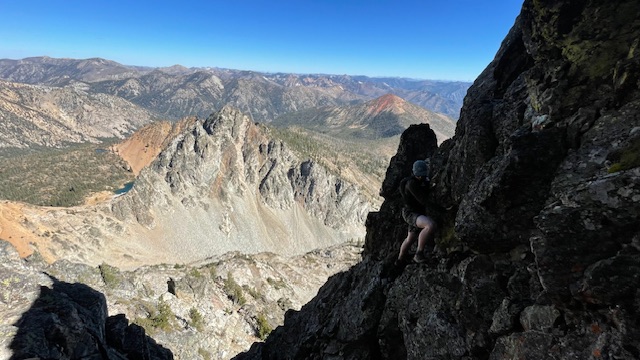
Stephen Schott Makes the crux move not too far from the summit. Kaden Platt Photo
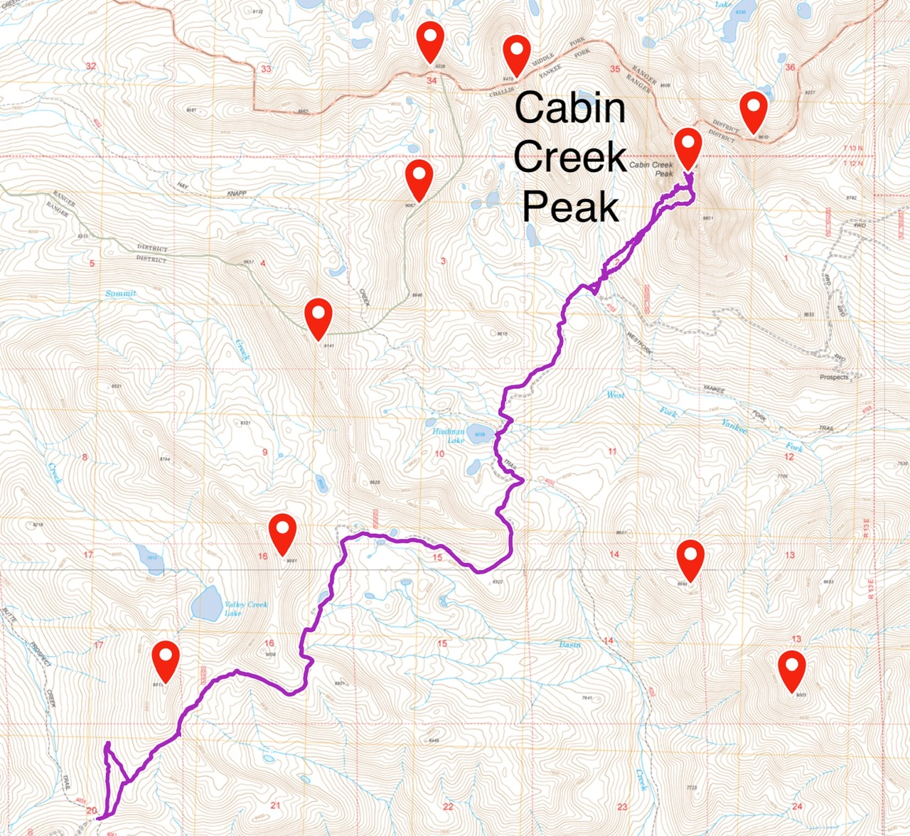
Kaden Platt’s GPS track.
Next: Skiing the Rim Road Around Crater Lake
Additional Resources
Regions: Eastern Salmon River Mountains->Salmon River Mountains->Southeast Corner Peaks->Tango Peaks->WESTERN IDAHO
Mountain Range: Eastern Salmon River Mountains
Year Climbed: 1988
First Ascent Information:
- First Ascent Year: 1988
- Season: Summer
- Route: East Face
- Party: Paul Bellamy, Dana Hansen and Tom Lopez
- Other First Ascent: South Ridge, Class 4+
- Year: 2023
- Season: Fall
- Party: Kaden Platt, Stephen Schott and Brandon Powell