Peak 7514 by Livingston Douglas

This peak is not in the book. The map elevation is 7,504 feet. Published December 2024 Thanks to LiDAR, Peak 7514 is now a ranked summit. It sits above the headwaters of both Aspen Creek and Left Fork Cherry Creek in the Bannock Range. Peak 7514 is the highest of a collection of foothills that are located south of Downey. … Continue reading

Peak 7480 by Livingston Douglas

This peak is not in the book. The map elevation is 7,475 feet. Published December 2024 Thanks to LiDAR, Peak 7480 is now a ranked summit. It sits above the convergence of the Middle Fork and Left Fork of Cherry Creek. Peak 7480 separates Mine Creek from Left Fork Cherry Creek. The peak is most easily climbed from the Middle … Continue reading

Swan Benchmark by Livingston Douglas

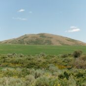
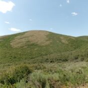
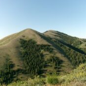
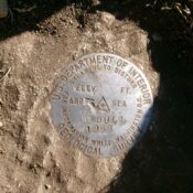
This peak is not in the book. Published December 2024 Swan Benchmark is located on a high ridge just southeast of Malad Summit. This ridge separates Devil Creek from Cherry Creek. Peak 7060 to its south-southeast is the high point on this ridge. This area is a mix of public land and posted, private land so be careful. This climb … Continue reading