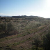
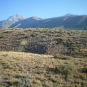
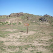
Bud Lewis Hill by Livingston Douglas

This peak is not in the book. Published November 2022 Bud Lewis Hill is located on the east side of the Rogerson-Jarbidge Highway. It is most easily climbed via its west face from the highway. This area is a mix of private and public land, so be careful. This hike is entirely on BLM land. USGS Cedar Creek Reservoir Access … Continue reading

Mud Flat Hill by Livingston Douglas

This peak is not in the book. Published November 2022 Mud Flat Hill is located at the crest of the Rogerson-Jarbidge Highway. It is on a ridgeline south of the highway. USGS Curtis Draw Access From Rogerson, ID, drive 29.9 miles west then southwest on the Rogerson-Jarbidge Highway to a crest in the road. Park in a pullout area here … Continue reading

Smelter Butte by Livingston Douglas

This peak is not in the book. Published November 2022 Smelter Butte is a minor butte that is located on the east side of FSR-134, just north of the Muldoon townsite and the junction of FSR-134 and FSR-126 at a private ranch entrance. This butte is on private land, though it is not fenced or posted. Please obtain permission from … Continue reading

Burnt Ridge by Livingston Douglas

This peak is not in the book. Published November 2022 Burnt Ridge is a rather unimpressive ridge that is located due north of Gopher Knoll and the King Hill Loop Road. It is just off I-84 and is east of the town of King Hill, Idaho. This is area is a mix of private and public land, so be careful. … Continue reading

Gopher Knoll by Livingston Douglas

This peak is not in the book. Published November 2022 Gopher Knoll is a small butte that is located just off I-84 and east of the town of King Hill. This is area is a mix of private and public land, so be careful. This hike is entirely on BLM land. Due to private land, Gopher Knoll is best climbed … Continue reading

Sugarloaf by Livingston Douglas

This peak is not in the book. Published November 2022 Sugarloaf is a handsome butte that is located on the south side of the Rogerson-Jarbidge Highway. It is most easily climbed from the northeast. This area is a mix of private and public land, so be careful. While the summit is on private land (not fenced or posted), almost all … Continue reading