Elevation: 3,160 ft
Prominence: 50
This peak is not in the book. Published November 2022
Burnt Ridge is a rather unimpressive ridge that is located due north of Gopher Knoll and the King Hill Loop Road. It is just off I-84 and is east of the town of King Hill, Idaho. This is area is a mix of private and public land, so be careful. This hike is entirely on BLM land. Due to a powerful canal that must be crossed, Burnt Ridge is best approached from the southwest. USGS Ticeska
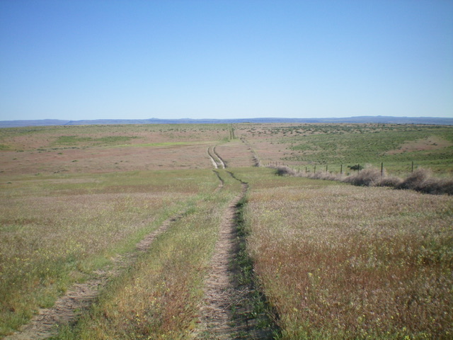
Burnt Ridge (the grassy ridge in mid-ground) as viewed from the south on the 2-track road. Livingston Douglas Photo
Access
From Exit 129 on I-84, drive north on Old Highway 30 for 0.1 miles to a signed junction with East Allen Road (“Gopher Knoll Road” on maps). Turn right onto East Allen Road and drive northeast then east for about 1.7 miles to a signed junction with Gopher Knoll Road. Turn left/north onto Gopher Knoll Road and drive about 0.2 miles to a “T” junction with King Hill Loop Road/1750S. Turn left/west onto King Hill Loop Road and drive about 0.3 miles to the crossing of a canal that has a dirt road on both sides of it.
These dirt roads are on the right/north side of King Hill Loop Road. Getting across this wide, powerful canal is the key to this hike. Turn right/north onto the second (leftmost) of the two dirt roads and drive 0.1 miles to a parking area at a split in the canal. You have now crossed both forks of the canal (via culverts) and can now avoid that water problem and successfully reach the summit of Burnt Ridge. Park at this canal fork (3,005 feet). You are now on the north side of the main canal. GPS coordinates: 42⁰58’07”N, 115⁰07’26”W.
South Ridge, Class 2
The Climb
From the canal fork, you can follow the 2-track road that is on the left/west side of the canal. The summit high point is about 50 yards right/east of the 2-track road. This was my descent route (South Face Route). Not knowing that the 2-track road (not shown on any maps) was heading to the summit, I followed the terrain to reach the top, only using the 2-track road for part of the ascent.
From the canal fork, hike up the 2-track road as it heads northeast up to Point 3129 then follow the 2-track road as it drops northeast down to a saddle of sorts. The road turns sharply left/north here and follows a fence row. Leave the road and bushwhack east up onto the wide, weaving south ridge through endless sagebrush. Follow the tedious, sagebrush-covered ridge northward to reach the summit. The summit is unimpressive. Point 3046 to the west is far more impressive. The summit hump is barely distinguishable as you approach it from the south, via either the ridge or the 2-track road. A most disappointing finish to the hike.
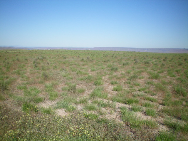
The flat, grassy summit area of Burnt Ridge. Livingston Douglas Photo
South Face, Class 1
The Descent
From the summit, follow the 2-track road all the way back down to the canal fork and your parked vehicle. The road route requires more ups and downs but is far superior to the ridge route because of the thick, awful sagebrush on the ridge proper.
Additional Resources