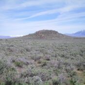
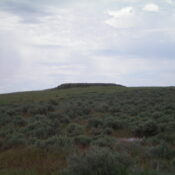
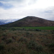
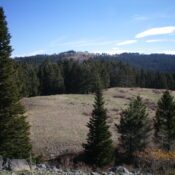
Peak 8313 by Livingston Douglas

This peak is not in the book. The elevation and prominence figures reflect recent LiDAR updates. Updated March 2025 Peak 8313 is one of several peaks that are near, or on, the Fourth of July Ridge deep in the Caribou Range due west of the north end of Palisades Reservoir. This climb is the second of a foursome that includes … Continue reading

Peak 7466 by Livingston Douglas

This peak is not in the book. Published December 2020 Peak 7466 is a thickly-forested hump that is located on the south side of FSR-017 about a mile east of FSR-075/Skyline Road. It is most easily climbed via its forested north ridge. Please be aware that hunters frequent this area in the Fall and hunting camps are likely to be … Continue reading

Lone Pine Ridge by Livingston Douglas

This peak is not in the book. Published December 2020 Lone Pine Ridge is one of many named ridges in this area of the Caribou Range. There is a jeep/ATV road (FSR-017) that crosses Lone Pine Ridge just over 0.3 miles from the summit high point. To make it a more meaningful endeavor, combine this hike with a climb of … Continue reading

Commissary Ridge by Livingston Douglas

This peak is not in the book. Published December 2020 Commissary Ridge is one of many named ridges in this area of the Caribou Range. It is one of the bigger ridges in the area and has a jeep/ATV road (FSR-017) leading to the ridge crest about a mile northwest of the summit. You must hike an old 2-track road … Continue reading

Black Cap Peak by Livingston Douglas

This peak is not in the book. Published December 2020 Black Cap Peak is an isolated hump that separates Graveyard Canyon from the Dry Fork Creek Valley. The only black rock is on the summit cap. Prior to reaching that area, this is a scrub-bashing climb after leaving Graveyard Canyon Road. The summit offers a magnificent aerial view of the … Continue reading

Peak 7391 by Livingston Douglas

This peak is not in the book. Published December 2020 Peak 7391 is a small, ridgeline summit that is located just north of the north end of Deadhorse Ridge and southeast of Currant Hollow. It separates the Horse Creek drainage from the Squaw Creek drainage. It is most easily reached via FST-267 (an ATV trail). USGS Conant Valley Access From … Continue reading