Elevation: 9,294 ft
Prominence: 514
This peak is not in the book. Jared ventured into this extremely remote section of the Sawtooth Wilderness climbing Big Buck Mountain, Peak 8662, and Smoky Peak in an epic journey. His trip report is set out below covers his journey from Big Buck Mountain to Smoky Peak. See the Big Buck Mountain page for the first part of the journey. Published August 2022
Smoky Peak is located on the western side of the Sawtooth Wilderness due east of Big Buck Mountain. USGS Nahneke Mountain
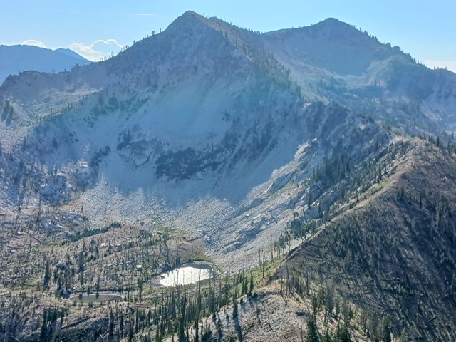
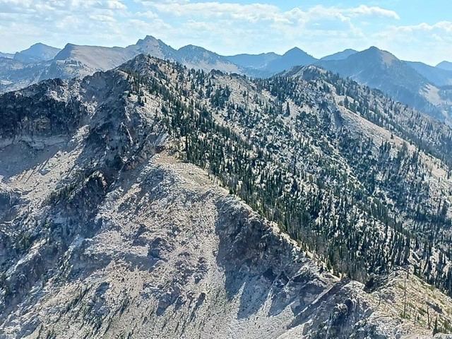
Descent from Point 8662 looking down to the small lake and connecting ridge to Smoky Peak. Jared Empey Photo
Access
See Big Buck Mountain.
Peak 8662 to Smoky Peak, Class 3
From Peak 8662, you get your first good view of the true test that lies ahead and the ruggedness that makes up this remote objective that is Smoky Peak. I quickly descended the connecting east ridge from Point 8662 to about 8,200 feet with a small lake below the ridge. This lake may be a lifeline in case you run out of water. It is easy to access so take advantage if needed.
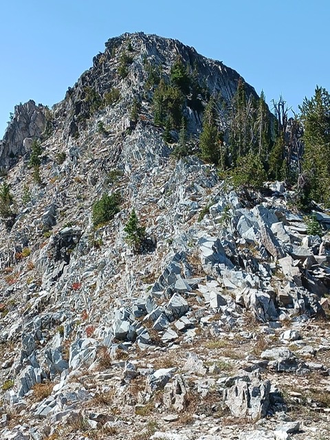
Next, ascend the ridge and enter the most rugged section. I counted six towers blocking the path to the lower north summit. Towers 1, 2, 5, and 6 can be bypassed but Towers 3 and 4 must be climbed. Tower 3 is Class 3 but requires you to go across a knife-edged ridge. Tower 4 requires hard Class 3 climbing and could arguably be rated Class 4.
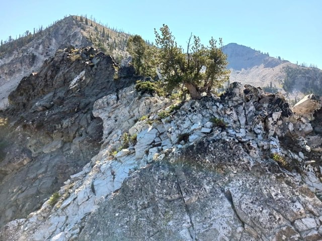
Knife-edged section of Tower 3. Jared Empey Photo
After navigating the towers, ascend to the north summit at 9,161 feet. The final summit block is Class 2+ if you stay on the right-hand side. From the summit, great views unfold of the Western Sawtooth Range. Perhaps never before climbed, Edaho Mountain looms close with the mysterious Rakers dazzling up close. Then, other peaks such as Anderson Peak (9,705 feet), Tackobe, and Picket are also visible.

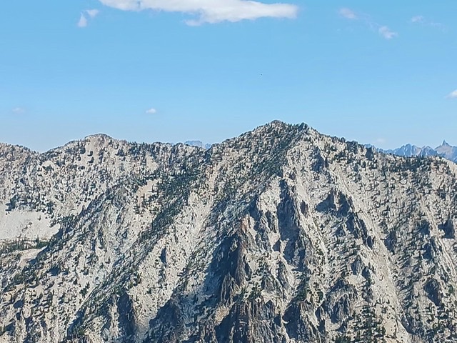
Ridge leading up to Point 9161. Jared Empey Photo
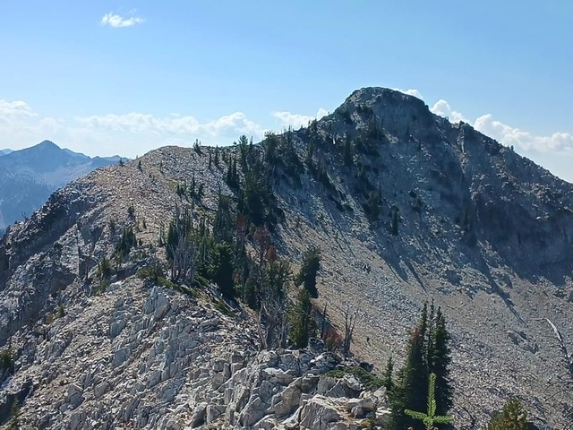
Summit ridge to Smoky Peak. Jared Empey Photo
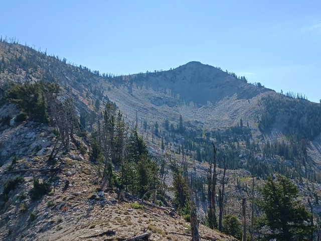
Smoky Peak as viewed from the north ridge. Jared Empey Photo
This one was so exerting, I let out two “Wahoo!” yells from the summit in honor of Erik Pohlmann’s videos that inspired me to get into hiking after my son’s passing five years before.
The Smoky Peak summit block. Jared Empey Photo
On top, I also noticed the extreme remoteness of the area and could not detect any prior human activity at the summit or on the ridge and quickly built a summit cairn. As I learned in business under review, if it is not documented, it did not happen. Therefore, I wish to claim this successful climb as a first ascent of Smoky Peak!
The pleasure of summiting complete, the slog began. To conserve water, I rationed what I had and struggled up each hill and returned to Big Buck around 4:00PM where I stashed one of my four water bottles. This sustained me until I was able to arrive at the North Fork where I drank to my delight. I arrived back at my ATV at about 6:30PM tired, satisfied, and ready for bed.
Jared’s GPS track. Trip stats: 5,300+ feet of cumulative climbing and approximately 15 miles.
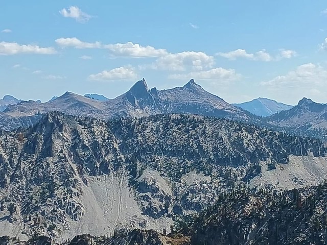
The Rakers as viewed from Smoky Peak. Jared Empey Photo
Edaho Mountain as viewed from Smoky Peak. Jared Empey Photo
The connecting ridge between Smoky Peak and Peak 9344 to the east. Jared Empey Photo
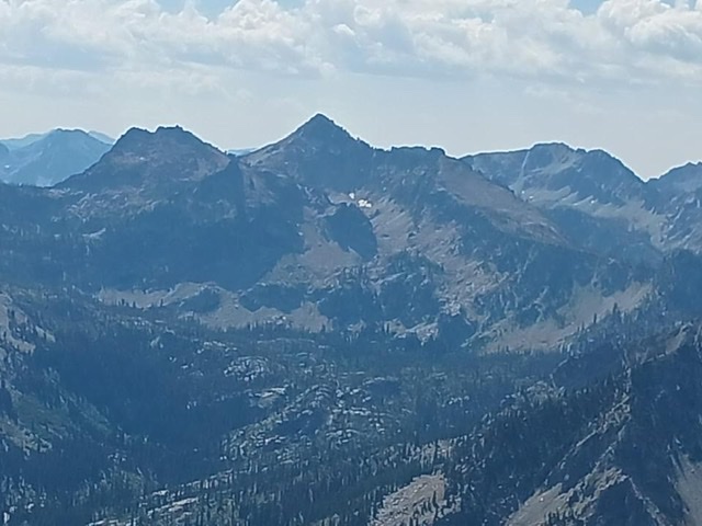
Peak 9704 (Anderson Peak) as viewed from Smoky Peak. Jared Empey Photo
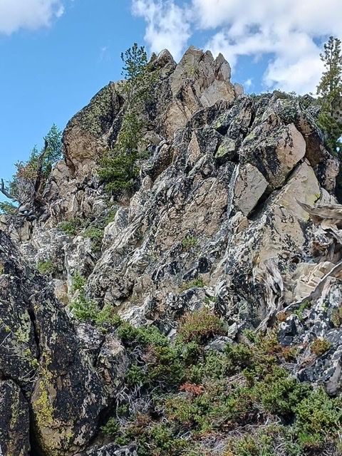
Class 3+ tower. Jared Empey Photo
Additional Resources
Regions: Northwest Peaks->Sawtooth Range->WESTERN IDAHO
Mountain Range: Sawtooth Range
Longitude: -115.16579 Latitude: 43.98819