Elevation: 8,777 ft
Prominence: 786
This peak is not in the book. Jared ventured into this extremely remote section of the Sawtooth Wilderness climbing Big Buck Mountain, Peak 8662, and Smoky Peak in an epic journey. His trip report is set out below and continues on the Smoky Peak page. Published August 2022
Big Buck Mountain is located on the western edge of the Sawtooth Wilderness, northeast of Graham. USGS Nahneke Mountain
The summit of Big Buck Mountain. Jared Empey Photo
Access
Graham Guard Station Road/FS-320 and Bayhorse Trail [(B)(6)(a) on Pages 209-210].
Jared’s Route, Class 2
8/26/22. As a child, I loved the series Star Trek because of the crew’s intrepid desire to boldly go where no man has gone before. In researching this area, I noted from the Tom Lopez website that Big Buck Mountain and Smoky Peak had no documented successful summit attempts. I hoped to change that.
The day started out with adventure at 3AM with the sounding of the alarm. At 4AM, I was on the road with the ATV down Forest Road 312 and coasted nearly into the Graham trailhead and was down the Bayhorse Trail at 5AM. The first section of this trail is reasonably well maintained, although it is obvious that wilderness is a magnet to blowdowns and a repellant to trail maintenance. Within the first five minutes, I crossed Cow Creek without getting my feet wet but soon arrived at the North Fork Boise River. In the dark, it was difficult to tell where to reach the river to cross (I now put cairns to assist) and I briefly got disoriented. I soon found a reasonable place to put on some old tennis shoes for a crossing. However, once across, I struggled to find the right exit point and had to travel downstream, thankfully, finding a helpful cairn.
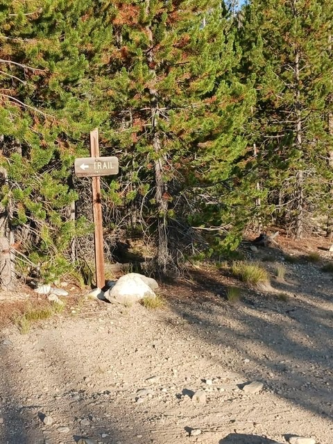
Sign showing the turn to the trailhead from Forest Road 312. Jared Empey Photo
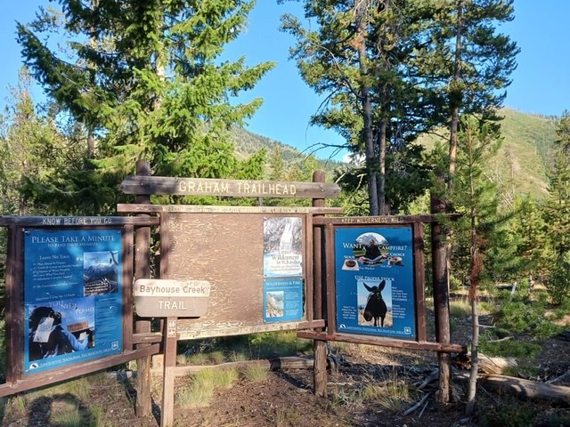
Graham trailhead. Jared Empey Photo
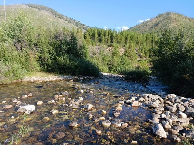
Crossing at the North Fork Boise River. Jared Empey Photo
Overgrowth along the Bayhorse Trail. Jared Empey Photo
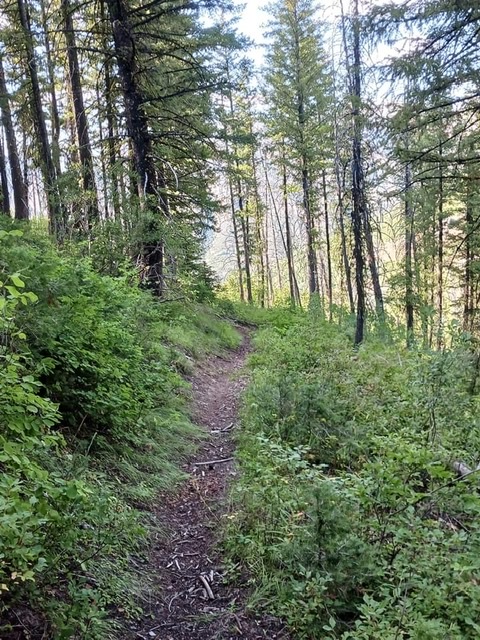
Upper section of Bayhorse Trail. Jared Empey Photo
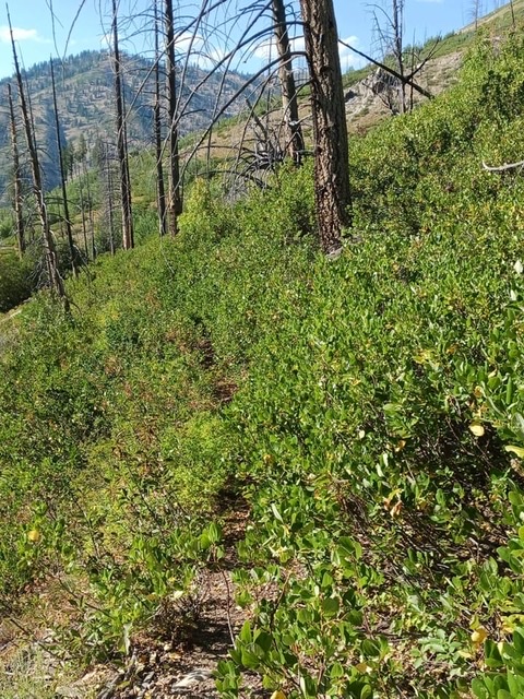
I soon stashed some of my stuff and headed down the trail that was intermittently covered with buck brush and quickly came to a fork in the trail with a blown-down sign. I took the right fork and headed up the trail. I soon learned why Big Buck has its name. It is not due to the above-average wildlife but the 8′-10′ tall buck brush that blocks the path. Sometimes you must fight through as if you were in a jungle. Do so for about 1.25-1.50 miles.

Beginning of sagebrush hill ascending to Big Buck Mountain. Jared Empey Photo
Eventually, you emerge in an old burned section with a noticeable cairn on your left. Cross the creek (which will likely be dry) and follow this trail until you reach the top of the trail at approximately 7,000 feet. This higher section is a nice relief from the lower overgrowth. In addition, the upper section is a mature, healthy forest.
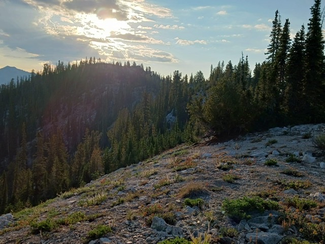
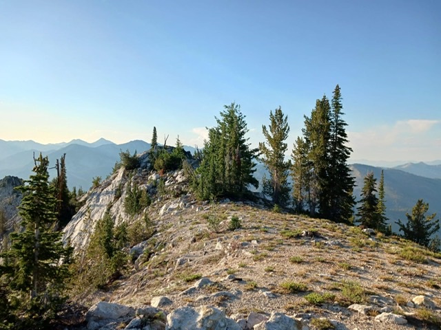
The west summit ridge of Big Buck Mountain. Jared Empey Photo
Now begin ascending a sagebrush hill with sparse trees for 1,700 vertical feet and one horizontal mile to reach the summit ridge. After gaining the ridge, proceed to the summit which is marked with a benchmark. From the top, the morning was new but the next summit (Smoky Peak) still looked far away. Commentary continues on the Smoky Peak page.
The summit of Big Buck Mountain. Jared Empey Photo
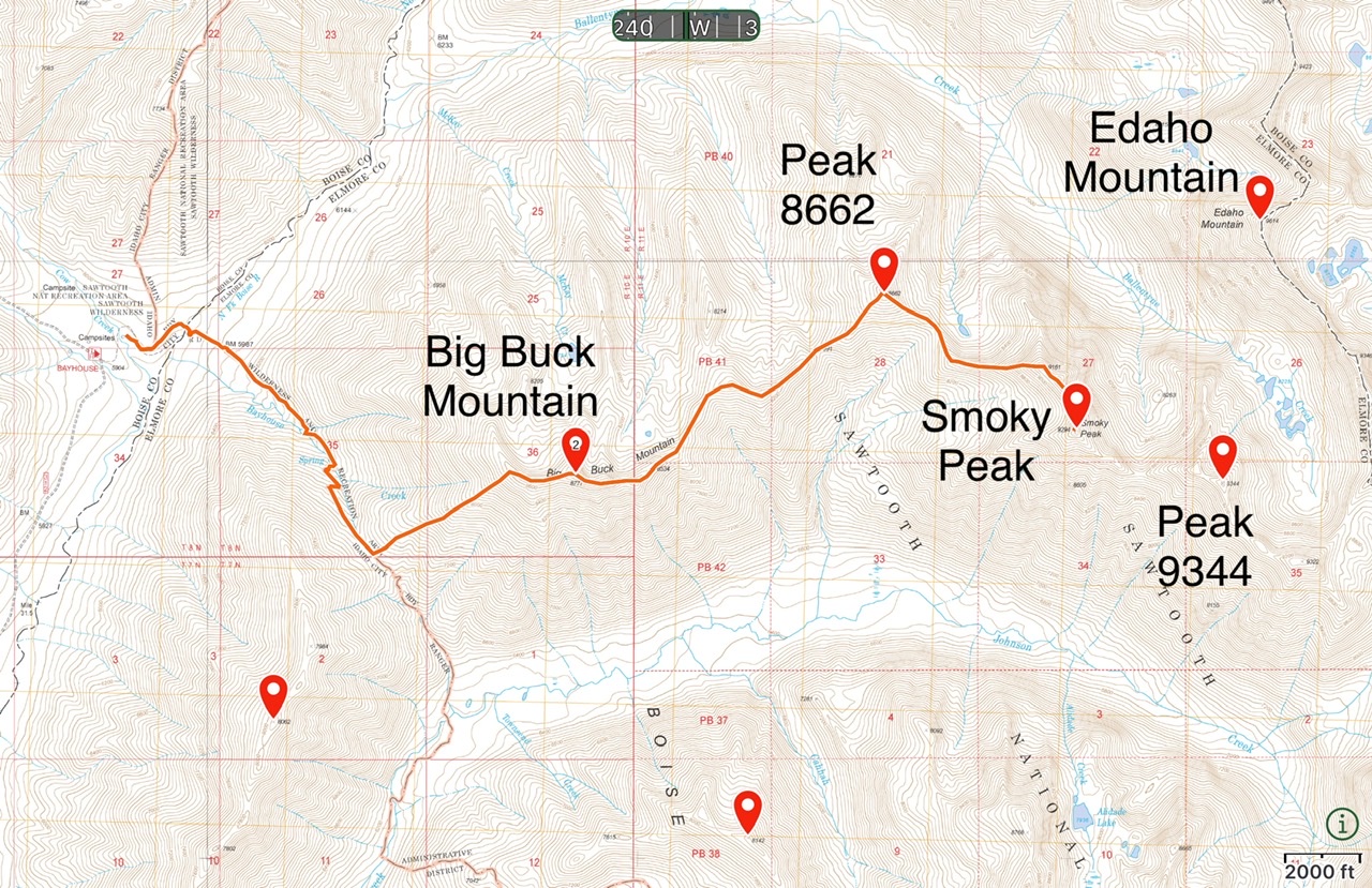
Jared’s GPS track. Trip stats: 5,300+ feet of cumulative climbing and approximately 15 miles.
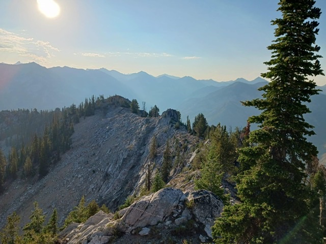
Looking east from the summit of Big Buck Mountain at the eastern ridge towers. Jared Empey Photo
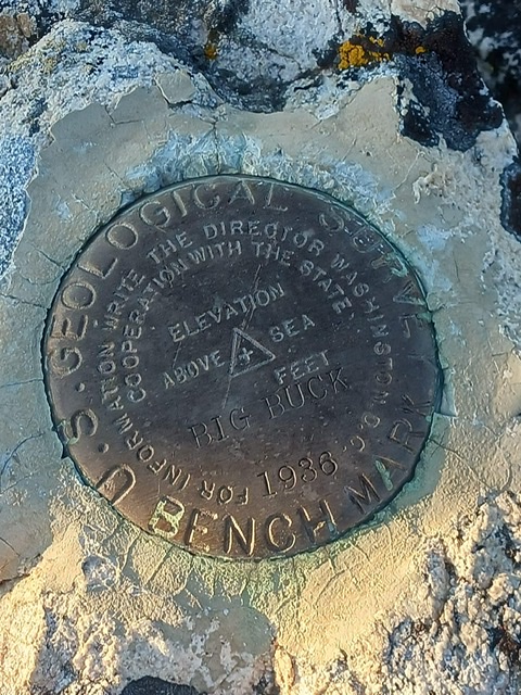
Big Buck benchmark. Jared Empey Photo
Additional Resources
Regions: Northwest Peaks->Sawtooth Range->WESTERN IDAHO
Mountain Range: Sawtooth Range
Longitude: -115.21429 Latitude: 43.98509