Elevation: 9,000 ft
Prominence: 300
This peak is not in the book. The route for this peak is part of a 3-peak ridge traverse that starts with Oliver Peak. Published November 2022
South Oliver Peak is located due south of Oliver Peak and is on a ridgeline that marks the boundary between Bonneville County and Teton County. It sits at the top of the Elbow Fork of Palisades Creek. USGS Victor
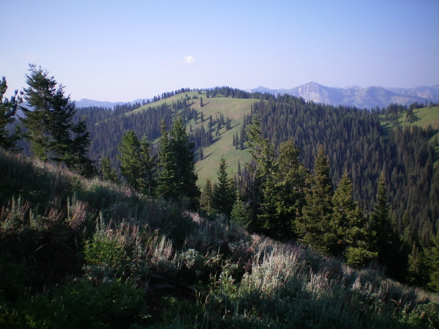
View of South Oliver Peak from high on Oliver Peak to its north. The summit is just left of center. Livingston Douglas Photo
Access
Same as for Oliver Peak. This is the second leg of a 3-peak journey that begins near the Mike Harris Campground. This adventure includes Oliver Peak (9,004 feet), South Oliver Peak, and Peak 8710. It covers 13.5 miles with 4,050 feet of elevation gain round trip.
East Face, Class 2
The Climb
From the 8,520-foot connecting saddle with Oliver Peak, follow FST-203 south up the east face of South Oliver Peak. Leave the trail after it reaches the open northeast side of the peak. Scramble right/west up through short scrub/grass to reach the summit. The summit has some thick-ish sagebrush but no summit cairn.
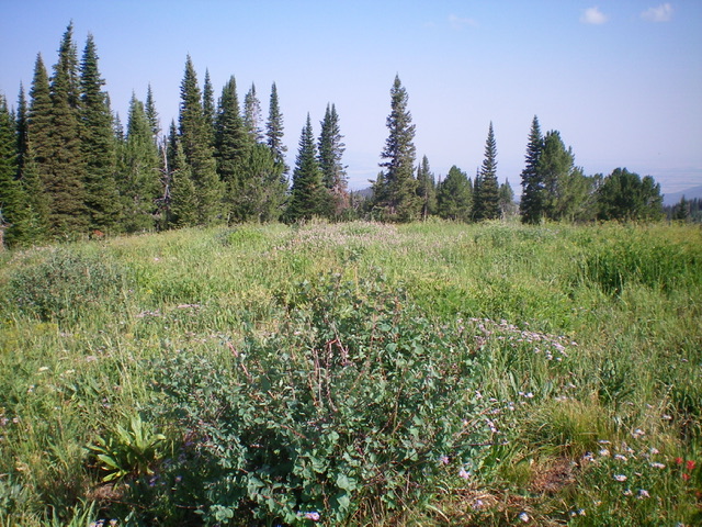
The brushy, open summit of South Oliver Peak. The bush in the foreground is the high point. Livingston Douglas Photo
Northwest Gully/Elbow Fork, Class 2
The Descent
From the summit, return back to the 8,520-foot connecting saddle at the head of the Elbow Fork of Palisades Creek. Leave the trail here and descend northwest into the drainage on a use trail. The Elbow Fork is initially dry but then becomes a substantial creek as you descend its right/northeast side on the use trail. The use trail is quite overgrown in open (non-forested) areas and can be difficult to follow in the tall field grass.
The use trail eventually reaches a “T” junction with [unsigned] FST-095. Go right/northeast up the trail briefly to reach an unsigned junction. At this junction, head left/northwest through open grass to quickly reach the crest of a shoulder and yet another unsigned junction. Go left/southwest at this junction onto FST-174 and descend the ridge into the forest and a saddle at 8,120 feet. This saddle is at the base of the east ridge of Peak 8710 and concludes the second leg of today’s journey. Peak 8710 is up next.
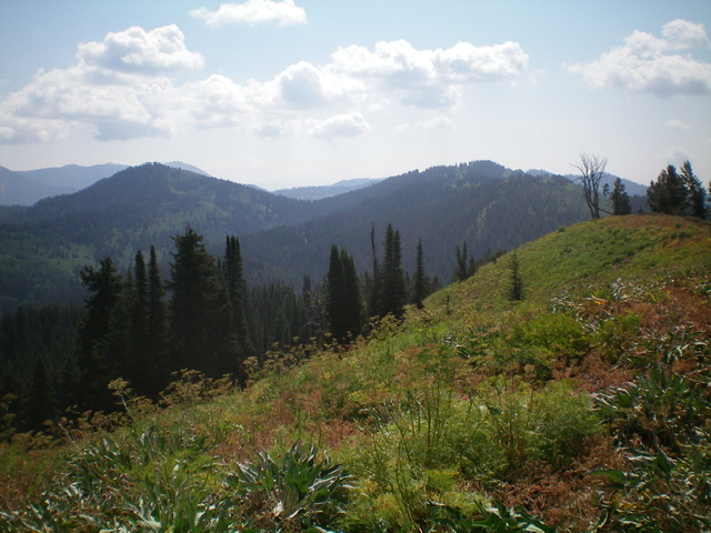
View of Oliver Peak (left hump in mid-ground) and South Oliver Peak (right hump in mid-ground) as viewed from the west. Livingston Douglas Photo
Additional Resources
Mountain Range: Big Hole and Snake River Mountains
Longitude: -111.05779 Latitude: 43.50889