Elevation: 9,004 ft
Prominence: 484
Climbing and access information for this peak is on Page 339 of the book. This is the first peak of a 3-peak ridge traverse. Published November 2022
Oliver Peak is located at the head of Stateline Canyon. It towers over WY-22 and is close to the Idaho/Wyoming border.This is the first leg of a 3-peak adventure that includes Oliver Peak, South Oliver Peak (9,000 feet), and Peak 8710. It covers 13.5 miles with 4,050 feet of elevation gain round trip. USGS Victor
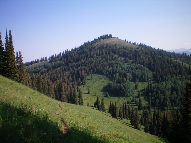
Oliver Peak as viewed from the south. Livingston Douglas Photo
Book Updates/Corrections
Please note that the book refers to the trail as FST-049 (Pages 339 and 342) but it is actually FST-203. It is Mikesell Canyon, not Micksell Canyon (Page 342). And it passes the west side of Oliver Peak so it crosses the southwest slopes not the southeast slopes (Page 339).
Access
From the junction of ID-31 and ID-33 in Victor, drive south on ID-33 for 3.7 miles to the [signed] turnoff for Mike Harris Campground. Drive south on the access road that leads to the campground. At 0.1 miles, reach a sharp right/west bend in the road and a poorly-marked trailhead for FST-201. Park along the road here where there is room for two vehicles (6,550 feet). The campground entrance is 0.1 miles to the west from here. Do not drive all the way to the campground since the trail is not there.
West Ridge, Class 1+
The Climb
From the signed trailhead, hike south on FST-201 for 0.4 miles to the mouth of Mikesell Canyon and a signed trail junction. Go right/southwest here onto FST-203 and hike 2.2 miles up Mikesell Canyon to reach the ridge crest at the head of the canyon and an unsigned trail junction. FST-203 goes straight/southeast here and FST-203A (shown on the Caribou-Targhee National Forest map but not shown on the USGS topo map) goes right/south here. Continue straight on FST-203 which is now a narrow footpath through thick brush and veg.
Skirt the left/east side of Point 8490 and continue southeast to reach the west side of Oliver Peak at a line between forest and open veg. Leave the trail here (small cairn here) and follow a use trail near the forest’s edge eastward all the way to the summit. The use trail is quite weak in spots so some degree of bushwhacking through thick veg is required. The summit of Oliver Peak has magnificent views and a nice summit cairn.
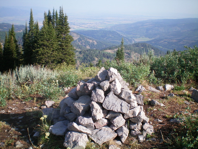
The summit area of Oliver Peak and its large summit cairn. Livingston Douglas Photo
The Descent
Return back down to FST 203. Follow FST-203 southeast then south to the 8,520-foot connecting saddle with South Oliver Peak. This concludes the first leg of today’s 3-peak adventure. South Oliver Peak (9,000 feet) is up next.
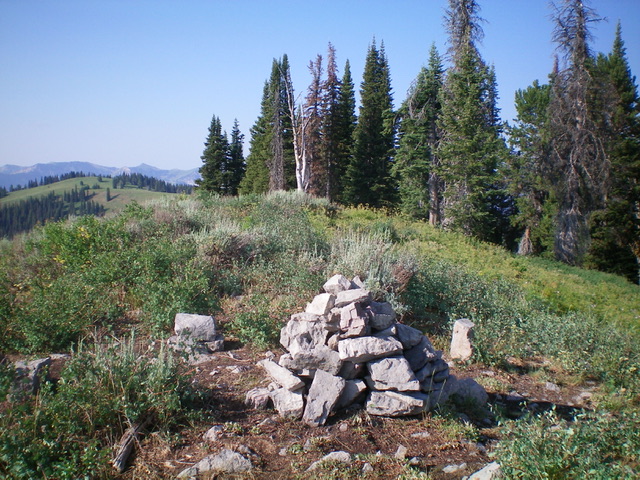
Looking back down Mikesell Canyon (ascent route) from the summit of Oliver Peak. Livingston Douglas Photo
Additional Resources
Mountain Range: Big Hole and Snake River Mountains
Longitude: -111.05589 Latitude: 43.51959