Elevation: 6,939 ft
Prominence: 679
This peak is not in the book. Published November 2022
Peak 6939 is the high point on a ridge that is located northeast of Toponce Creek in the Portneuf Range. This peak is in open scrub terrain and is an easy climb. Peak 6939 is most easily climbed via its southwest ridge from Toponce Canyon Road/FSR-375. USGS Jeff Cabin Creek
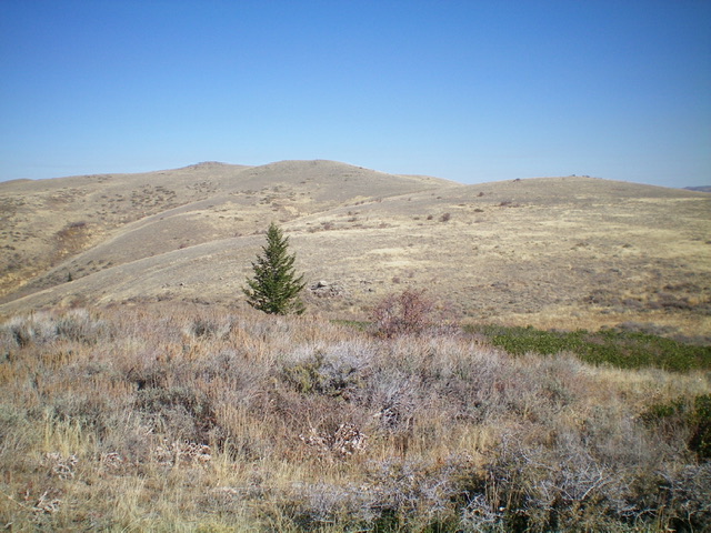
Peak 6939 (center hump) as viewed from the west. Point 6191 is the right hump and is at the base of the southwest ridge. Livingston Douglas Photo
Access
From US-30 on the east side of Lava Hot Springs (12.5 miles east of Exit 47/McCammon on I-15), drive north on [unsigned] Old Highway 30 for 10.7 miles to a signed junction with Kelly Toponce Road. Turn left onto Kelly Toponce Road and drive 7.1 miles north on the paved road to a signed junction with Toponce Canyon Road/FSR-375. Drive 5.1 miles up Toponce Canyon Road to a large pullout at a cattle fence on the right/north side of the road. Park in this pullout (5,865 feet). GPS coordinates: 42⁰52’37”N, 112⁰03’38”W.
Southwest Ridge, Class 2
The Climb
From the parking pullout, jump a cattle fence and scramble east up a steep scrub slope with some loose underlying scree to reach gentle Point 6191. You are now on the crest of the southwest ridge of Peak 6939. Follow the open ridge northeast then east up to Point 6831. The ridge terrain is a mix of easy scrub and thick patches of sagebrush and other veg. Game trails usually help through the thicker sagebrush/veg. From Peak 6831, drop northeast through a patch of thick scrub to a minor saddle. From the saddle, continue northeast to another hump, where the ridge bends left-ish/north.
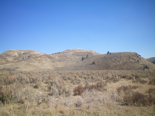
Peak 6939 (small hump in distance, well left of center) as viewed from high on the southwest ridge. Livingston Douglas Photo
Head north over yet another false summit to finally reach the elusive summit hump of Peak 6939. The high point is the highest of the large ground boulders on the summit area. There is a small cairn atop the highest boulder. The summit hump is not visible until you almost get there. The southwest ridge undulates and meanders quite a bit so be alert to stay on it, particularly during the descent. This ridge climb seems to take forever, given all of the minor ups and downs along the way.
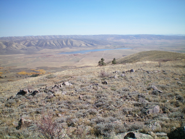
Summit view from atop Peak 6939. Livingston Douglas Photo
Additional Resources
Regions: Portneuf Range->SOUTHERN IDAHO
Mountain Range: Portneuf Range
Longitude: -112.03829 Latitude: 42.88659