Craig Gulch is the next major gulch located north of Leslie Gulch. Craig Gulch and lower Three Finger Gulch are accessed by a long, rugged 4WD road that is accessed from the Leslie Gulch Road. There are thirteen summits accessible from this road including the four forbidding peaks towering over lower Three Finger Gulch.
Directions
To reach Craig Gulch, take the Leslie Gulch Road. To reach the Leslie Gulch Road, drive US-95 south from its junction with ID-55, which is just east of Marsing, Idaho. From US-95, turn west onto McBride Creek Road and follow this good gravel road for 8.0 miles to Rockville where there is a small elementary schoolhouse and several ranches. Turn west onto the Succor Creek Road. [Note: The Succor Creek Road is also accessible from either Oregon Highway 201 to the north or US-95 to the south.] The Succor Creek Road/Leslie Creek Junction is signed. Turn west onto Leslie Gulch Road. Turn west and follow this road 3.8 miles to the junction with Craig Gulch Road. There are BLM sign boards at this junction but I have never observed anything posted on them.
Mileages from the Craig Gulch/Leslie Gulch Junction:
- Acton Butte Access (4.2 miles)
- Owyhee Trail Road (4.8 miles)
- Peak 4220 Access (5.3 miles)
- Road’s End/Three Finger Gulch (8.5 miles)
Caution: The Craig Gulch Road is a true 4WD Road and is used more by ATVs than 4WDs. The Oregon Owyhee peaks are desert peaks. Remember above all else that this is wild, remote desert country. Be prepared for difficult and sometimes treacherous travel conditions including bad and/or impassable roads, heat, rattlesnakes and every other conceivable hazard found in desert terrain. Take a 4WD vehicle with good all-terrain tires (6 or more ply sidewalls). Don’t depend on cell phone coverage. Buy BLM Surface Management maps to supplement topographic maps. Keep your gas tank full. Don’t expect anyone to find you if you get stuck or if your battery goes dead. Consider taking an emergency car battery as a backup. A shovel is a necessity and chains are essential in wet weather.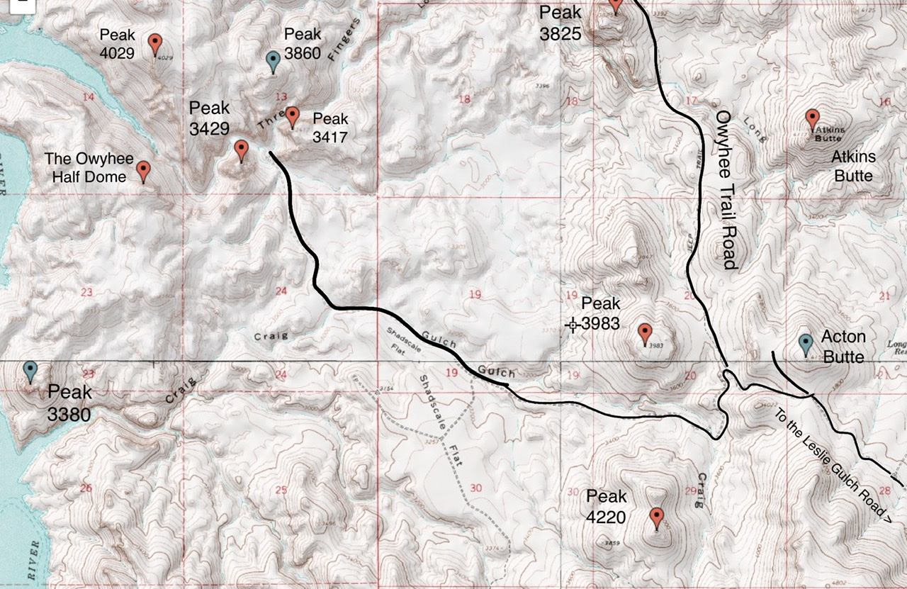
Craig Gulch Corridor Peaks
The following peaks are listed from east to west.
-
Acton Butte, Class 2
This peak is located on the north side of the Craig Gulch Road. A 4WD road leads from the main Craig Gulch road to the saddle on the butte’s west side. From this saddle hike west and then southwest across a series of short walls that comprise the summit.
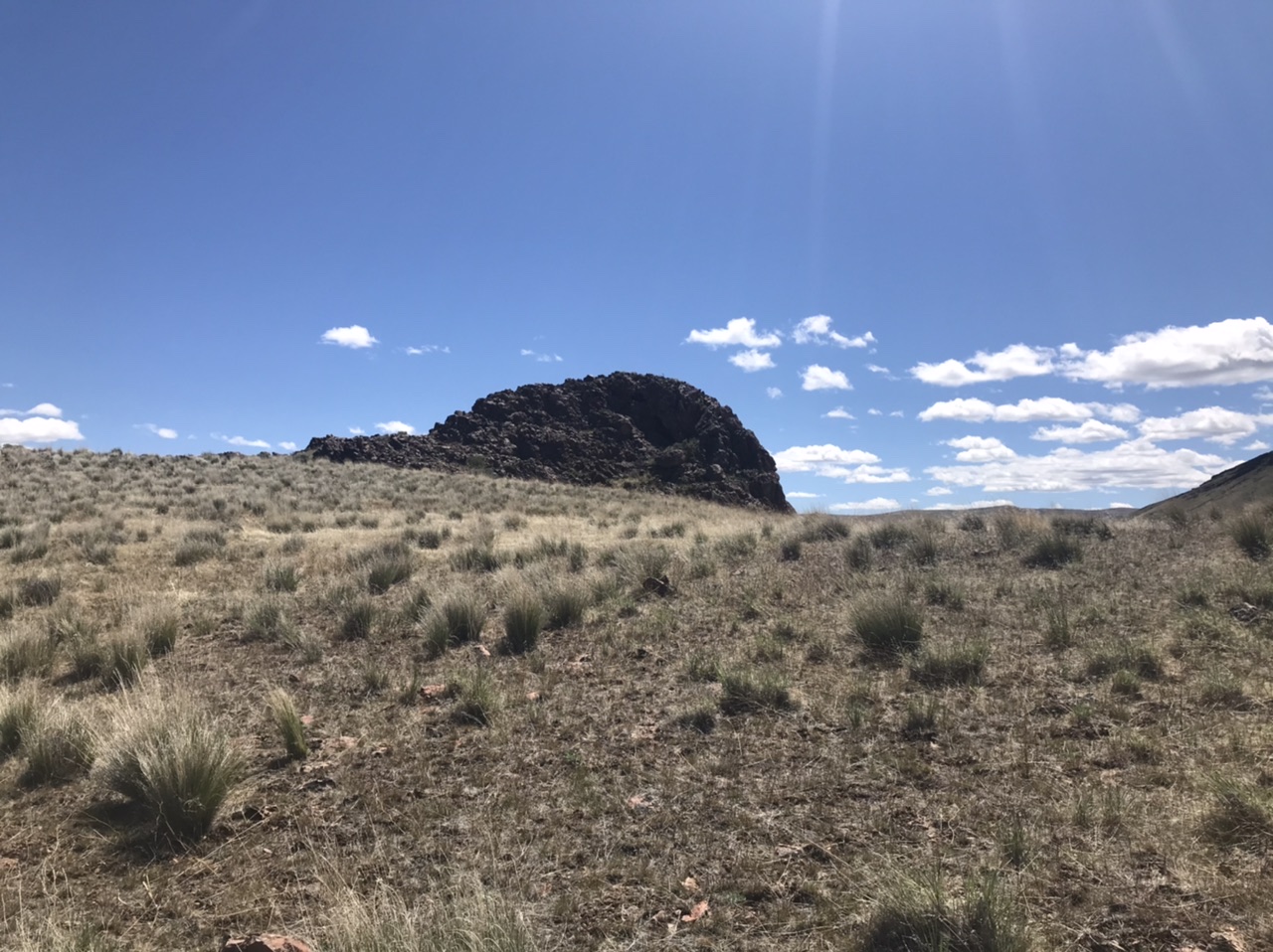
The rocky summit block on Acton Peak
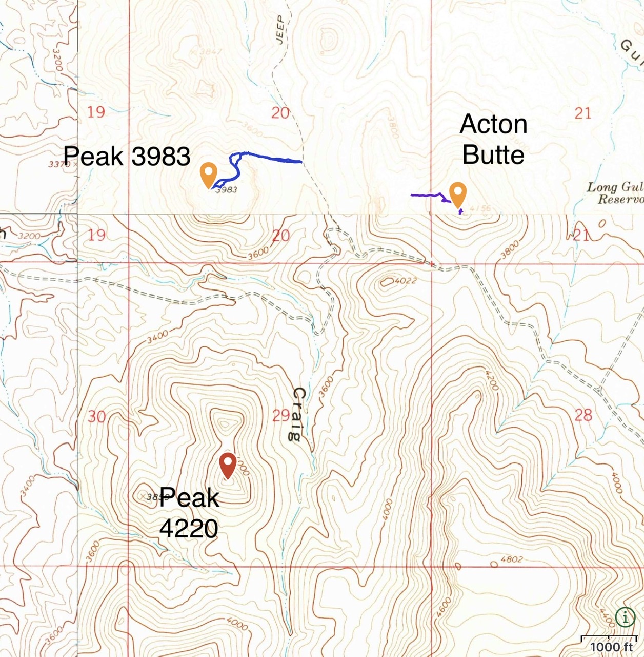
GPS tracks for Peak 3983 and Acton Butte.
-
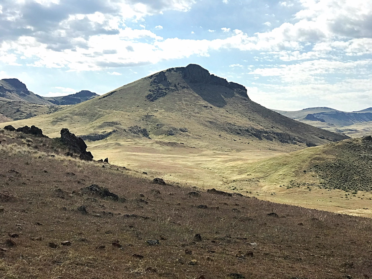
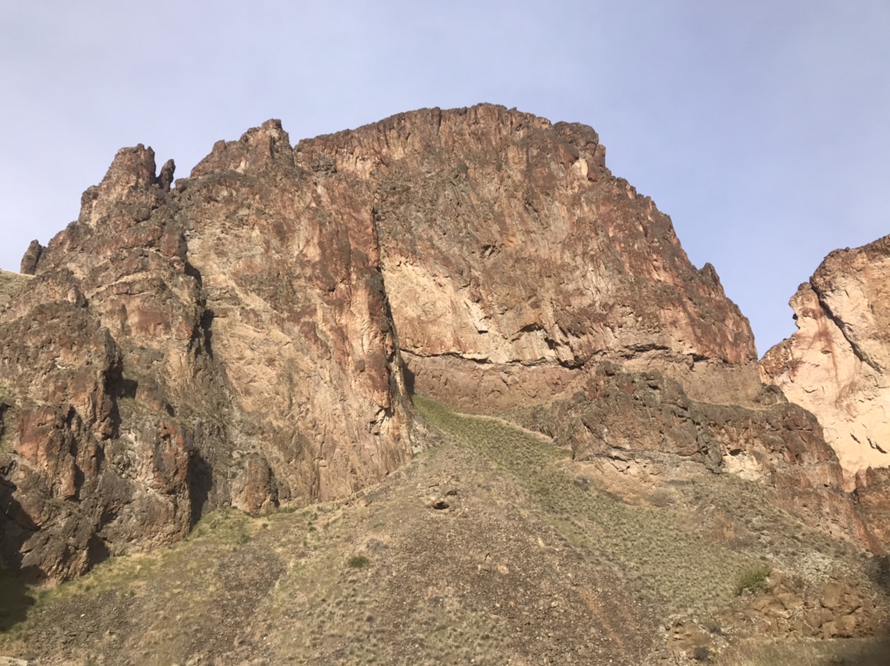
Peak 3825
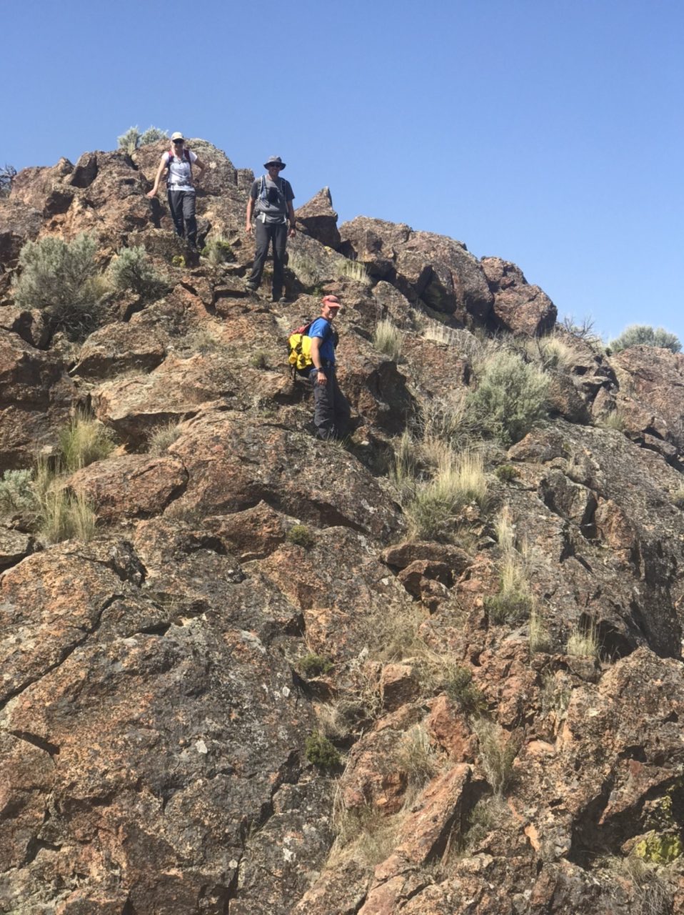
This summit with a bulging summit block is located northwest of Atkins Butte. Access is from the Owyhee Trail Road. Leave the Craig Gulch Road 4.8 miles from its start (just north of Peak 3983). Follow the road to the pass on the peak’s eastern side and park. From here (see the map below), climb up and around the peaks grassy lower slopes. Once on the west side of the summit block, climb up toward the west edge of the block. Look for a 25-foot, Class 3 chimney. Climb the chimney, turn right, and walk 10 feet to the top. Round trip stats: 0.5 miles with 365 feet of elevation gain.

Peak 3825 as viewed from Atkins Butte
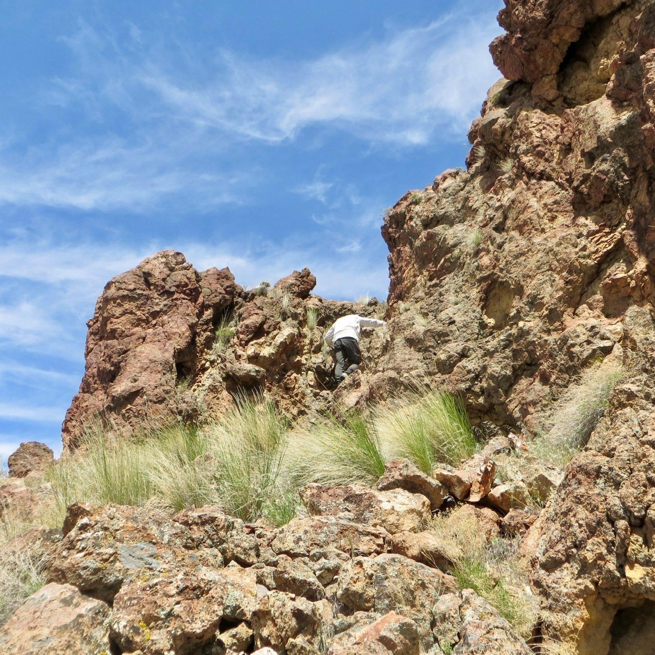
The climber is in the chimney that leads to the top. Steve Mandella Photo
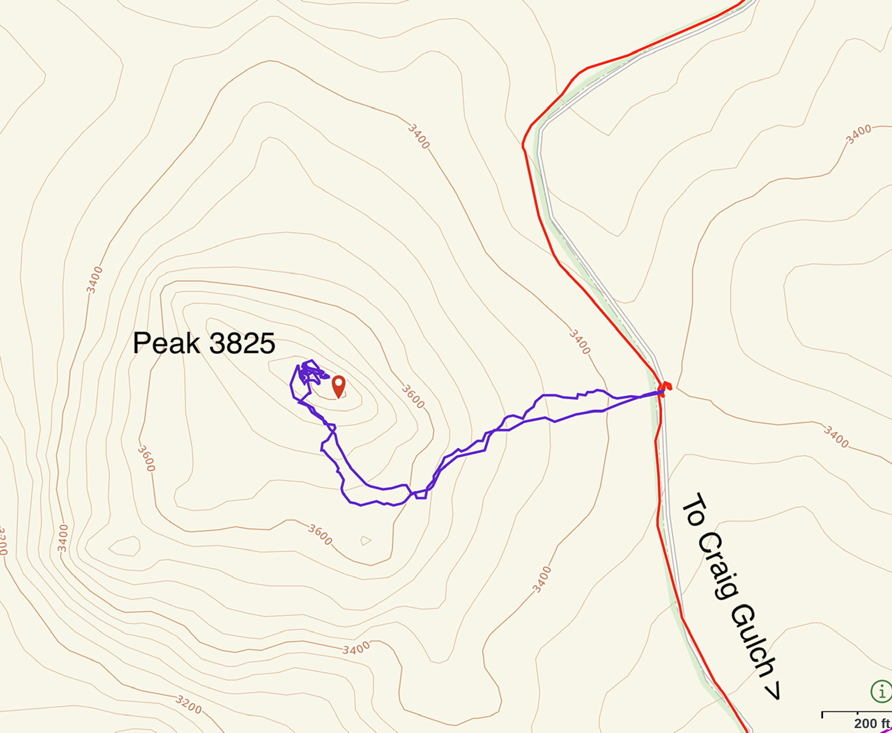
My GPS track for Peak 3825
-
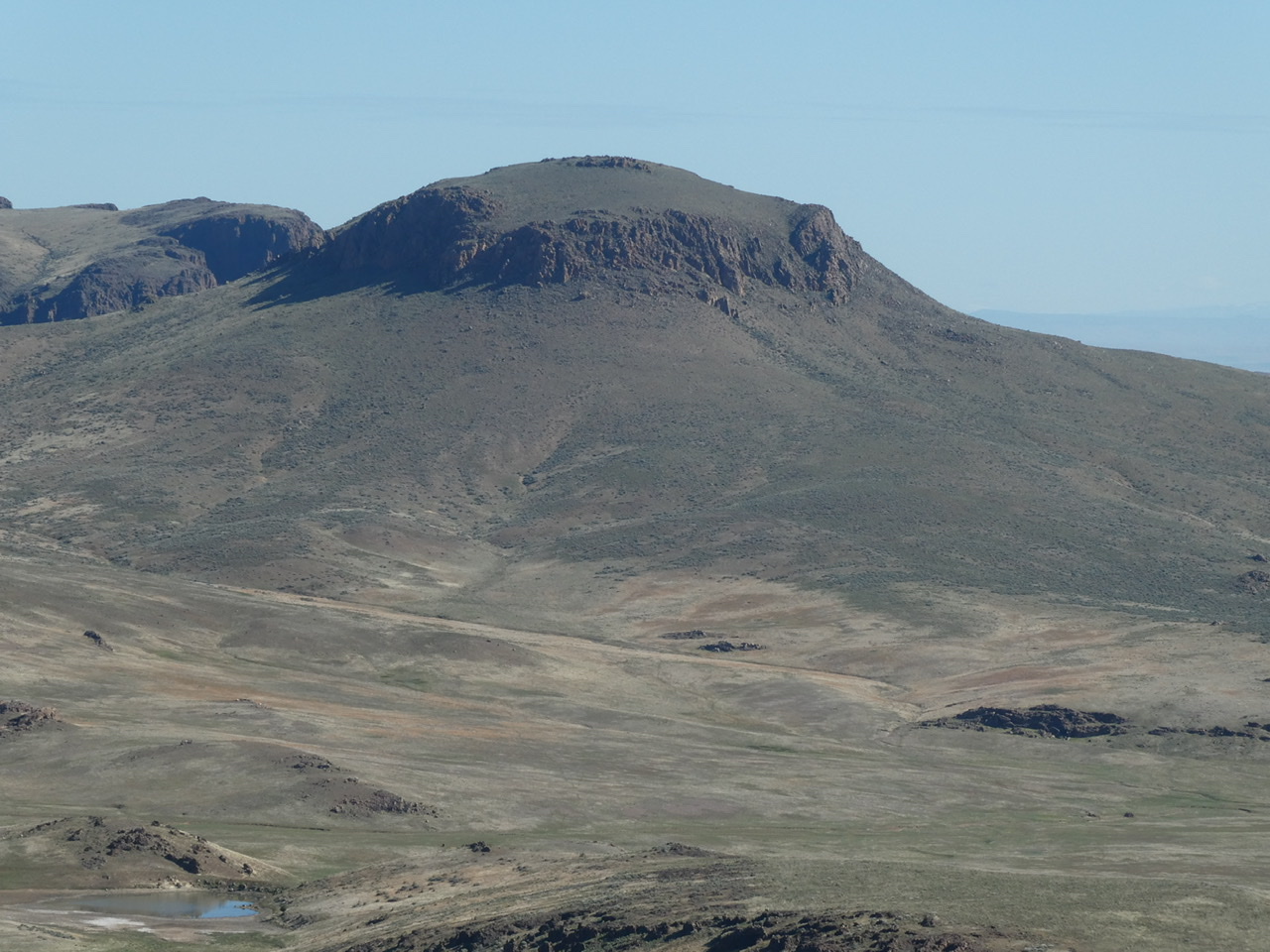
Atkins Butte
Atkins Butte is located due north of Acton Butte. Follow the Owyhee Trail Road north from Craig Gulch Road. Park just after crossing Long Gulch. Hike due west to the peak’s north ridge. Climb the ridge to the east side of the summit dome. The summit dome is a short Class 3 scramble.
Atkins Butte as viewed from the northwest
Climbers descending the short Class 3 summit dome.
-
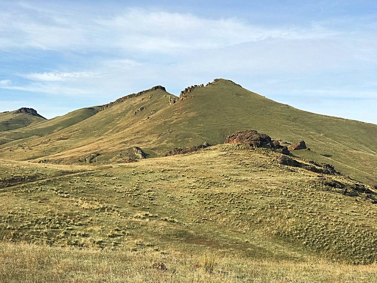
Peak 3983
This peak is located northwest of the Craig Gulch/Owyhee Trail Road junction. There is a closed road that leads to the summit. Access this road from just north and a bit downhill from the junction. Follow the road to the top.
Peak 3983 as viewed from the west
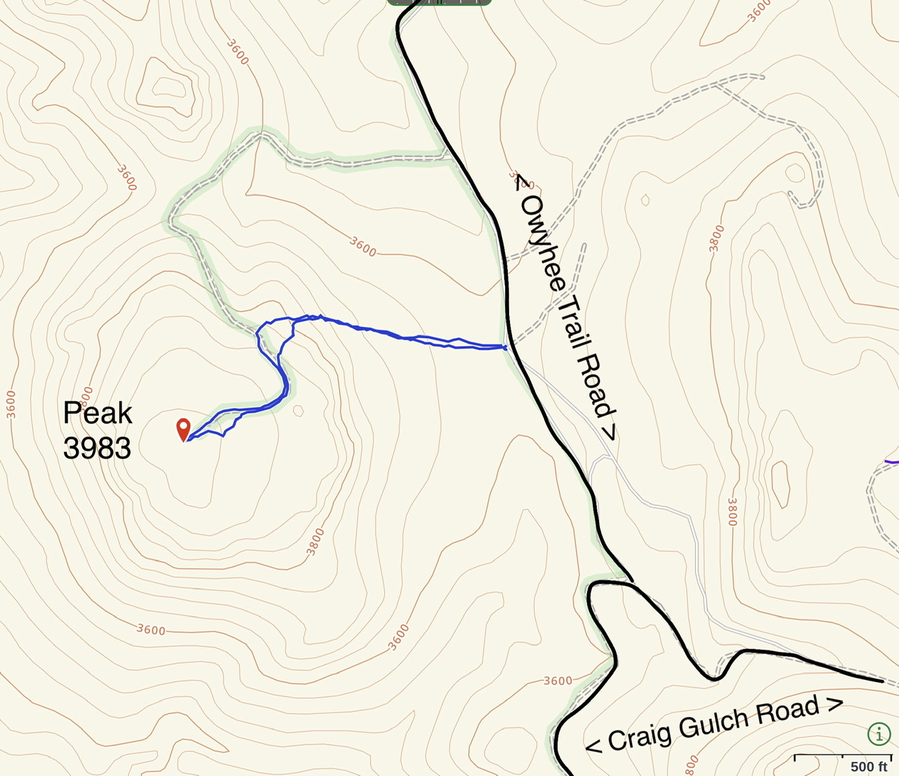
My GPS track. We climbed straight up from the pass and joined the road.
-
Peak 4220
Peak 4220 is located on the south side of Craig Gulch Road due south of Peak 3883.
Peak 4220 as viewed from the Craig Gulch Road. The second point is the high point.
-
Peak 4352 and Peak 4340
These two remote peaks are located south of Craig Flats.
-
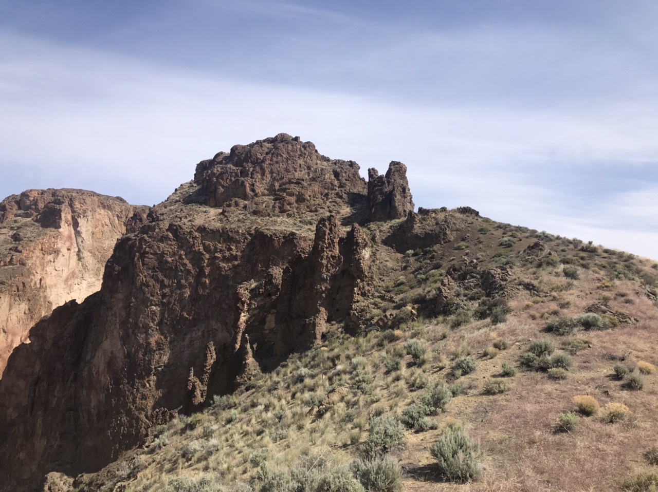
Peak 3417
This peak is one of three rugged summits on the south side of lower Three Fork Gulch.
Peak 3417 as viewed from the west. Steve Mandella Photo
-
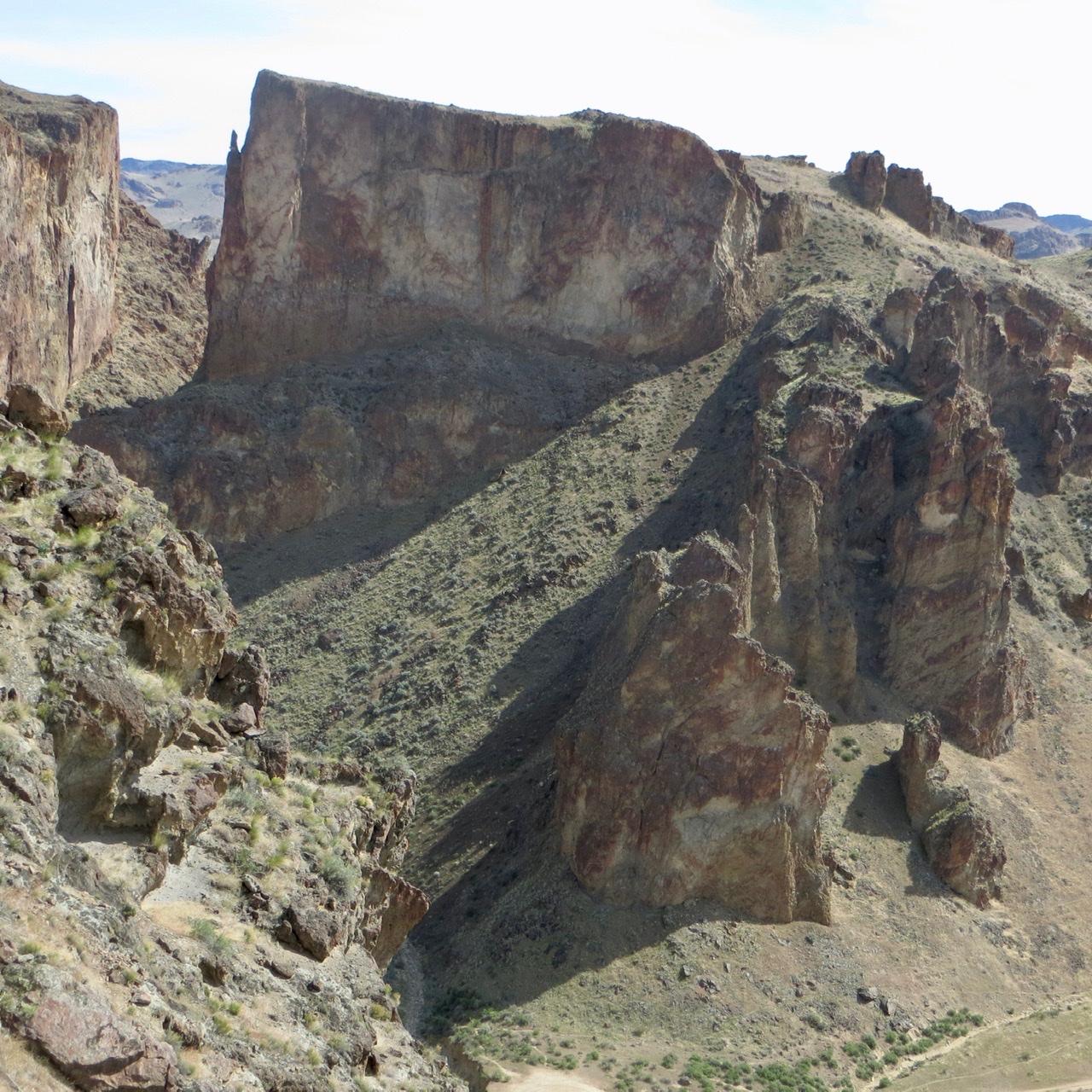
Peak 3492
This unclimbed tower has defeated all attempts to reach its summit.
The east face of Peak 3492
The west face of Peak 3492
-
The Owyhee Half Dome
This distinctive summit is located due west of the end of Craig Gulch Road.
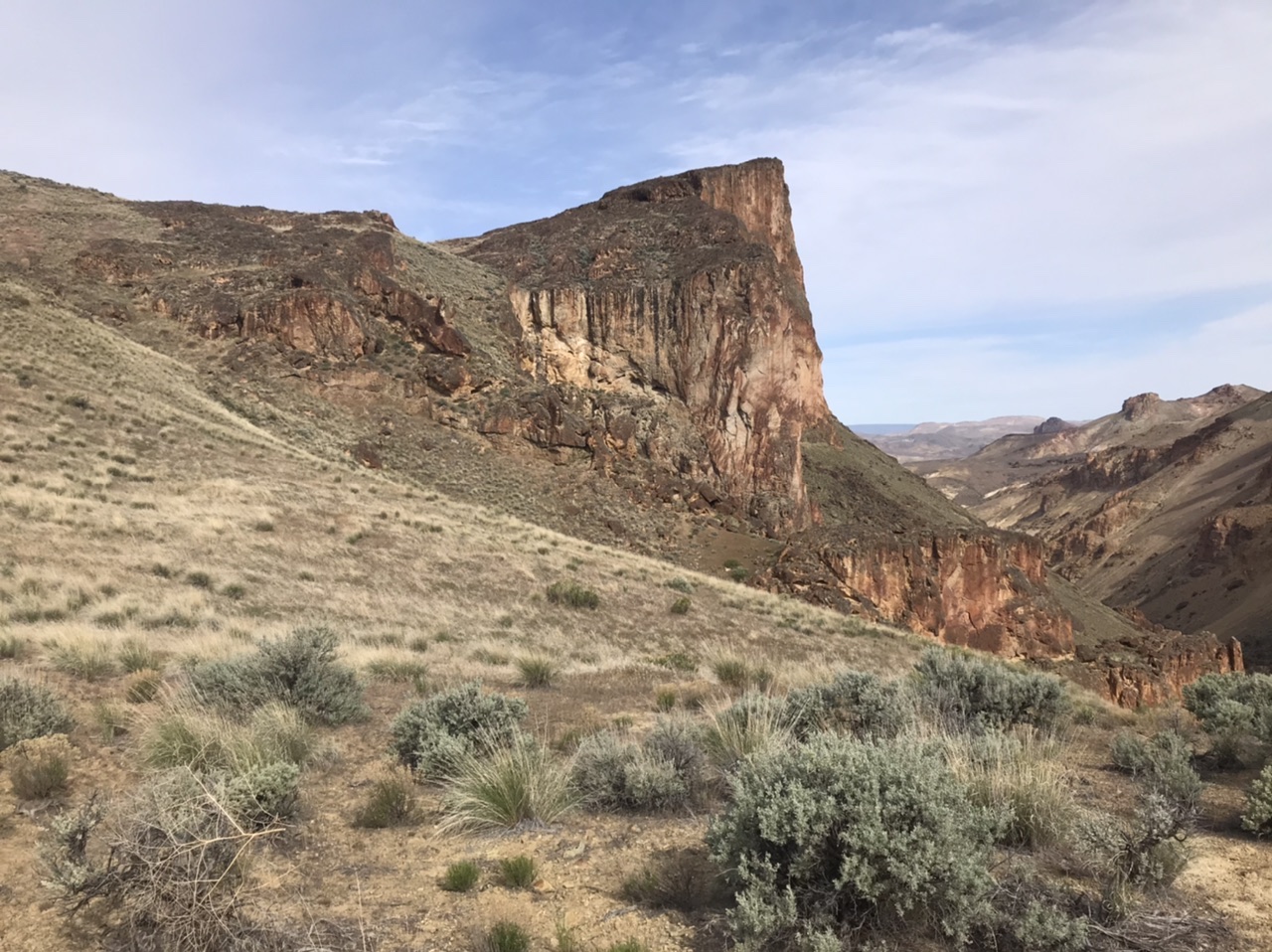
Owyhee Half Dome as viewed from the east
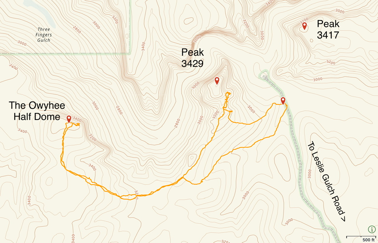
My GPS track for the ascent of Owyhee Half Dome and an attempt on Peak 3492.
-
Peak 4029 and Peak 3860
These two peaks are located on the north side of Craig Gulch. I have not climbed them. A 4WD road leads to Shadescale Spring. Climb these two peaks from the spring.