This area is located south of the Leslie Gulch Road corridor and stretches south past Jordan Valley, Oregon and west of the Idaho/Oregon border. Mahogany Mountain and a prominent ridge system south of Jordan Valley are the most distinctive features in this section. Peaks are discussed below from north to south.
-
Sucker Benchmark (4,775 feet)
This peak is located just east of US-95. Access the peak by turning on to the south end of Succor Creek Road. This junction is 18 miles north of Jordan Valley, Oregon and 26 miles south of the ID-55/US-95 junction (just east of Marsing, Idaho). Follow the Succor Creek Road north to the 4WD road shown on the map. Drive or walk the road to its end and then continue through the sagebrush to the summit.
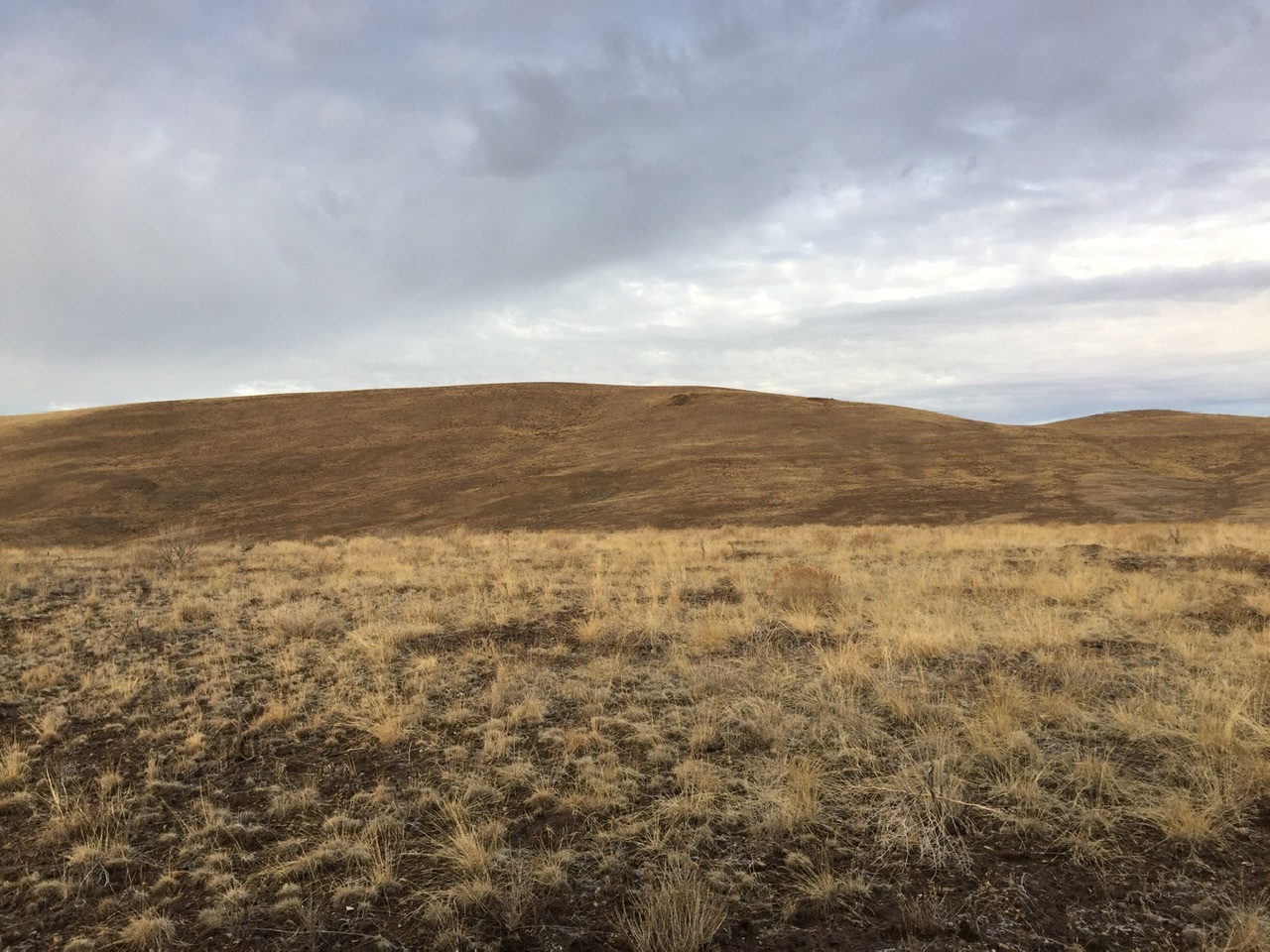
Succor Benchmark is a nondescript summit
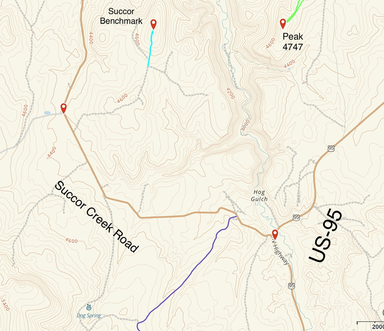
This map shows the route to Succor Benchmark from US-95
-
Mahogany Mountain (6,552 feet)
Mahogany Mountain is a massive summit located north of Jordan Valley, Oregon. This upland is composed of an ancient caldera volcano. Geologists believe its last eruption was 15.5 million years ago. The eruption is credited with ejecting the rhyolite and tuff that is found in the scenic formations observed in Leslie Gulch and the Honeycombs north of Mahogany Mountain. Much of the mountain, including the summit, is on private land.
Additional Resources:
Wikipedia Mahogany Mountain Page
-
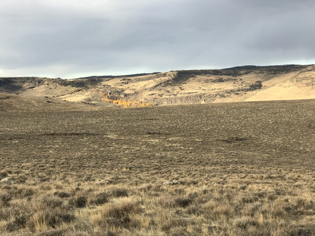
Spring Mountain
Spring Mountain is a big, hulking mountain located southeast of Mahogany Mountain. It has many high points with the highest topping out at 5,988 feet. Private property limits the possible ascent routes. Access the peak from the south end of Succor Creek Road. Roughly 0.5 miles west of US-95, turn south onto a sketchy 4WD road and follow it until the road reaches a broad saddle west of Point 5071. Turn west on another 4WD road that climbs to Hereford Springs. The road continues onto private property at this point. Park here and follow the GPS track shown on the map below. This route covers 3.8 miles with 750 feet of elevation gain round trip.
Spring Mountain
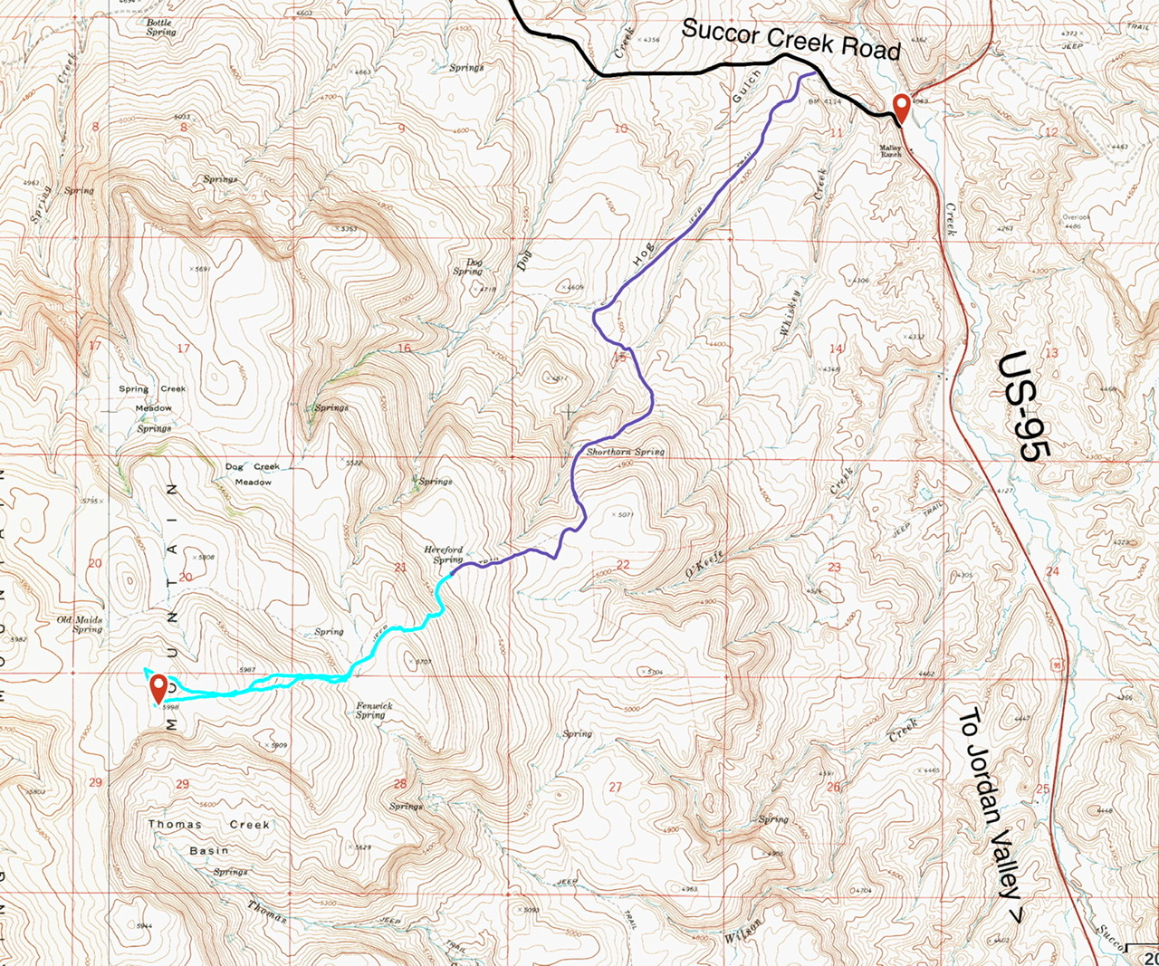
Spring Mountain. My GPS track is shown in light blue. The dark blue line is the 4WD approach road.
-
Peak 5291
This peak is located north of Jordan Valley.
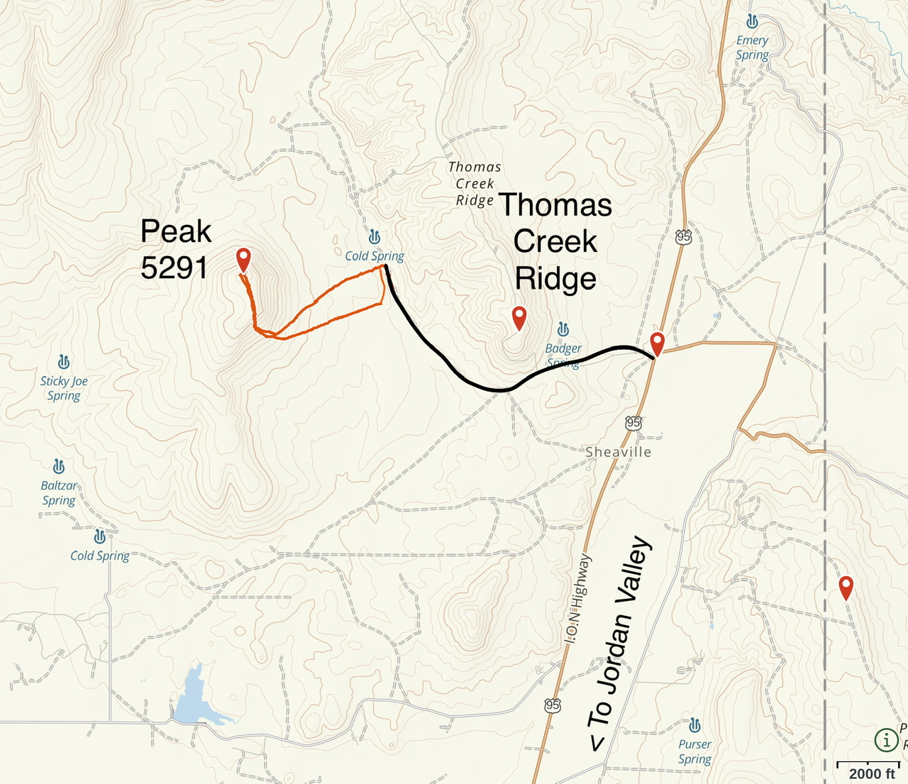
Peak 5291 and Thomas Creek Ridge
-
Parsnip Peak (6,121 feet), Round Mountain (5,820 feet) and Peak 5138. Class 2
Parsnip Peak is the highest Oregon Owyhee summit south of Jordan Valley, Oregon. It is the only distinctive summit in the area. Nearby Round Mountain and Peak 5138 are also good hiking destinations if you are in the area.
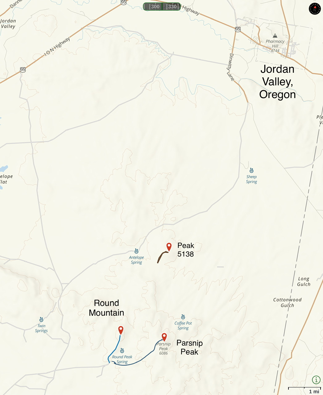
This map shows the access routes and GPS tracks for these three peaks
As shown on the map below, the land status map and the fencing on the ground do not match up for Parsnip Peak. According to the land status map, the summit is on BLM land if you approach from the west. However, there is a fence 200 feet west of the peak’s high point that is festooned with “No Trespassing” sign. Either the fence or the land status map is wrong. I believe the summit and fence are both located on BLM-managed land and you can legally access the summit.
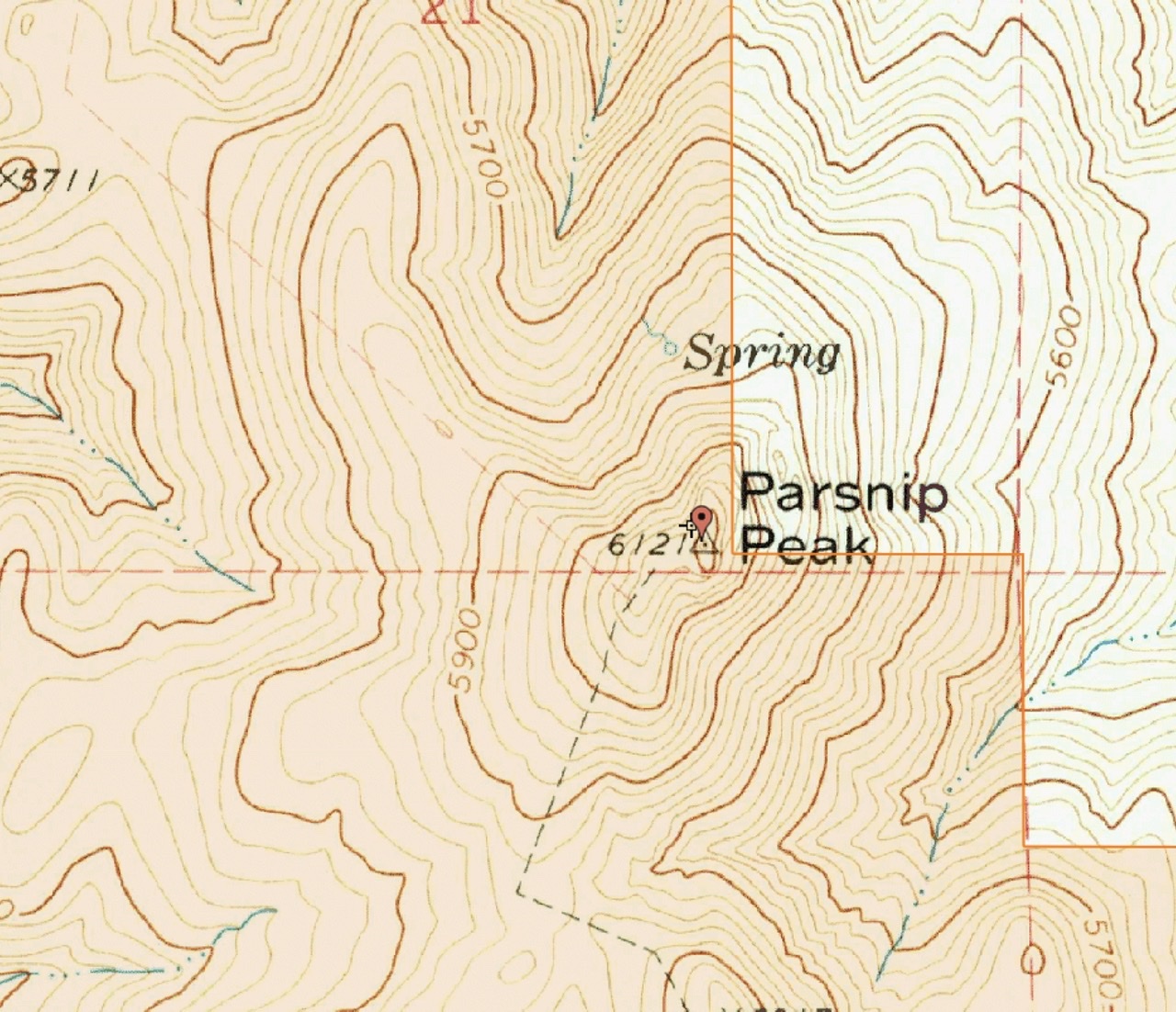
The brown-shaded terrain is public land. The existing fences are shown as faint dashed lines. This map clearly demonstrates that the summit is on public land.