This area includes the area between the Oregon/Idaho border, the Snake River to the north, and the Leslie Gulch Road to the south. The peaks and features are listed from north to south.
Northern Northeastern Peaks
-
Blackjack Butte (3,632 feet), Class 2
Blackjack Butte is a big, broad summit. Access the peak from the west from the Owyhee Reservoir Road. Private property blocks access on the peak’s east side.
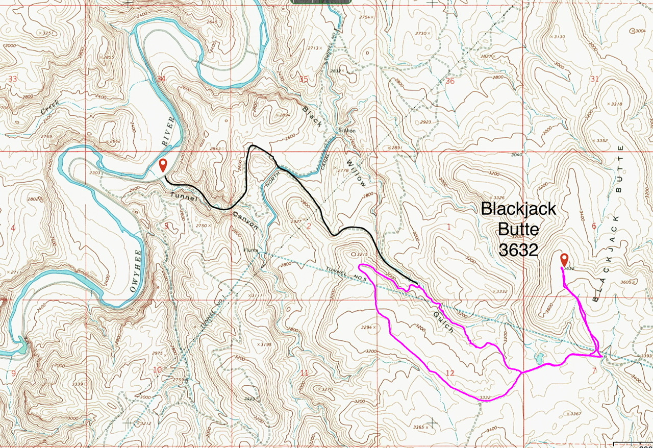
The approach up from Tunnel Canyon is marked in black and my GPS track is in lavender
-
Owyhee Ridge and Board Corral Mountain
These two peaks can be climbed from the connecting pass between them. Both ascents are Class 2 walks through sagebrush and grassy slopes without any significant obstacles. Owyhee Ridge (4,948 feet) is a broad ridge that culminates in a flat, rocky cap. Board Corral (4,961 feet) is one of the best vantage points in the immediate area.
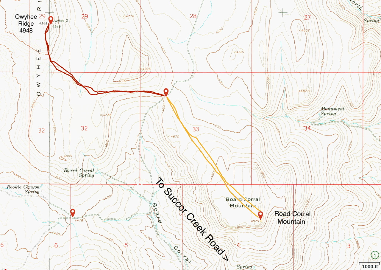
This map shows my GPS tracks for both peaks
-
Sheephead Mountain and Sheephead Ridge
These two peaks are located southwest of Owyhee Ridge and Board Corral Mountain. Sheephead Mountain (4,686 feet) is a minor summit with a long, nondescript summit ridge. On the other hand, Sheephead Ridge (4,973 feet) is a major summit.
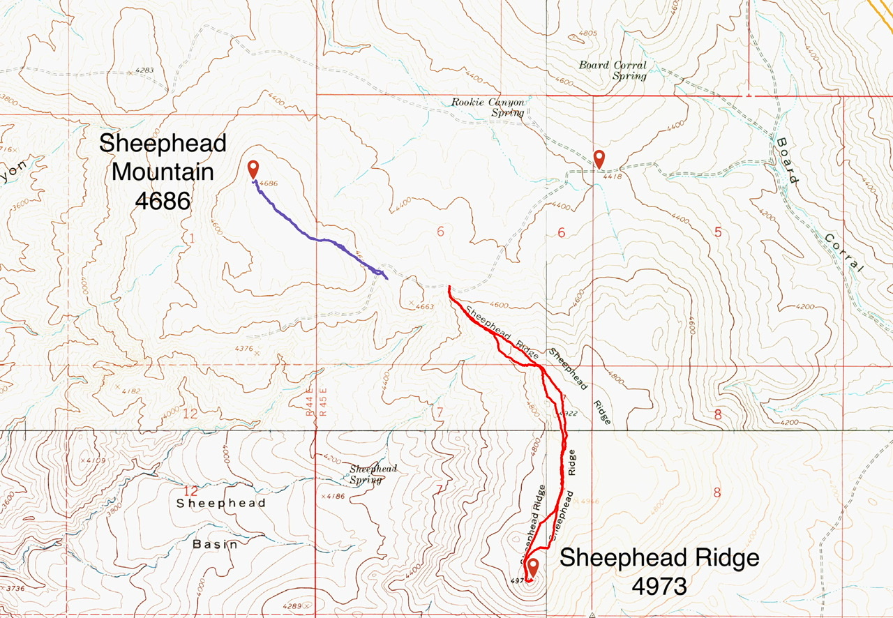
My GPS tracks for Sheephead Mountain and Sheephead Ridge
Upper Three Finger Gulch Road Peaks
The Upper Three Finger Gulch Road is a rugged and exciting 4WD Road. It can be accessed from the Succor Creek Road in the east or the Owyhee Trail Road in the west.
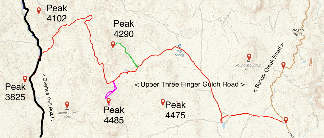
The Upper Three Finger Gulch Road is a steep, challenging 4WD road in spots
-
Peak 3860
I have not climbed this tower. I doubt that anyone has.
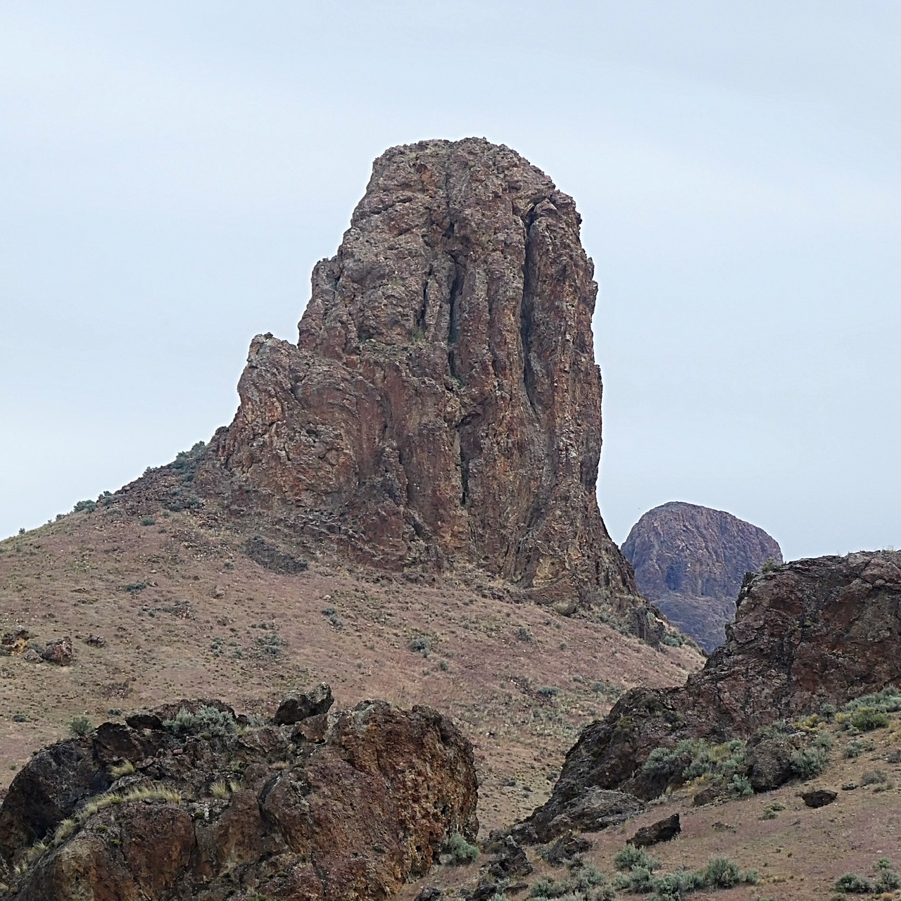
Peak 3860 is the most striking peak found along the gulch
-
Peak 4290
This peak is one of the nicest ridge walks in the Oregon Owyhees.
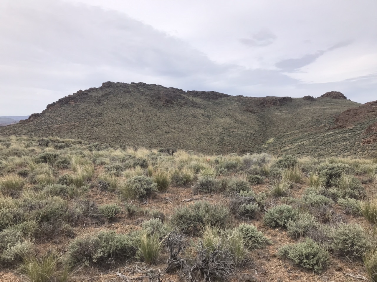
Peak 4290 as viewed from the east
-
Peak 4485
Peak 4485 is a short, steep pull from the Upper Three Finger Gulch Road.
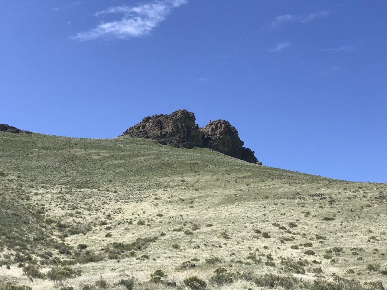
Peak 4485 as viewed from the Upper Three Finger Gulch Road.
Owyhee Trail Road Peaks
-
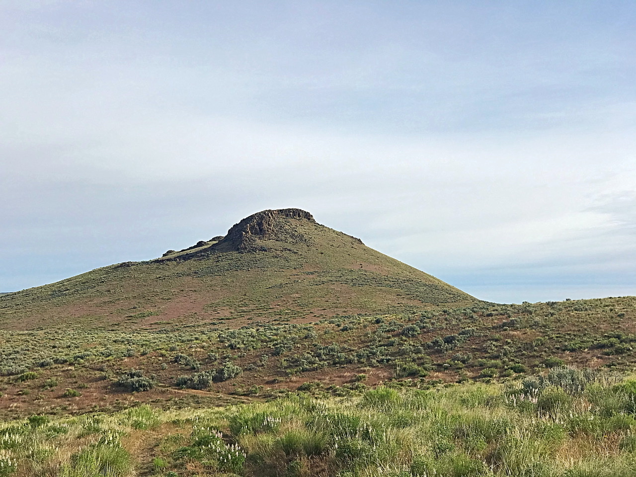
The Twins, Peak 4771 and Peak 4856
These two peaks form the high ground between Carlton Canyon and Three Finger Gulch. They are easily accessed from the Owyhee Trail Road. If you want to shorten your hike, you can drive the rough, seldom-used road that leads up to the saddle between the two peaks.
Peak 4856 as viewed from the north
Peak 4771 as viewed from the south
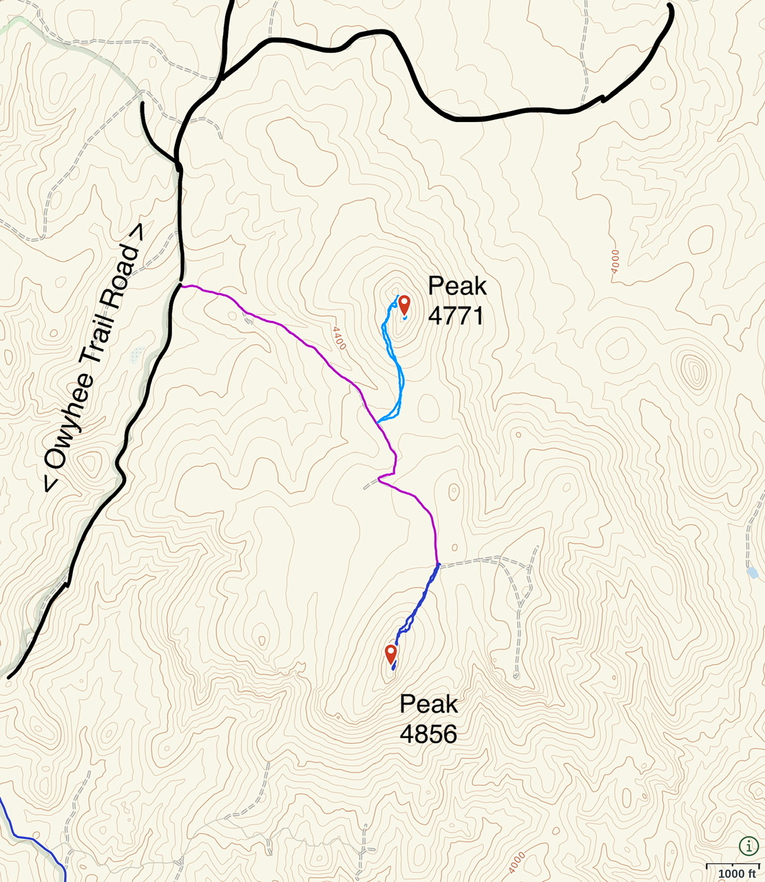
Both peaks are short hikes from the 4WD drive road to the saddle
-
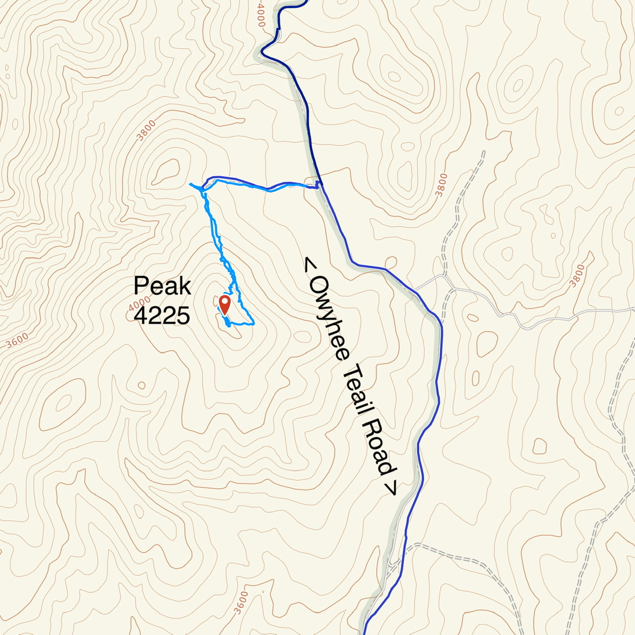
Peak 4225
This peak is located on the west side of the Owyhee Trail Road and southwest of the Twins. A rough road leads up to the saddle on its north ridge. The summit is reached after a short, steep climb from the saddle.
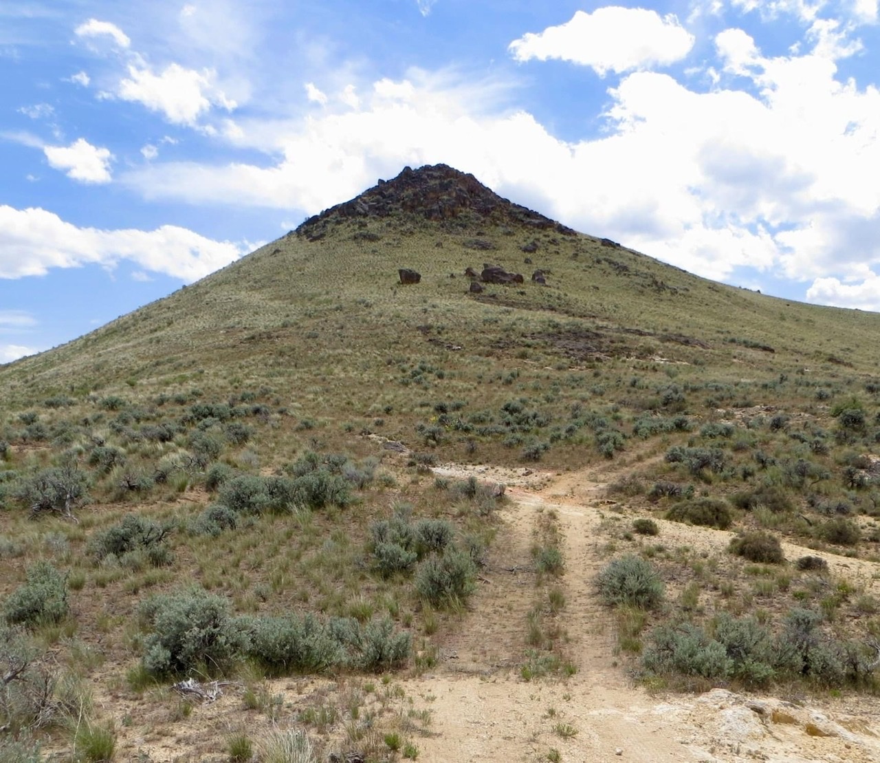
Peak 4225 as viewed from the saddle on its north ridge
Peak 4225
-
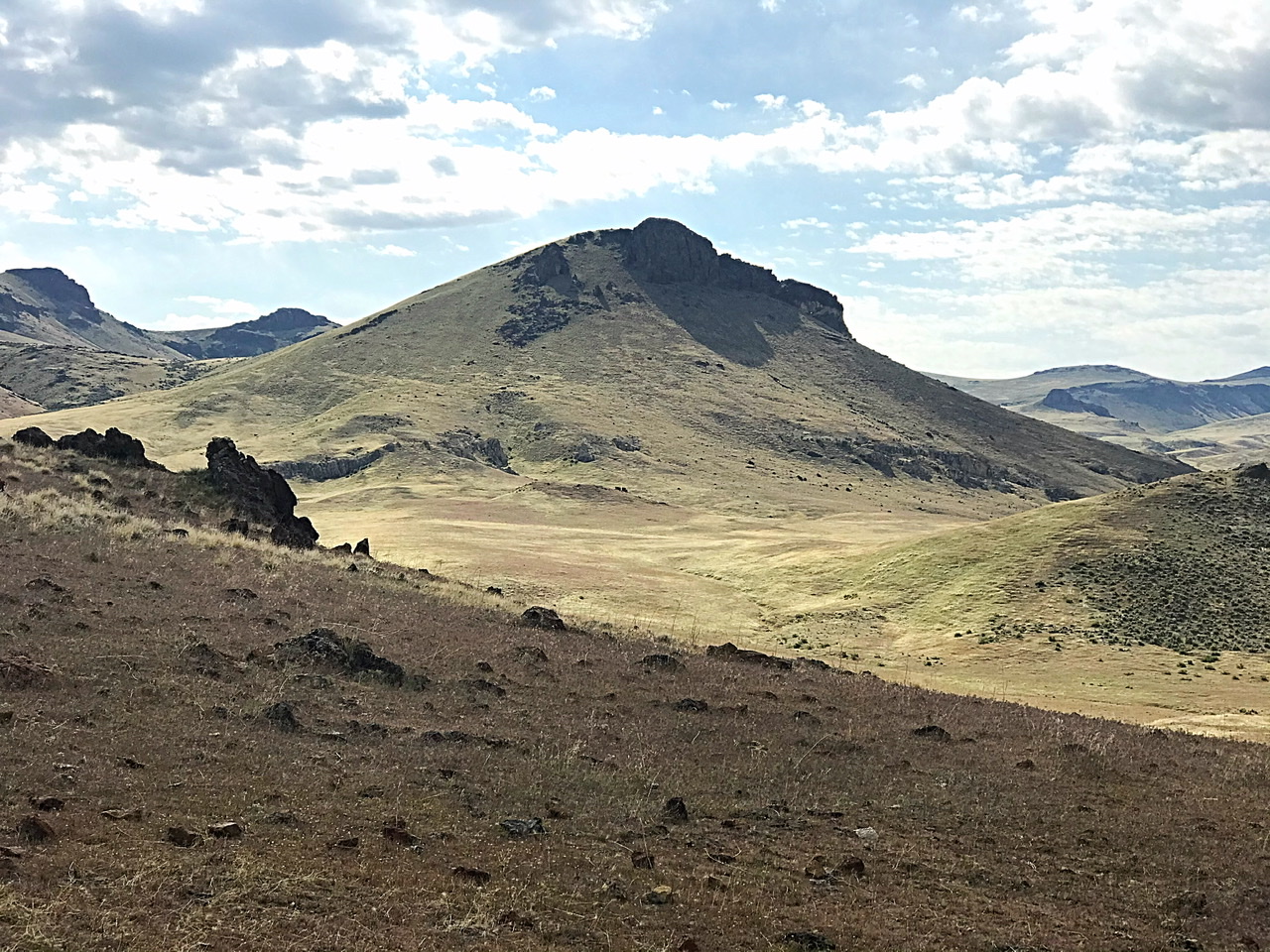
Atkins Butte (Class 3) and Peak 3825 (Class 3)
These two peaks are located north of Leslie Gulch along the Owyhee Trail Road. They rise up on the north side of Long Gulch which descends into Three Finger Gulch. Access these peaks from Leslie Gulch Road. Take Three Finger Gulch Road to the Acton Butte/Peak 3983 saddle. Turn north on the unnamed 4WD road that leaves from the saddle. Follow it north to the base of these peaks.
Climb Atkins Butte via its north ridge. This ridge leads to a point just east of the summit dome. A short Class 3 scramble gets you to the top.
Peak 3825 is capped by a rocky bulge. To reach the summit, drive to the pass east of the peak and park. Hike up and around the base of the summit block on grassy slopes. There is a 25-foot, Class 3 chimney at the top of grassy slope on the peak’s west side. At the top of the chimney, you are a few feet from the high point.
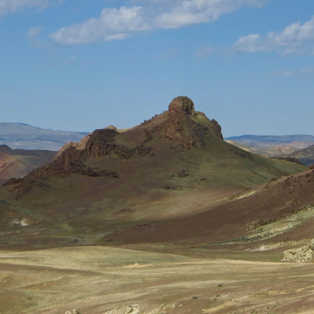
Peak 3825 as viewed from Atkins Butte
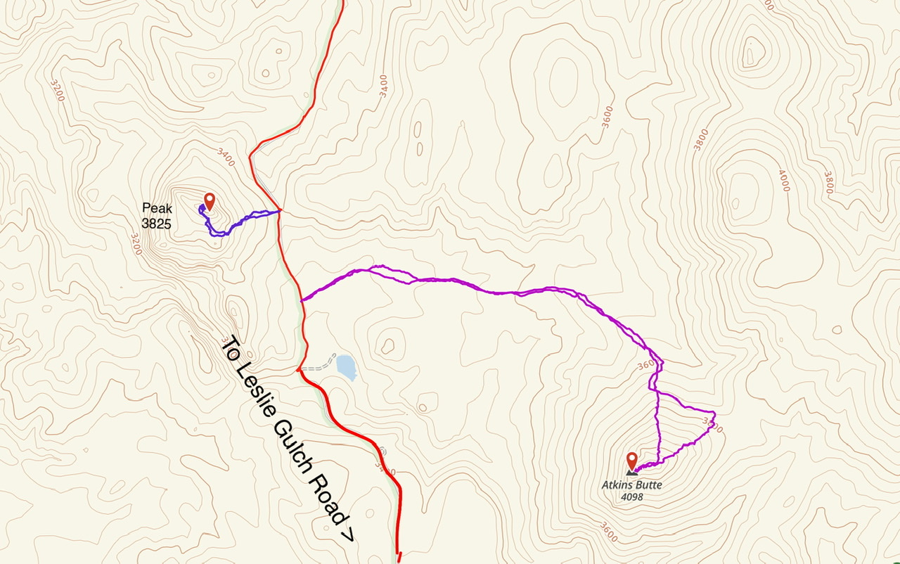
My GPS tracks for these two peaks
South Central Northeastern Peaks
This is an area of big, cliff-ridden peaks and towers.
-
Three Finger Rocks, Class 5.2
Unquestionably, this peak is the monarch of the Oregon Owyhees. It has no equal. It is located due west of Succor Creek and McIntyre Ridge.
Three Finger Rocks as viewed from the southwest.
The middle summit is the highest of the three “fingers.” YDS 5.2, one pitch. The east finger is Class 3. Most people only climb the [lower] east finger. The west finger is Class 4. With a 4WD and a bit of luck, you can drive to base of the peak. Follow the dirt road shown on the USGS quad until due east of the peak. A steep, rough road climbs west to the top of an intervening ridge. It then makes a tight left-hand turn which will be difficult for long wheel-based vehicles. There are lots of rocks that will cut sidewalls.
From the road’s end a faint trail climbs up and around the north end of the east pinnacle. Climb up into the notch. The route we took is just down the south side of the notch. One pitch takes you to the summit ridge. There are remnants of a survey triangulation station on top. A Class 3 route to the east finger leaves right on top of the notch. There are three register cans on the east finger.
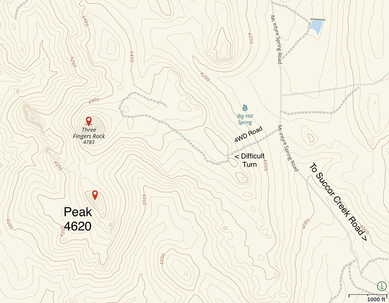
Three Finger Orientation Map
-
McIntyre Ridge
McIntyre Ridge is the northernmost of three big peaks that rise up directly west of the Succor Creek Road. The peak has many large faces but is easily climbed from the west. My route shown on the map below covers 2.7 miles with 450 feet of elevation gain round-trip.
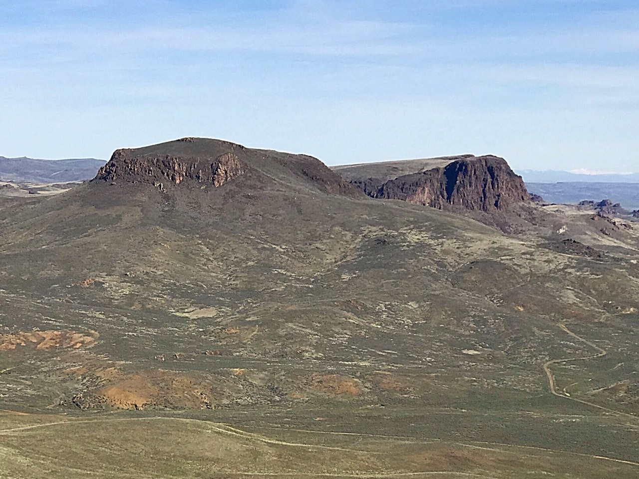
McIntyre Ridge as viewed from Round Mountain
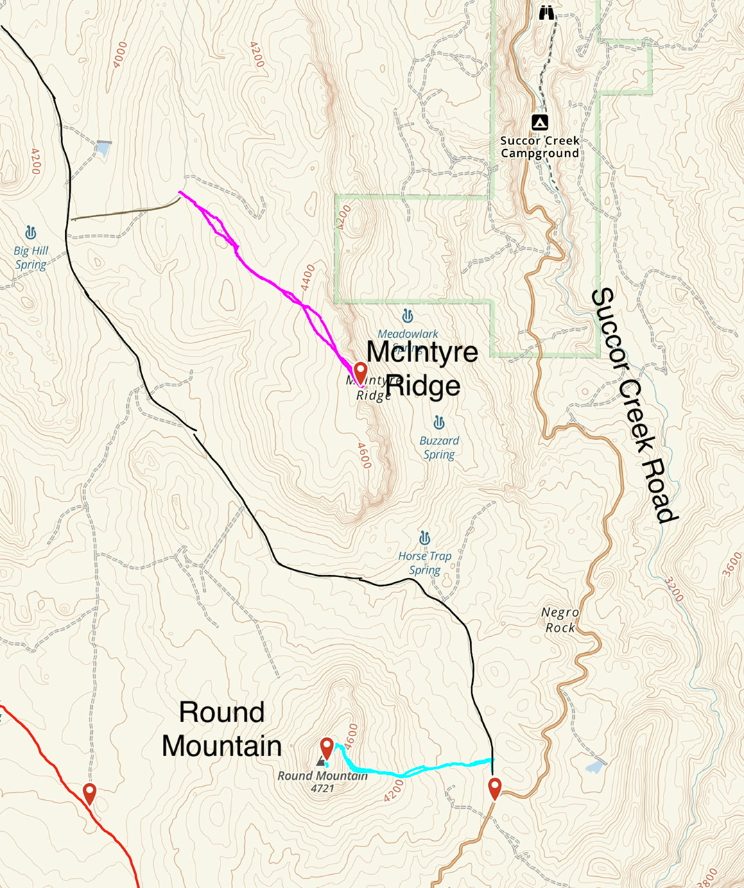
My GPS track is shown in lavender
-
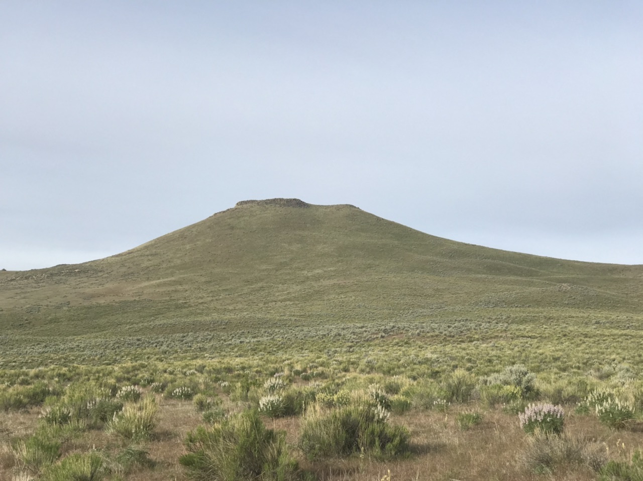
Round Mountain
Round Mountain is a distinctive peak located just west of the Succor Creek Road between McIntyre Ridge and Smith Butte.

Round Mountain
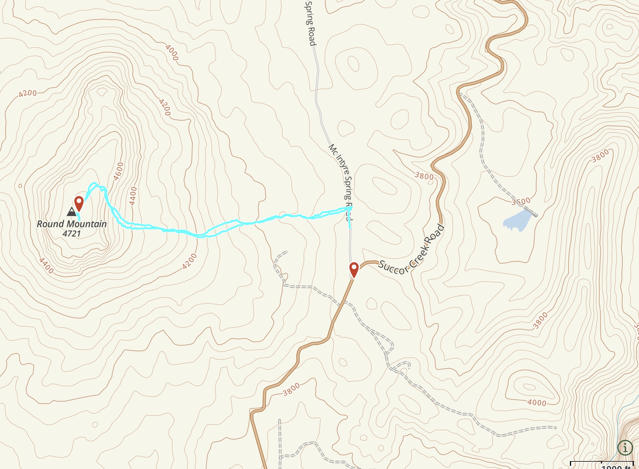
Round Mountain
-
Smith Butte
Smith Butte rises directly east of the Leslie Gulch Road south of Round Mountain. The easiest route is from the north. My route (shown on map below) covers 2.6 miles with 875 feet of elevation gain.
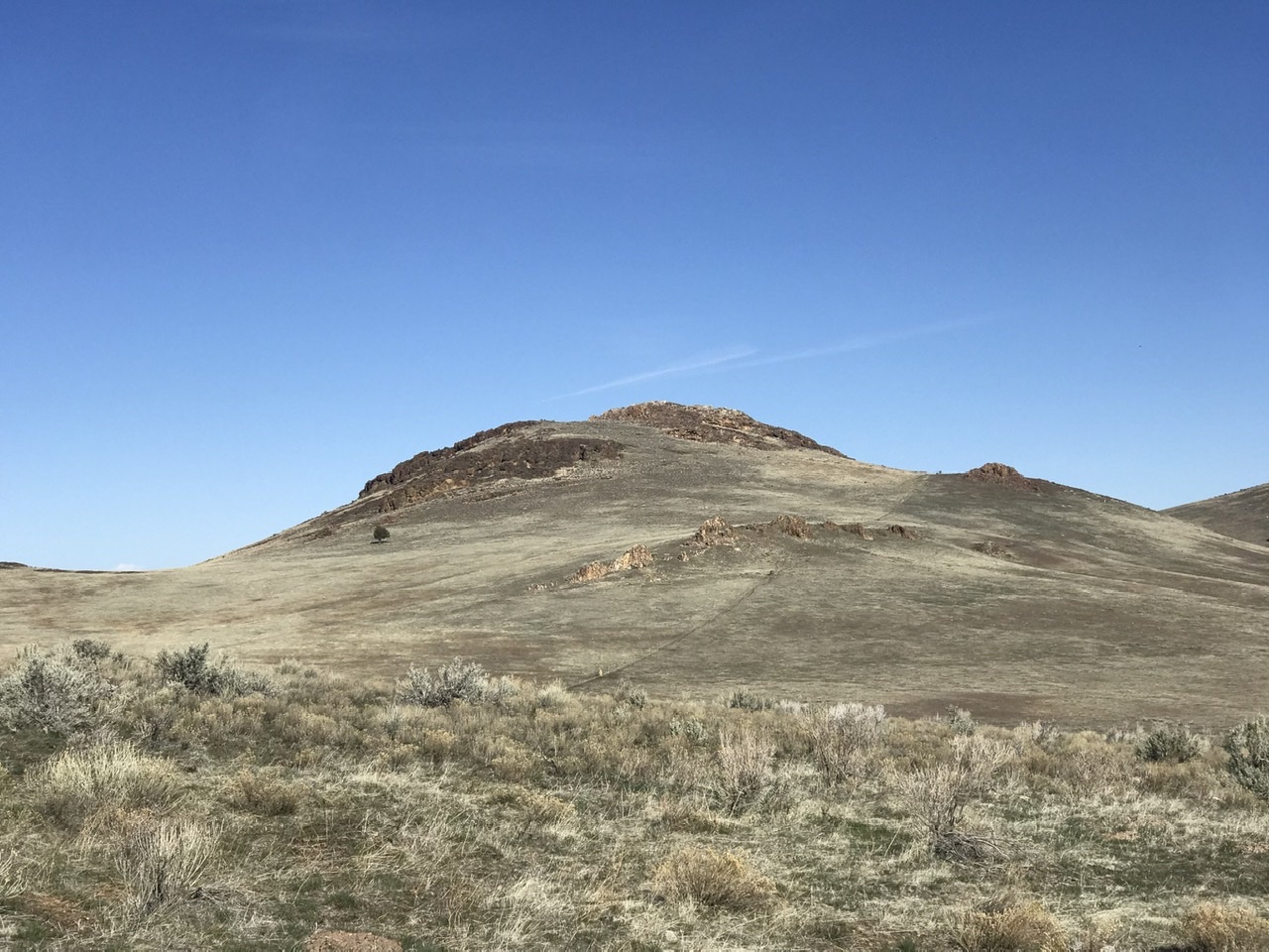
Smith Butte as viewed from the north
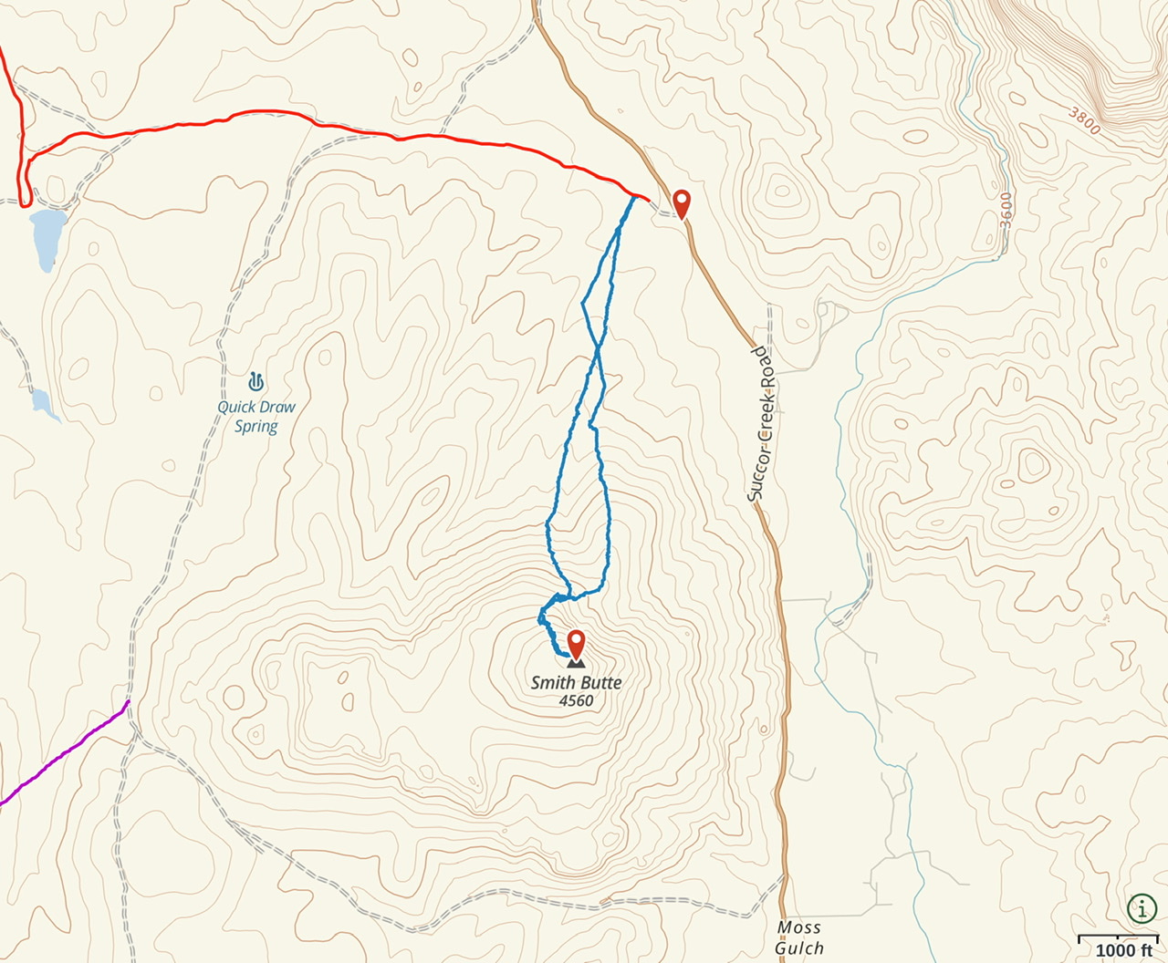
Smith Butte orientation map
-
Saddle Butte, Class 3
This peak is located west of Succor Creek and Smith Butte. This peak is the most rugged summit bordering Succor Creek. Access the peak from the Succor Creek Road just north of Smith Butte as shown on the map below. The route shown on the map uses a steep gully that climbs to the ridge top just north of the summit. Look for a small window on the wall on the south side of this gully. A short climb up a 10-foot step on the east side of the summit block is Class 3. Once up the step, turn south and scramble a short distance to the summit.
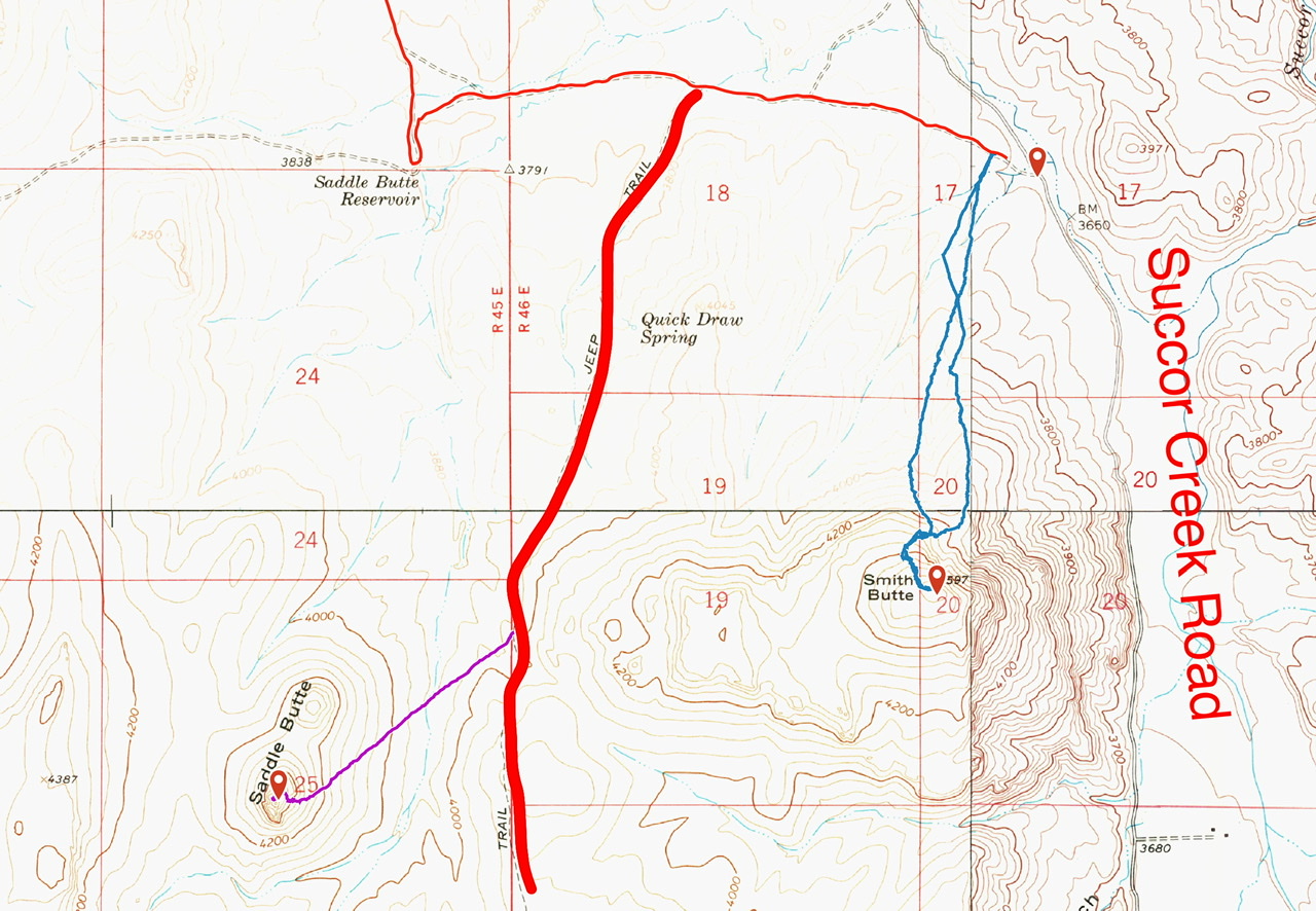
My GPS track in purple for the ascent of Saddle Butte. The climb encompassed 1.5 miles with 700 feet of elevation gain round trip.
-
The Honeycombs
The Honeycombs are a conglomeration of spires, steep canyon walls, and caves. These impressive formations are formed from volcanic tuff. This area is located between Juniper Ridge and Carlton Canyon.
Access: There is no easy access to this area which is a Wilderness Study Area. If you can boat up the Owyhee Reservoir to Bensley Flatt, you can reach the base of this formation by hiking up the drainage on its south side. If you lack a boat, you must access the area on foot from Juniper Ridge. Reaching Juniper Ridge requires a 4WD, dry conditions, and map-reading skills. Once you reach the ridge, you must hike along the ridge for 4 up-and-down miles. From the end of the ridge, you must descend roughly 1,000 feet to reach the base of the Honeycombs. Here you will be surrounded by large spires, boulder fields, and steep canyon walls that are spotted with caves.
Resources:
Backpack the Painted Canyon Loop, Honeycombs Wilderness