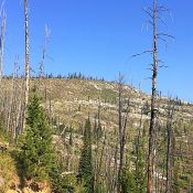
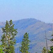
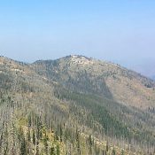
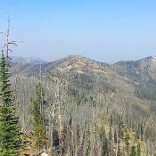
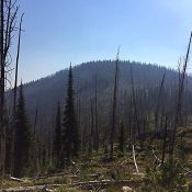
Packer John Mountain

This peak is not in the book. Packer John Mountain is located in the North Fork Range, east of ID-55. The peak has a long North-South summit ridge which was once the home of a fire lookout. The true summit is farther south and almost 50 feet higher. USGS Packer John Mountain Access and Routes (Class 2) The North Fork … Continue reading

Puhitempi Kuaikatete

This peak is not in the book. This peak was formerly known as Squaw Butte. In 2022 the word “squaw” was removed from all geographic names in the United States. I have not found a translation for the name which is of Native American origin. Access is now apparently closed to the public. In April 2017, there were no “Private Property-No … Continue reading

Peak 5587

This peak is not in the book. Livingston Douglas added updates on access, map errors, a new descent route, and new photos. Updated October 2025 Peak 5587 sits southeast of Grape Mountain and due south of Peak 5424. These 3 peaks surround the Trail Creek drainage. The peak was burned over at some point in the past. The forest is not … Continue reading

Peak 5453

This peak is not in the book. Elevation and prominence figures are based on recent LiDAR measurements. The map elevation is 5,440 feet. Livingston Douglas climbed the peak via the south ridge which was my descent route. He added a a description of that route and new photos. Updated October 2025 Peak 5453 is located east of Slide Gulch. The … Continue reading

Peak 6300

This peak is not in the book. Livingston Douglas added additional access and route information as well as new photos. Updated October 2025 Peak 6300 is located south of the Middle Fork Boise River. The peak is drained by Elk Creek, Corral Creek, and Alder Creek. USGS Twin Springs Access Access Peak 6300 from Middle Fork Boise River Road and … Continue reading

Peak 5424

This peak is not in the book. Livingston Douglas added two new photos. Updated October 2025 Peak 5424 is located west of Slide Gulch and south of the Middle Fork Boise River. The peak can be climbed from Trail Creek on the south or from the pass on the peak’s East Ridge. USGS Long Gulch Access Access the peak by … Continue reading