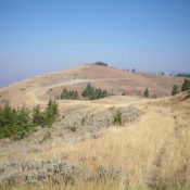
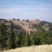
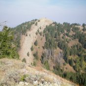
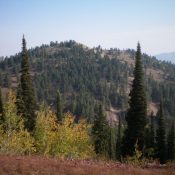
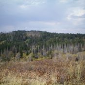
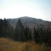
Peak 7340 by Livingston Douglas

Looking up the final stretch of the northwest ridge at the summit of Peak 7340. Livingston Douglas Photo

This peak is not in the book. Published October 2020 Peak 7340 is the high point on a ridge line that parallels Mahogany Ridge. Rash Canyon separates these two ridges that sit south of Fall Creek Canyon. Like many of the Caribou Ranges, the northwest ridge of Peak 7340 has its ups and downs, but they are not as pronounced … Continue reading

Peak 6420 by Livingston Douglas

Peak 6420 (dead center, mid-ground) as viewed from Peak 6796 to its southeast. Livingston Douglas Photo

This peak is not in the book. Published October 2020 Peak 6420 sits above The Narrows: a rugged, cliff-faced section of Wolverine Canyon in the Blackfoot Mountains. Hikers drive past this peak on their way to Taylor Mountain, which is another 2.4 miles up Wolverine Road. Peak 6420 is an easy scramble from a gully to its east and offers … Continue reading

Peak 5342

Peak 5342 viewed from the lower slopes of Red Mountain.

This peak is not in the book. Published October 2020 Peak 5342 is located northeast of Red Mountain and east of the main Owyhee Mountains crest. USGS Toy Pass Access This peak is accessed from Oreana, Idaho. The directions in the book [A](3) on Pages 346-347] described the route to Toy Pass via the Bachman Grade/Triangle Road. This road is … Continue reading

Lookout Mountain 7539

This peak is not in the book. Published September 2020 This peak is located just southeast of Bellevue, Idaho. The peak is on BLM land but is completely surrounded by private land. As a result, access is an issue. Nevertheless, the peak is occasionally climbed. Dan Robbins’ trip report is linked below and discusses a possible access route. USGS Seamans … Continue reading

Peak 9242 (Mount Mills)

View of the ridge connecting Mount Mills (9,424’) with the point marked Mount Mills (9,195’) on the topographic map. Judi Steciak Photo

Climbing and access information for the lower summit of Mount Mills is on Page 129 of the book. Judi Steciak and Carl Hamke pointed out to me that the map makers placed the peak’s name on its lower northern summit (not an uncommon occurrence). This entry corrects the error and will get you to the true summit. Published September 2020 … Continue reading

Peak 8860 (Center Ridge Peak #2)

Peak 8860 (Center Ridge #2) viewed from the south. John Platt Photo

Peak 8860 is located in the Frank Church River of No Return Wilderness east-southeast of Edwardsburg on an long ridgeline that divides Little Marble Creek and Snowslide Creek. This ridge starts at Cougar Peak and runs northeast over Peak 8421, Peak 8860, and Snowslide Peak to Center Mountain. USGS Edwardsburg Access Access is  via the Cougar Basin Trail/FST-004 [(B)(3.2)(c) and … Continue reading