Elevation: 9,201 ft
Prominence: 301
This peak is not in the book. Published December 2020
Peak 9201 is one of five ranked peaks that surround the upper reaches of Irving Creek. Two of the peaks are on the Continental Divide and a third peak is very close to the CD. This five-peak adventure includes Peak 8589, Peak 8589, Peak 9521, Peak 9660, Peak 9201, and Peak 8881. It covers 11.0 miles with 4,500 feet of elevation gain. It is a magnificent ridge traverse that I highly recommend. USGS Fritz Peak
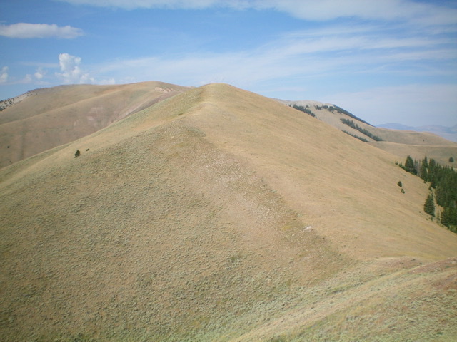
Looking back at Peak 9201 (gentle hump in dead center) from a minor hump to its east. Livingston Douglas Photo
Access
Same as for Peak 8589. This is the fourth leg of a 5-peak journey that begins along Irving Creek Road.
West Ridge, Class 2
The Climb
From the 8,900-foot connecting saddle with Peak 9660, hike east-northeast up easy scrub to the gentle hump that is the summit of Peak 9201. The summit has a cairn and an ID/MT boundary post.
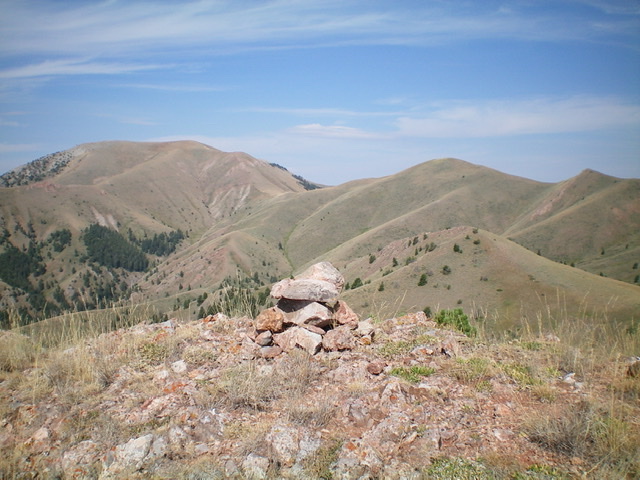
Peak 9660 (left of center) and Peak 9201 (right of center) as viewed from the southeast. Livingston Douglas Photo
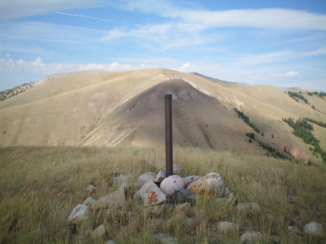
The summit cairn and ID/MT boundary post atop Peak 9201. Livingston Douglas Photo
East Ridge, Class 2
The Descent
From the summit, follow the ridge crest east down to a saddle then up over an easy hump with a game trail on the right/south side of the ridge to expedite the hike. From this hump, descend east on a less well-defined, rounded ridge on steep, loose terrain (scrub and underlying scree) to reach flatter slopes. Angle southeast through sagebrush to cross the head of a large, dry gully. Bend right/south and descend to a gentle saddle of sagebrush. This 8,500-foot saddle connects Peak 9201 to Peak 8881 and concludes the fourth leg of today’s five-peak journey. Peak 8881 is up next.
Additional Resources
Regions: Beaverhead Range->EASTERN IDAHO
Mountain Range: Beaverhead Range
Longitude: -112.64459 Latitude: 44.48969