Elevation: 8,589 ft
Prominence: 329
This peak is not in the book. Published December 2020
Peak 8589 is one of five ranked peaks that surround the upper reaches of Irving Creek. Two of the peaks are on the Continental Divide and a third peak is very close to the CD. This five-peak adventure includes Peak 8589, Peak 9521, Peak 9660, Peak 9201, and Peak 8881. It covers 11.0 miles with 4,500 feet of elevation gain round trip. It is a magnificent ridge traverse that I highly recommend. USGS Fritz Peak
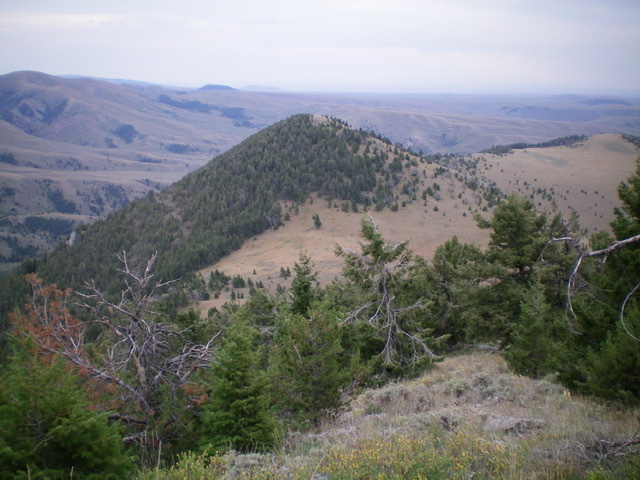
Peak 8589 (gentle hump in center) as viewed from the northwest. Livingston Douglas Photo
Access
From I-15 at Dubois, ID, drive west on ID-22 for 5.9 miles to [signed] Medicine Lodge Road. Turn right/north onto Medicine Lodge Road and reset your odometer. At 21.0 miles, the pavement ends. At 25.7 miles, reach a [signed] road junction with Irving Creek Road. Turn right/northeast and reset your odometer. At 2.7 miles, reach an unsigned road junction with a cattle gate for each road. Go straight/north to continue up Irving Creek Road/FSR-194. Go through the cattle gate and drive 0.4 miles to the BLM land boundary at a cattle guard. Park just beyond this cattle guard in a pullout area (6,880 feet). The road has severe ruts beyond this point and is not advised for vehicular traffic.
East Shoulder/Southeast Ridge, Class 2
The Climb
From the cattle guard, hike north up Irving Creek Road for ½ mile to reach an obvious, mostly open shoulder on the left/west side of the road with a gully immediately preceding it. Leave the road to cross a grassy field and find a gap in the tall, thick willows that surround Irving Creek. This gap is located well before reaching the toe of the shoulder. After crossing Irving Creek, angle right/northwest and bash through tall, thick sagebrush to reach the open shoulder. The shoulder is mostly short, easy scrub initially. Scramble northwest up the shoulder to reach the semi-open pine forest. Head west directly up toward the southeast ridge. This requires a final scramble up a steep face of loose dirt/pine duff without much blowdown to contend with.
Once on the southeast ridge, stay on the ridge crest or just to its left/west to be in easier, semi-open terrain. You will see another ridge to the west, with a gully in between you and it. That ridge is the south ridge. Stay on the southeast ridge and do not attempt to reach the south ridge because the two ridges merge high up, near the summit. Follow the ridge northwest then west-northwest in a semi-open pine forest. You may have to skirt pines on the crest itself by moving from side to side to make better progress. As you near the summit, the terrain becomes a combination of short scrub and broken rock with some talus. The summit has two cairns. I believe that the eastern cairn is on the highest point but stand atop both just to be sure. They are not too far apart.
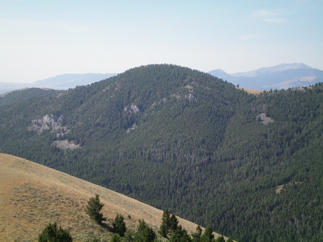
Peak 8589 as viewed from the northeast. Notice the hidden rock buttresses in the forest. Livingston Douglas Photo
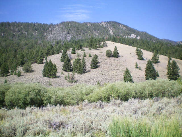
Peak 8589 as viewed from the Irving Creek Road at the base of the east shoulder. The summit is right of center and is hidden by the forest. Livingston Douglas Photo
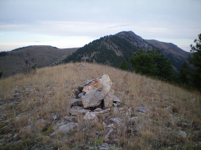
The summit area of Peak 8589, looking northwest up the rocky ridge at Peak 9521 (right of center). Livingston Douglas Photo
Northwest Face, Class 2
The Descent
From the summit, descend northwest down through an easy pine forest to reach a saddle of open scrub at 8,260 feet. This is the connecting saddle with Peak 9521. It concludes the first leg of today’s five-peak journey. Peak 8589 is, in reality, a ridge hump on the long southeast ridge of Peak 9521. And that peak is next on our hit list for the day.
Additional Resources
Regions: Beaverhead Range->EASTERN IDAHO
Mountain Range: Beaverhead Range
Longitude: -112.63119 Latitude: 44.45709