1895 Survey of Hyndman Peak

Idaho 12er

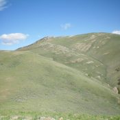
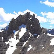
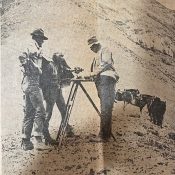
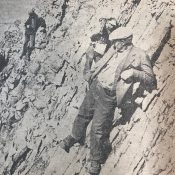
The Ketchum Keystone, August 24, 1895 The geological survey corps of  E.T. Perkins, Jr., is now at Sawtooth. During the past few weeks it has been operating on the headwaters of the various streams tributary to Wood river from the north. The highest of the peaks at the head of East Fork of Wood river has been duly confirmed with … Continue reading

T.M. Bannon by Rick Baugher

T.M. Bannon. USGS Photo

Thomas M. Bannon was also a self-taught mountaineer. Although his name is not widely known in mountaineering circles, during his surveying career from 1889 to 1917 he climbed nearly one thousand summits in the American West. More than two hundred of these summits were in Idaho. Bannon’s cryptic reports, supplemented by the rock Cairns, Wooden triangulation signals, chiseled cross-reference marks; … Continue reading

Appendicitis Hill and T.M. Bannon

Appendicitis Hill as viewed from the south. Livingston Douglas Photo

On February 26th, 1926, the Sunday Idaho Statesman published the following report by E.S. Crawford describing the origin of the name Appendicitis Mountain, now Appendicitis Hill. Bannon’s extensive surveying contributions to Idaho Surveying are discussed on Pages 14 and 15 of the book. Appendicitis Case – Responsible for Mountain’s Name Answering a query of The Statesman several weeks ago as … Continue reading

Mountain Peaks: Determining the True Summit and the True Elevation by Livingston Douglas

Mountain climbers and obsessive peak-baggers have a common goal: to stand atop a specific mountain or series of mountains. It is generally accepted that you must stand on the highest point of a mountain to claim a successful ascent. Thankfully, about 95% of the time, there is no dispute as to the mountain top’s exact location (true summit) and its … Continue reading

Lyman Marden

Lyman Marden was a member of the USGS team that surveyed the Borah Peak quadrangle. He wrote an article entitled Climbing the Slopes of Mount Borah—the Dean of Idaho Peaks about the survey. This article appeared in the Idaho Statesman in 1935. In 1950, he wrote the following report for the Boise Public Library. —An account given to the Boise Public Library … Continue reading

Lee Morrison

Lee Morrison leading his survey crew across Chicken Out Ridge on Mount Borah. Lyman Marden Photo

Lee Morrison was a USGS topographic engineer who led many mapping expeditions in Idaho in the 1920s and 1930s. He announced in 1929 that his calculations had identified an unnamed peak in the Pahsimeroi Mountains of the Lost River Range as being much higher than Mount Hyndman. The peak was soon there after named Borah Peak (aka Mount Borah). In … Continue reading