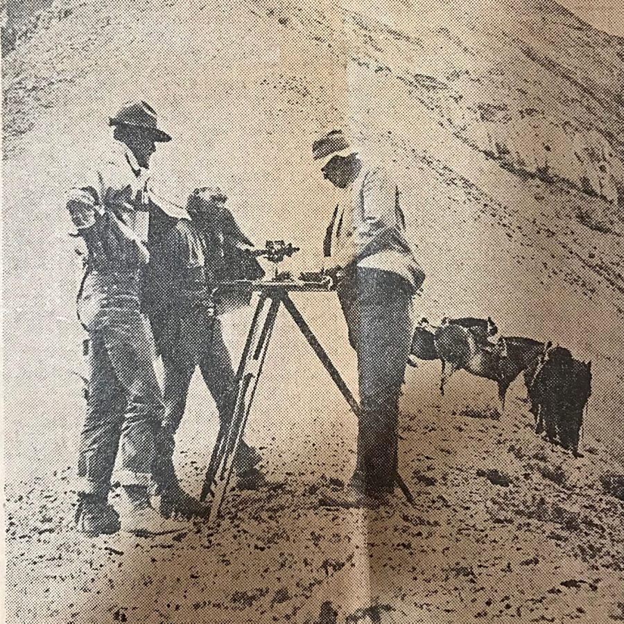
Lyman Marden was a member of the USGS team that surveyed the Borah Peak quadrangle. He wrote an article entitled Climbing the Slopes of Mount Borah—the Dean of Idaho Peaks about the survey. This article appeared in the Idaho Statesman in 1935. In 1950, he wrote the following report for the Boise Public Library.
—An account given to the Boise Public Library on April 15, 1950 by Colonel Lyman Marden, a member of the party that surveyed the Borah Peak quadrangle and placed the benchmark on the top (September 13, 1934).
Located halfway between Mackay and Challis, Idaho. Elevation 12,665 feet above sea level. Highest in the State. Approached via Highway 93 to Challis and Highway 93 toward Mackay or via Highway 20 to Arco, thence to Mackay and toward Challis.
The Challis approach is enriched by the Salmon River country through which Highway 93 runs.
The Arco-Mackay approach is one of great contrast. The Lost River Range, which culminates in Borah Peak, begins as low hills near Arco on the edge of the Snake River Plain. From there, the Range rises to a long series of peaks over 11,300 feet and several over 12,000 feet. See United States Geological Survey, Topographic Map, Borah Peak Quadrangle 1934-35.
A road crosses the mountains just a few miles from Borah Peak through Doublespring Pass and gives access to beautiful country at the headwaters of the Pahsimeroi River, one fork of which rises from the North and East Faces of Borah Peak. These headwaters are scenic with long, grassy slopes called Horse Heaven and at a higher elevation Goat Heaven, and a backdrop of perpendicular mountain faces carved out by glacier action. Small caves may be found at surprising places in the high ridge between the forks of the Pahsimeroi. Good but limited camp spots are available. Obtain Forest Service advice at Challis or Mackay and local ranchers’ advice on springs, streams, wooded areas, etc.
Rivers and creeks in the near vicinity of Borah Peak are of the Lost River type and are apt to lose themselves in the gravel of the valleys for many miles only to reappear. Big Lost River and Little Lost River lose themselves in the Snake River Plain.
The Pahsimeroi River reappears just before emptying into the Salmon River. Fishermen say it is a peculiar shock to run out of water while fishing downstream. There are many interesting phenomena in the general area. Almost certainly some of the peaks have never been climbed. There are castle rocks and pinnacles, hanging lakes, big springs, and distorted and twisted strata. Just north of Borah Peak on the edge of the Pahsimeroi Valley and east of Doublespring is an old volcanic crater containing a crater lake, part of the volcanic action represented by the Craters of the Moon National Monument many miles to the south. It is believed that a large meteor left a wide pockmark in the Pahsimeroi Valley near the upper edge of a distinctive alluvial fan close to the North Face of the Pahsimeroi Mountains. Those who desire to climb Idaho’s highest peak are advised to seek a road to the base of the mountain that leaves the Challis-Mackay Highway 93 quite close to the Dickey Ranch and Post Office. The view of Borah Peak from Dickey will reveal a long, curved ridge ascending to the top. The base of the ridge nearest Dickey is divided by a shallow draw slightly darkened by scrub timber. Ascend the shallow draw and continue along the converged, sharpened ridge to the top.
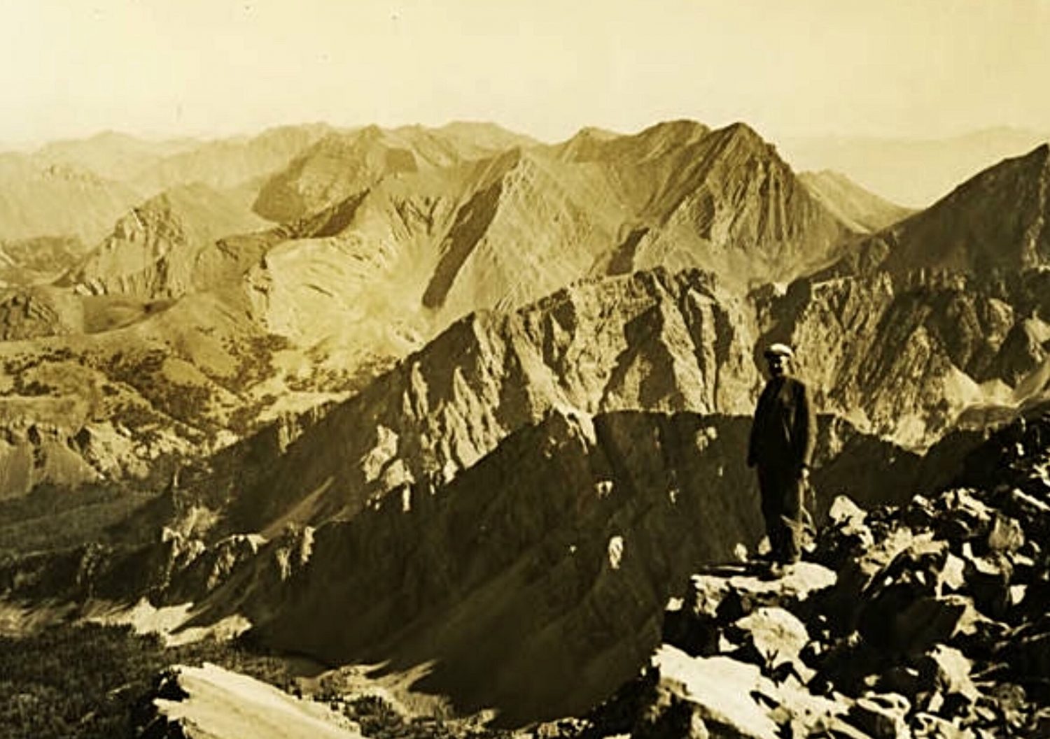
The Lost River Range as viewed from the summit of Mount Borah by Lyman Marden (USGS 1934).