Elevation: 10,660 ft
Prominence: 560
This peak is not in the book. Livingston Douglas revised this page adding a new route and new photos. Farther down the page, you will find a route and photos contributed by Brett Sergenian. Updated October 2025
Trial End Peak sits on a high, rocky ridgeline at the headwaters of Trail Creek in the northern Boulder Mountains. It is most easily climbed from the Trail Creek Loop Trail/FST-126 and the east ridge. USGS Meridian Peak
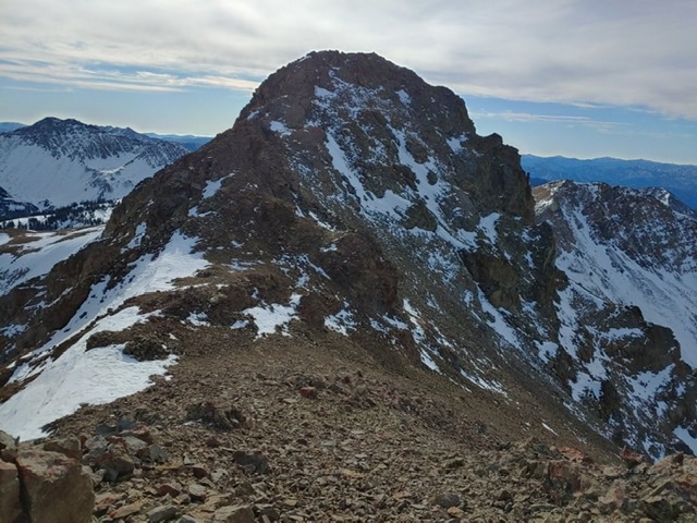
Trail End Peak. Brett Sergenian Photo
Access
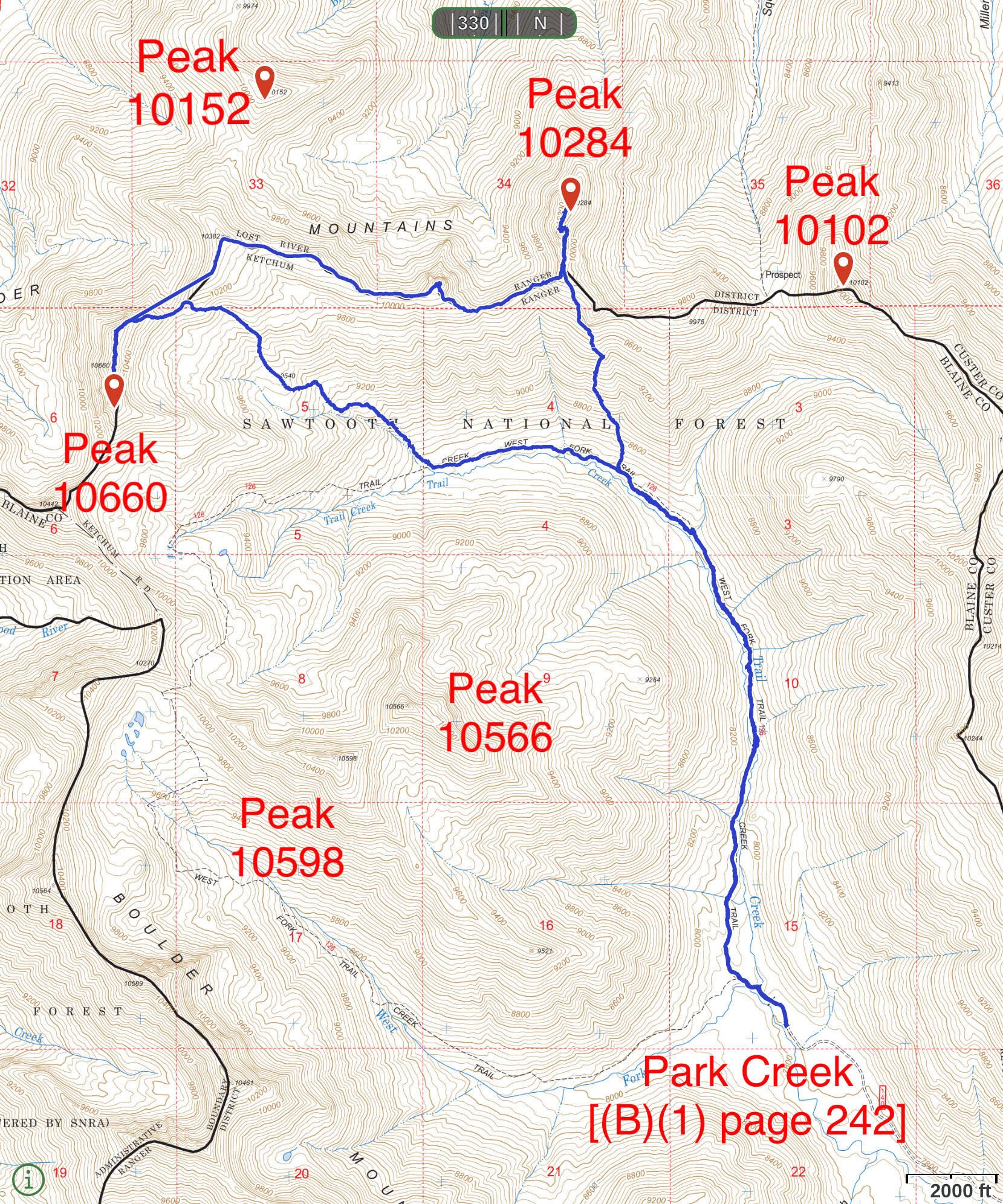
Park Creek Road, FS-140 and the Trail Creek Loop Trail, FST-126 [(B)(1)(a) Page 242]. The Trail Creek Loop Trail, FST-126. As a loop trail the question is whether to hike it clockwise or counterclockwise. We recommend counterclockwise. The left hand of the loop (clockwise) has not been maintained in many years. Furthermore, trail is not in the location shown on the Forest Service topographic map. See the map below. The tread is easy to follow until roughly 9,000 feet. After that point, there are cairns marking the route until tree line. Expert route finding skills are recommended. Roughly one hundred yards from the trailhead, the trail crosses Trail Creek and then forks. Therefore, taking the right hand fork (counterclockwise) allows you to followed a trail which is in much better shape.
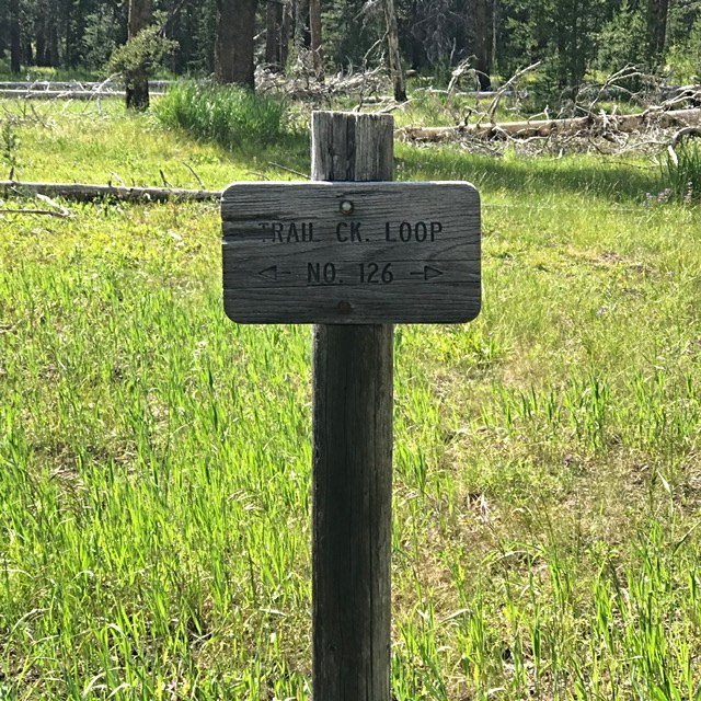
This sign is located a hundred yards from the trailhead. Go right here.
East Ridge, Class 2
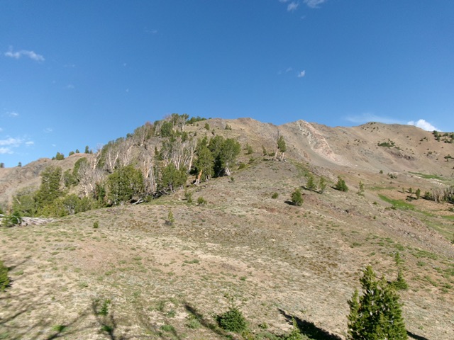
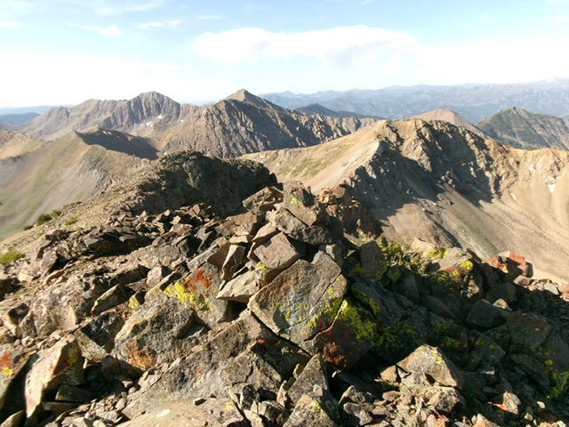
Peak 10660 as viewed from near tree line on the east ridge (left of center). The summit is in dead center. Point 10640+ is the bump just right of center with the whitish rock rib leading up to it. Point 10600+ is the bump even farther to the right. Livingston Douglas Photo
The Ascent
From the trailhead, follow a foot trail to Trail Creek. Follow a spur trail upstream for about 75 yards to a log crossing of Trail Creek. Cross the log bridge then return downstream to intercept the foot trail. Follow the foot trail to a signed trail junction (Loop Trail/FST-126). Go right/north here to follow the trail up the west side of Trail Creek. Contrary to the poor condition of the West Fork section of the Loop Trail, the Trail Creek section of FST-126 is in decent shape and seems to be at least somewhat maintained. In order to get close to Peak 10660, this trail needs to exist and be useful, and it is.
Hike north then northwest then west up FST-126 for about 3-1/4miles to a feeder stream crossing at 8,560 feet. This spot is at 43°52’35.6”N, 114°21’08.8”W. It sits at the toe of the east ridge of Peak 10660. After crossing the feeder stream, leave the trail and bushwhack northwest up through thick-ish pine forest on a shoulder that is on the left/west side of the feeder stream. This narrow shoulder is close to the stream and has copious blowdown. Move left/south of it to find open sagebrush and much easier bushwhacking.
Head west then right/north in the steep, open sagebrush to intercept the obvious, semi-open crest of the east ridge higher up. The east ridge is forested on its crest and on its right/north side but is open sagebrush on its angled left/south side. Scramble west up the angled scrub for a short while then move into the pine forest on the ridge crest. Despite blowdown on the ridge crest, the forest bushwhack is not bad thanks to game trails in it. Higher up, the thick forest ends and it is an easy scramble up scrub and scree/gravel, albeit with some steep sections. There are still some scattered pines but they are easy to avoid.
High up, the east ridge becomes a steep-ish scramble up loose gravel to the crest of the south ridge. From this ridge juncture, head right/north up over a rocky false summit to reach the final, easy talus/scree scramble to the high point of Peak 10660. I built a nice cairn atop the summit boulders. When approaching the summit ridge from high on the east ridge, it looks like Point 10640+ (the north summit) is the high point. But when you stand on the official/south summit (which I verified with GPS), you can see that the rocky north summit hump is slightly lower. The summit offers magnificent views of nearby 10ers.
When descending the east ridge, the ridge wiggles a bit. Stay on an eastward trajectory, keeping a massive gully to your left/north. This gully is the headwaters of the critical feeder stream of the ascent route. The main Trail Creek drainage is to your right/south as you descend the east ridge. Lower down, bend right-ish/southeast with the noisy feeder stream nearby to reach FST-126 at the feeder stream crossing. Most of the east ridge is in open terrain and the forested areas typically have game trails to avoid the blowdown.
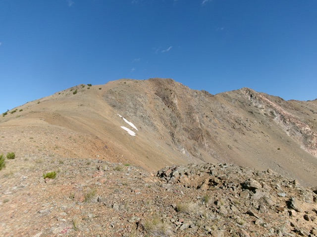
Peak 10660 (hump in dead center) and the final push up the east ridge (left of center). This was my ascent route. The east ridge leads directly to the high point. Livingston Douglas Photo
The newly-built summit cairn atop Peak 10660, looking down the curving south ridge. Livingston Douglas Photo
Northeast/North Ridge by Brett Sergenian
Northeast/North Ridge, Class 3
From the Trail Creek Trail, climb to the ridgeline northeast of the summit. Climb the northeast ridge until it joins the north ridge. Follow the north ridge to the summit. Use the link below to read Brett Sergenian’s trip report.
This map shows Brett Sergenian’s GPS track for Trail End Peak and Ursa Peak. His route covers 12.3 miles with 3,200 feet of elevation gain round trip.
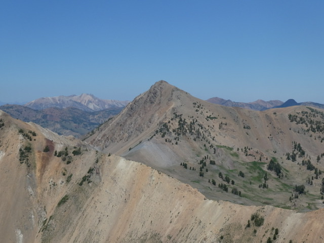
Trail End Peak as viewed from Hemingway Peak
Additional Resources
Regions: Boulder Mountains->EASTERN IDAHO
Mountain Range: Boulder Mountains
Longitude: -114.35241 Latitude: 43.8812