Elevation: 3,610 ft
Prominence: 260
This butte is not in the book. Published October 2025
Twin Buttes, East and Twin Buttes, West are located several miles southeast of Grindstone Butte along South Grindstone Road. They are an easy scramble from the nearby road. A narrow ridge crest connects the two peaks. USGS Notch Butte
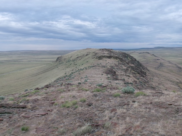
Twin Buttes, East as viewed from the northwest on the high ridgeline. Livingston Douglas Photo
Access
Same as for Grindstone Butte. Continue southeast on South Grindstone Road for another 5.4 miles to reach the Twin Buttes. Park along the road here [3,302 feet; 42°30’00.4”N, 115°11’25.8”W]. This is the first leg of a 2-peak adventure that includes Twin Peaks, East and Twin Peaks, West (3,610 feet). It covers 1.5 miles with 425 feet of elevation gain round trip.
Map Errors
The USGS topo map shows a jeep road on the northeast side of the Twin Buttes. That road no longer exists. It also shows a nonexistent jeep road heading northeast away from the Twin Buttes.
Northeast Face/Northwest Ridge, Class 2
The Climb
From South Grindstone Road, scramble southeast directly at the saddle between Twin Buttes, East (to the left) and Twin Buttes, West (to the right). The terrain is easy field grass initially. It becomes steep, but easy, field grass and scrub as you approach the ridge saddle. Once on the ridge, follow a good foot trail to the water tank and the summit of Twin Buttes, East. The high point is a collection of large boulders on a minor hump. A large water tank sits a bit farther southeast and is a bit lower in elevation.
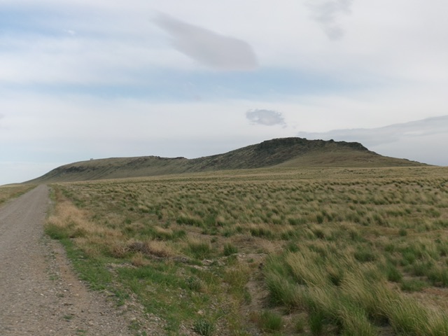
Twin Buttes, East (left of center) and Twin Buttes, West (right of center) as viewed from the north. Livingston Douglas Photo
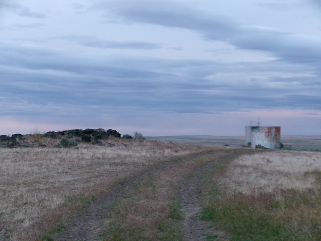
The summit of Twin Buttes, East with its summit boulders (left) and the nearby water tank (right). Livingston Douglas Photo
From the summit, follow a good foot trail along the rocky ridge crest (and on its northeast side) back down to the 3,530-foot connecting saddle with Twin Peaks, West. This concludes the first leg of today’s 2-peak adventure. Twin Peaks, West (3,610 feet) is up next.
Additional Resources