Elevation: 6,921 ft
Prominence: 541
This peak is not in the book. Published October 2025
Peak 6921 is a ranked ridge hump that sits on a long ridge that separates Williams Creek from Perreau Creek in the Eastern Salmon River Mountains. It is most easily climbed via its east ridge from a BLM road that comes up from Perreau Creek Road. USGS Williams Lake
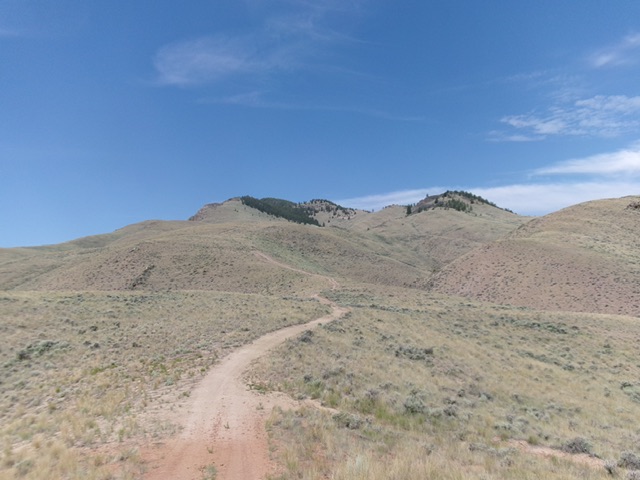
Peak 6921 (dead center) as viewed from the east, early in the climb. Livingston Douglas Photo
Access
From US-93 about five miles south of Salmon, turn right/west onto Williams Creek Road (signed for Williams Lake and Shoup Bridge). Drive 0.7 miles west on Williams Creek Road to a sharp bend in the road and a signed junction with Perreau Creek Road/FSR-027. Head straight/west onto Perreau Creek Road and drive 1.1 miles to a cattle guard. Cross the cattle guard to reach BLM land. About 50 yards past the cattle guard, go left/southwest onto an unsigned spur road. This is the east ridge road that goes up Peak 6921 for a ways.
Follow this spur road as it drops slightly to ford Perreau Creek (about eight inches deep when I forded it). Continue about 0.2 rocky miles farther on the 2-track road (continue straight/south at an unsigned road junction soon after the creek fording) to reach a flat area at the base of a much steeper section of the road. The road becomes an ATV/Jeep trail after this point. Park here [6,661 feet; 45°03’00.9”N, 114°01’52.2”W].
Map Updates
The USGS topo map fails to show a handy 2-track road section that is high up on the east ridge.
East Ridge, Class 2
The Climb
From the flat parking area, hike south then southwest then west then southwest up the meandering ATV trail to Point 5811, where it ends. The 2-track trail weakens as you go higher, but it still makes for a good hiking trail. From Point 5811, descend 25 vertical feet to a minor saddle. From the saddle, scramble west-northwest up steep, but easy, grass/scrub to reach more difficult terrain high up—a mix of rocky outcrops and pine forest.
Either stay on the laborious ridge crest (or near it) OR skirt it higher up near Point 6607 and remain in open scrub on the edge of the forest to reach the forested summit hump. Bushwhack up through the easy pine forest to find the rocky summit crest and the cairned high point at its northwest end. I stood atop another high boulder/outcrop to its southeast of very similar height. The summit area is a nasty mix of boulders/outcrops and mountain mahogany.
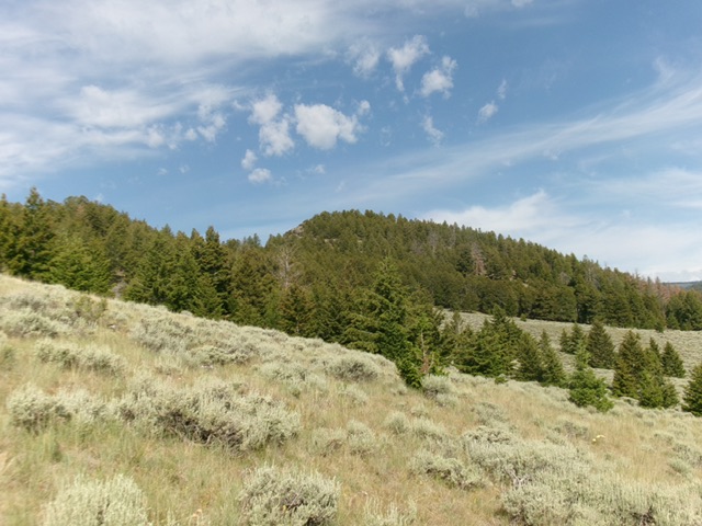
The forested summit hump of Peak 6921 (dead center) as viewed from high on the east ridge. This was my ascent route. Livingston Douglas Photo
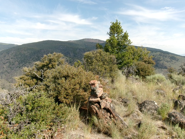
The cairned summit of Peak 6921. Livingston Douglas Photo
Additional Resources
Mountain Range: Eastern Salmon River Mountains
Longitude: -113.9776 Latitude: 45.0898