Elevation: 7,326 ft
Prominence: 426

This peak is not in the book. Published October 2025
Peak 7326 sits above the headwaters of Johnson Creek in the foothills of the Caribou Mountains. It is an easy bushwhack from Dan Creek Road to its southwest. The USGS topo map shows this peak at 7,325 feet. USGS Homer Valley
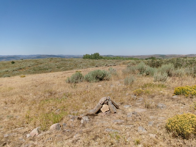
Peak 7326 as viewed from Dan Creek Road (start of climb). Livingston Douglas Photo
Access
From Exit 116/Sunnyside Road on I-15 in Idaho Falls, drive east on Sunnyside Road all the way to its end at a “T” junction with Bone Road. Drive south on Bone Road for 0.1 miles to a signed junction with Eagle Pass Road. Go left/east on Eagle Pass Road (which soon merges into Kepps Crossing Road) and drive 8.3 miles to a signed junction with Dan Creek Road. Reset your odometer here. Turn right/south onto Dan Creek Road and drive 16.7 miles to a bluff/ridge crossing. Park here [6,332 feet; 43°14’22.3”N, 111°33’38.4”W].
West Face, Class 2
The Climb
From Dan Creek Road, bushwhack northeast into a wide, grassy gully (easy). From the gully, aim to reach a shoulder to the right/northeast that has a large, solo pine tree on its crest. After leaving the easy, somewhat-open gully of gapped sagebrush, scramble up a steep-ish, rounded shoulder of sorts in thick scrub (not fun) to reach the ridge/shoulder and the solo pine tree. From there, continue right-ish/east to reach an easier, flattish area between two patches of thick pine forest. This flattish area has a lot of dead leafy veg but also has a fair amount of thick scrub to avoid or work around.
After crossing this flattish section, head left-ish/northeast directly up a face/headwall of steep-ish scrub, dead leafy veg, and some underlying rock. There are some minor open areas on this face section. Once you near the summit crest, cross an easy cattle fence and head right/east to reach the open high point area. There is an old 2-track road just north of this area as the USGS topo map shows. There is thick-ish scrub near the bare high point, both to its south and north. There was no summit cairn so I built a nice one.
The summit of Peak 7326. Livingston Douglas Photo
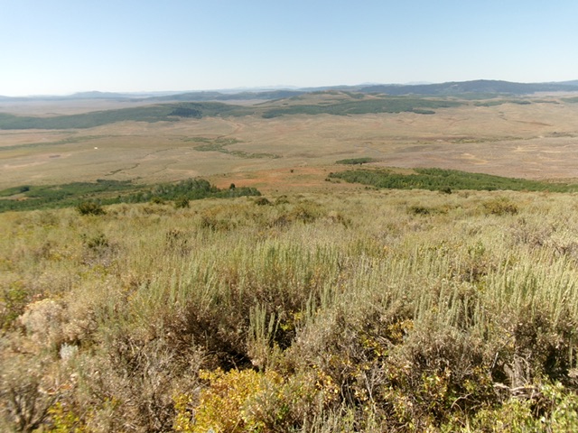
Looking west down into the valley from the summit. The critical gap between the forested areas is in the middle. Aim for it on both the ascent and descent. Livingston Douglas Photo
Southwest Face, Class 2
The Descent
From the summit, descend back down to the flattish area. Continue on a southwest trajectory down thick brush/scrub on a face then a gully to reach Dan Creek Road. Once on the road, follow it for about ½ mile northwest back to the ridge/bluff crossing and your parked vehicle.
Additional Resources
Regions: Caribou Range->SOUTHERN IDAHO
Mountain Range: Caribou Range
Longitude: -111.5323 Latitude: 43.2484