Elevation: 9,364 ft
Prominence: 1,184
Climbing and access information for this peak is on Page 296 of the book. Published October 2025
Poison Peak is a magnificent, rocky peak that is located east of the Salmon River and north of Poison Creek. It is most easily climbed from its southeast side. USGS Poison Peak
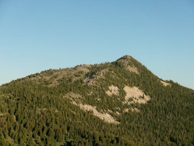
Poison Peak as viewed from Watson Peak to its east. Livingston Douglas Photo
Access
Same as for Peak 8740 South. This is the third leg of a 3-peak adventure that includes Watson Peak (8,671 feet), Peak 8740 South, and Poison Peak. It covers 8.5 miles with 3,115 feet of elevation gain round trip.
Map Errors
The trail coming up from Saddle 8205 to the 8,340-foot connecting saddle north of Peak 8740 South reaches the saddle on its southwest end. The USGS topo map incorrectly shows this trail crossing the north ridge of Peak 8740 south. The trail section near Saddle 8205 no longer exists. There is an unmapped 2-track coming up from Saddle 8205 to the southeast ridge.
Southeast Ridge, Class 2
The Climb
From Saddle 8205, follow the remnants of an unmapped 2-track (mostly a grassy clearcut now) west then right-ish/northwest up onto the southeast ridge. This old 2-track soon ends. Continue up the open forest on the ridge as it heads north then northwest to reach the summit rocks of Poison Peak. As you advance higher on the ridge, easy tundra takes over. High up, the southeast ridge joins the south ridge.
From a nice, open area high up that has only a few scattered pines (inaccurately shown as forested on the USGS topo map), follow a climber’s trail diagonally (then straight up in one section) to cross/climb a talus field and reach the crest of the rocky east ridge. Scramble west up the rock-and-fir crest of this ridge to reach the rocky summit of Poison Peak. The USGS benchmark is still there with a post in a modest summit cairn. A rocky outcrop just to the west may be slightly higher and had a small, torn-down cairn. I built a cairn on the highest boulder here as it may be the actual high point.
From the summit, return to Saddle 8205 then cross a thick patch of sagebrush to its east to access the thick, blowdown-strewn pine forest to the northeast. Find a magnificent, wide, maintained foot trail hiding in this forest. Follow this trail northeast then east up through the thick pine forest to reach the 8,340-foot connecting saddle on the south side of Watson Peak. Re-climb Watson Peak then descend the weak 2-track on the ridge crest heading northeast then north back down to the Forest Service road. The 2-track gets better as you descend. Once on the road, head southeast about ¼ mile back across Warm Spring Creek to reach the grassy pullout and your parked vehicle.
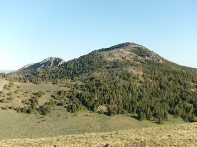
Poison Peak (right of center) and Peak 9198 (left of center) as viewed from Peak 8740 South to the southeast. Livingston Douglas Photo
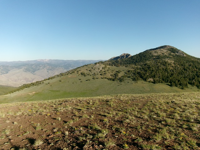
Poison Peak (right of center) and its enjoyable southeast ridge (rising diagonally from the lower left). This was my ascent route. Livingston Douglas Photo
Additional Resources
Regions: EASTERN IDAHO->Lemhi Range
Mountain Range: Lemhi Range
Longitude: -113.8709 Latitude: 44.8916