Elevation: 10,377 ft
Prominence: 357
This peak is not in the book. Livingston Douglas added a new descent route, new photos, and a trip report of a 4-peak ridge traverse found at the following link: The Argosy Adventure. Updated October 2025
Argosy Peak is located about a mile southwest of Err Peak and the main Pioneer Mountain Crest. It is most often climbed with Err Peak and Pion Peak. The round trip shown below covers 9.1 miles with 4,300 feet of elevation gain. USGS Trail Creek
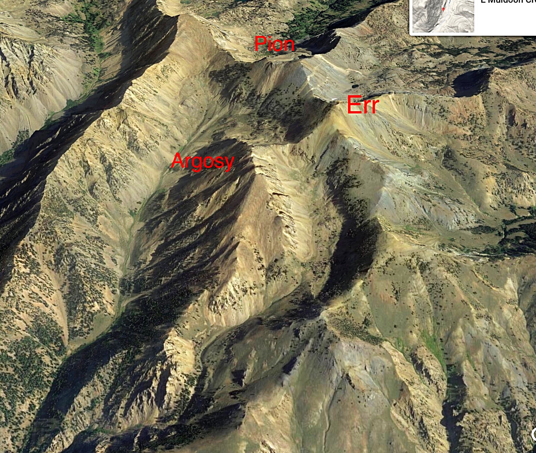
A Google Earth image of the Argosy Trio
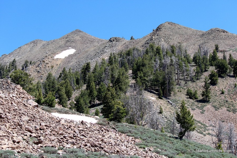
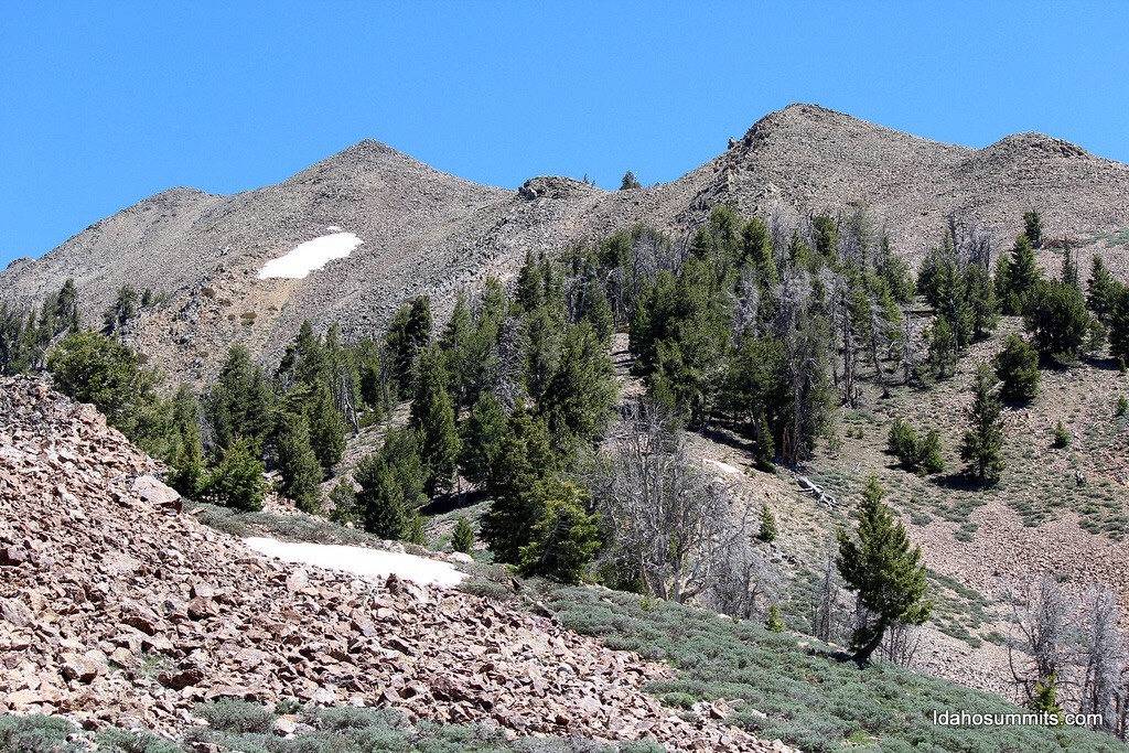
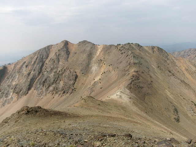
Argosy Peak as viewed from Pion Peak
Access
Argosy Creek is accessed from ID-20 at Carey, Idaho. Look for the sign on the east end of town stating “Little Wood River Reservoir 11.0 miles.” See [(E)(1) on Page 261]. Take this good paved road out of town passing homes, farms and ranches. The road turns to good gravel before reaching the turn for the reservoir. Continue on the main road. At 17.4 miles, the road takes a sharp right turn and runs through the middle of a ranch. Continue through the ranch buildings for 6.8 miles to an unsigned junction just past a turn for another ranch.
This road, shown on the map below, is FS-126. Most maps show it as a 4WD road when, in fact, it is a good road suitable for most vehicles when dry. Follow FS-126 as it skirts around the ranch property and works its way into upper Muldoon Creek for 2.5 miles where the road is wide enough to park. This spot is just past the confluence of Muldoon Creek and Argosy Creek.
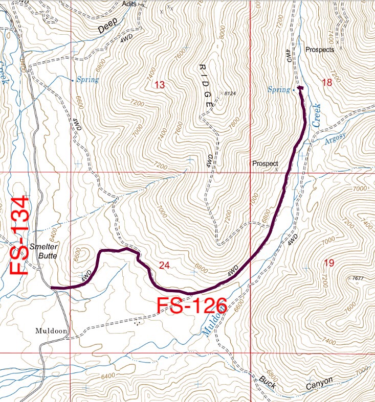
FS-126 access
Muldoon Creek is clogged with willows. Finding your way across the creek and then through the willows may be the crux of the climb. The best spot we found was 0.1 miles south of our parking spot. Good luck.
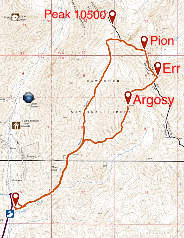
My GPS track for the Argosy Trio. Matt Durrant, Mike Fox and I hiked the loop portion clockwise. We skipped Peak 10500, but it can easily be climbed from the head of Argosy Creek.
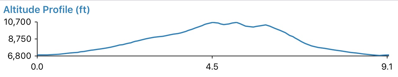
Elevation profile. The great thing about combining all three peaks in one day is that once you make the first peak, the up and down to the other peaks is minimal.
Use the links below to read trip reports from John Platt and Dan Robbins for just such an excursion.
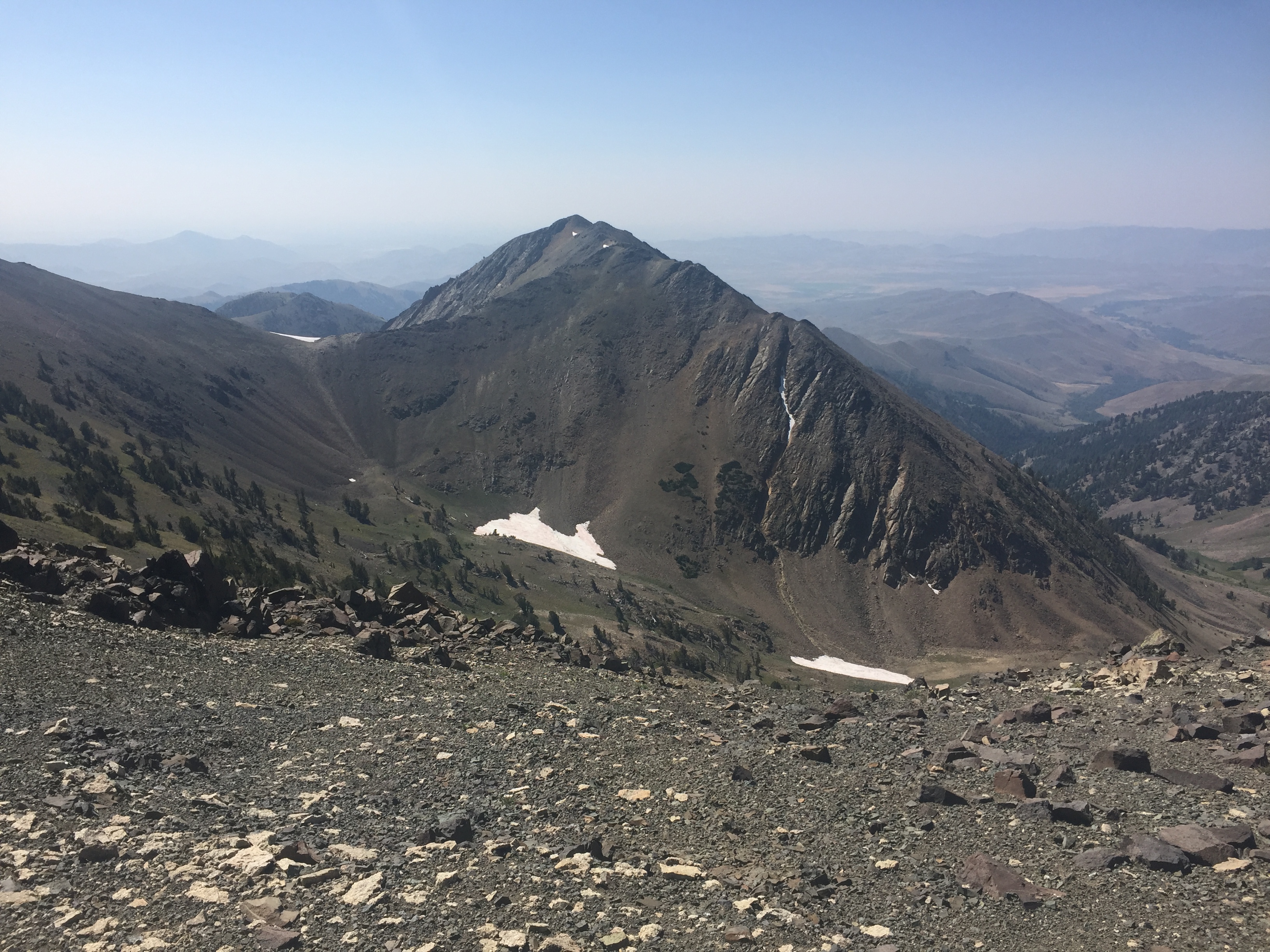
Argosy Peak. Dan Robbins Photo
Argosy Peak. George Reinier Photo
South Ridge/West Gully Descent by Livingston Douglas
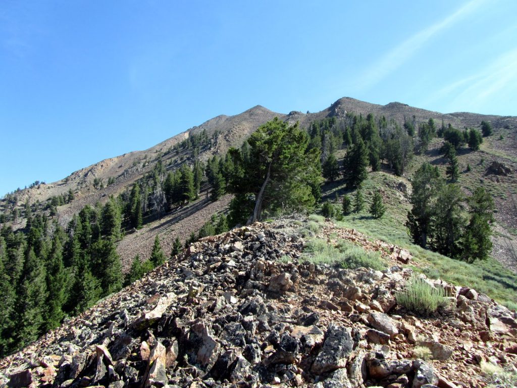
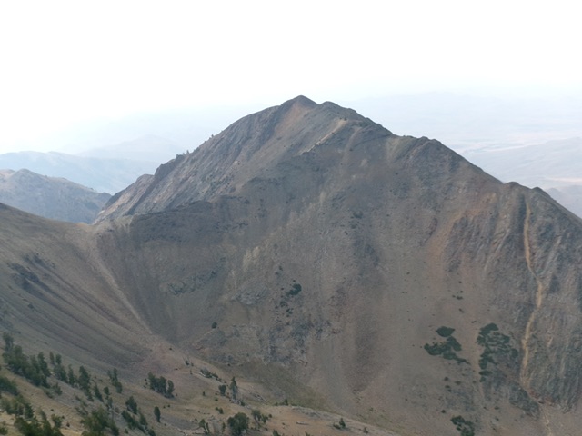
Argosy Peak as viewed from Err Peak to its northeast. The summit is the hump farthest left of center. The northeast ridge is just right of center. This was my ascent route. Livingston Douglas Photo
South Ridge/West Gully, Class 2
The Descent
This is the final leg of a 4-peak adventure (The Argosy Adventure) that includes Peak 10500, Pion Peak, Err Peak, and Argosy Peak. It covers 10.5 miles with 5,300 feet of elevation gain round trip. Surprisingly lacking a summit cairn, I built a nice cairn on the high point of Argosy Peak. From the summit, descend the ridge crest south then southwest then south on miserably-loose talus and boulders to reach the head of a forested gully that sits just north of the 8,740-foot saddle that is located just underneath, and north of, Point 8978.
Leave the ridge and descend an open, rocky gully that heads southwest then west down to the Argosy Creek drainage. The gully widens as you descend. It is easiest to stay on the left/south side of the gully initially in easy pine forest with a gravel base. Lower down, move into the scree-filled gully as it opens up and widens out. The scree is still unstable so be careful. Reach the easy terrain of the wide Argosy Creek drainage and follow game and cattle trails back to the crossing of Muldoon Creek.

Looking back up the scree-filled west gully of Argosy Peak. This was the second leg of my descent route. Livingston Douglas Photo
Argosy Peak as viewed from Pion Peak to its north. Livingston Douglas Photo
Additional Resources
Regions: EASTERN IDAHO->Pioneer Mountains
Mountain Range: Pioneer Mountains
Year Climbed: 2017
Longitude: -113.84919 Latitude: 43.61239