Elevation: 5,730 ft
Prominence: 20
This formation is not in the book. Published October 2025
Bernards Bedground is a rather insignificant hump with an unusual name. It is located west of Bruneau Canyon and west-northwest of Triplet Butte in extreme southern Idaho on the Snake River Plain. It is most often climbed in combination with nearby ranked Peak 6196. USGS Triplet Butte
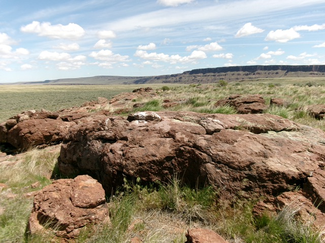
The rocky high point of Bernards Bedground. Livingston Douglas Photo
Access
Same as for Triplet Butte. Leave Roland Road (spelled “Rowland” on the USGS topo map) at 29.3 miles southeast of the road junction near Grasmere and ID-51 and 1.9 miles northwest of the Lower Trailhead for the Triplet Butte climb. Drive east on a somewhat-rugged, rutted 2-track road and reset your odometer. At 0.7 miles, go right at an unsigned junction. At 1.1 miles, go right at an unsigned junction. At 1.9 miles, park alongside the 2-track road [5,780 feet; 42°01’57.3”N, 115°41’31.5”W]. This is the first leg of a 2-peak adventure that includes Bernards Bedground and Peak 6196. It covers 4.0 miles with 565 feet of elevation gain round trip.
West Face, Class 2
The Climb
From the improvised parking spot, bushwhack east then southeast through clumpy field grass with clumpy underlying dirt (somewhat tedious) to find then climb the west face of Bernards Bedground. The west face is an obvious hump with rocks/boulders, surprising for a peak with a rise of only 20 vertical feet. The high point of Bernards Bedground is obvious but it’s a little southwest of the measured high point on the USGS topo map.
South Face, Class 2
The Descent
From the summit, descend 35 vertical feet southwest to cross a dry gully. This gully crossing is the low point between Bernards Bedground and Peak 6196. It concludes the first leg of today’s 2-peak journey. Peak 6196 is up next.
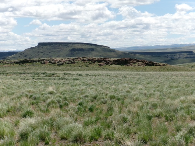
Bernards Bedground (rocky area in mid-ground) as viewed from the west. Livingston Douglas Photo
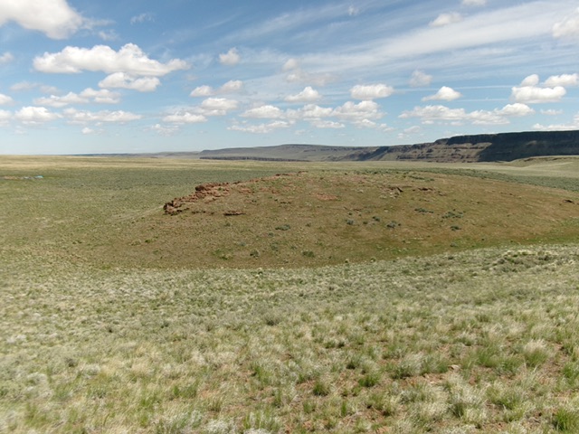
Bernards Bedground (in mid-ground) as viewed from the south. Livingston Douglas Photo
Additional Resources