Elevation: 4,406 ft
Prominence: 96
This peak is not in the book. Published October 2025
Big Hill is located due east of ID-51. It is easily approached via a primitive 2-track road that heads from a highway gravel pit eastward to the southwest side of the hill. USGS Table Butte
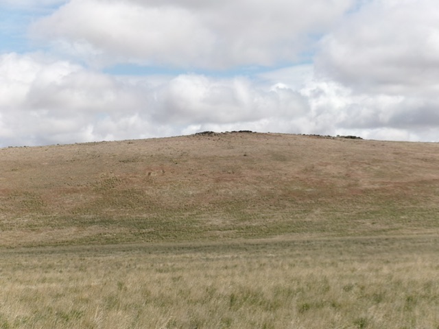
Big Hill as viewed from the southwest. The summit rocks are visible from here. Livingston Douglas Photo
Access
Turn off ID-51 at a gravel pit at about 42°37’20”N and 115°54’27”W. Drive through the gravel pit on a decent 2-track road and continue southeast then south on a cinder 2-track road that soon deteriorates into a hard mud/dirt 2-track. This 2-track road soon bends hard left/east. Follow this road for 2.6 miles to a cattle cistern where the 2-track (pretty faint now) turns hard left/north. Park at the cattle cistern [4,226 feet; 42°36’58.5”N, 115°51’48.5”W]. This is an excellent launch point for a climb of Big Hill. The 2-track road is shown on the USGS topo map in its entirety.
Southwest Face, Class 2
The Climb
From the cistern, bushwhack east-northeast through easy field grass and scrub up a wide gully. Cross a ridge saddle and descend 45 vertical feet as you head northeast directly at the summit rocks from the saddle to cross a dry gully. Scramble up the grass/scrub on the southwest face to reach the summit rocks. There is no summit cairn or USGS “Ridge” benchmark to be found.

The summit of Big Hill. Livingston Douglas Photo
Additional Resources