Elevation: 5,378 ft
Prominence: 88
This formation is not in the book. “ A kīpuka is an area of land that is surrounded by younger lava flows, in effect an “island” within a sea of lava. Literally translated, the Hawaiian word signifies a variation, or change of form. It is one of the few Hawaiian words, like pāhoehoe and ʻa‘ā, to be adopted into the broader vocabulary of geology.” —NPS. These areas are of interest to botanists because they have not been grazed by cattle which cannot reach the Kipuka due to the surrounding lava. Published October 2025
Carey Kipuka is located in the southwest corner of the Craters of the Moon National Monument. It is best accessed via Laidlaw Park Road to its south, which can be easily reach from US-20 to the northwest. Carey Kipuka is a sagebrush hump that is surrounded by a sea of lava rock. USGS Little Park
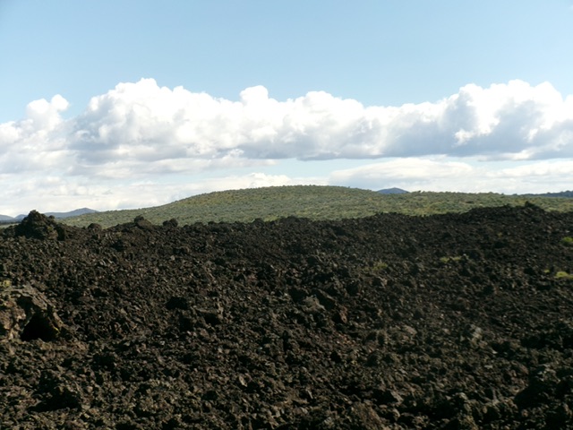
Carey Kipuka as viewed from the lava fields to its south. Livingston Douglas Photo
Access
Laidlaw Park Road is located along US-20 exactly 4.3 miles east of the north end of Carey (at the Little Wood Reservoir Road junction). North Laidlaw Park Road is located another 2.2 miles east of Laidlaw Park Road and 0.1 miles west of Fish Creek Road. All three of the aforementioned roads are signed along US-20. You can reach Laidlaw Park Road either directly (from the west) or from North Laidlaw Park Road, which begins 1.2 miles north of Laidlaw Park Road on US-20.
From the signed junction of Laidlaw Park Road and North Laidlaw Park Road, drive east then southeast then east on Laidlaw Park Road for 9.4 miles to an unsigned junction with a 2-track road (shown on maps) heading left/north. Reset your odometer here. Drive north up the 2-track road. At 0.2 miles, go right/north at an unsigned junction. At 1.1 miles, the 2-track road ends. Park here [5,124 feet; 113°39’58.3”N, 43°18’22.8”W].
South Face, Class 2
The Climb
From the end of the 2-track road, bushwhack east-northeast up a wide gulch that is a continuation of the road’s direction (the USGS topo map shows the road still here but it is long gone and there are no remnants of it). Follow a cattle/use trail initially which soon disappears. Upon approaching the lava fields at the head of the sagebrush gulch (the sagebrush is a bit thick in areas but is not too difficult), move right/southeast to stay in the open sagebrush for a bit longer and avoid the tedious lava rock.
Head northeast, following the right/south side of toe of the lava fields (tall cairn here) until the sagebrush ends. Begin the inevitable lava rock scramble now. Head northeast then north-northeast and aim directly at the sagebrush hump in the distance, which is Carey Kipuka. After toiling in the up-and-down lava blocks, talus, and ground slabs/fingers of lava (with gullies/gaps along the way), drop to a wonderful field of sagebrush.
Scramble north-northeast then north to the summit area. You must first come up over a false summit (which is what you see from a distance) to finally see the summit hump. The sagebrush is a bit thick and tedious but it does have gaps and lanes. The summit of Carey Kipuka has several ground boulders of similar height. There was no summit cairn so I built one.
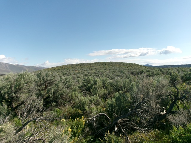
The summit hump finally comes into view. Livingston Douglas Photo
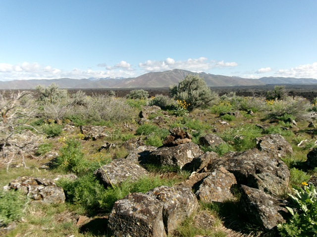
The summit of Carey Kipuka. Livingston Douglas Photo
Additional Resources