Elevation: 5,383 ft
Prominence: 416

This butte is not in the book. Published October 2025
Cedar Butte is a ranked summit on the Snake River Plain. It sits above Dutch Flat and I-15 to the east. This area is a mix of private and public land, so be careful. This climb is entirely on public land and is probably the only public access to the peak. USGS Cedar Butte
The summit hump of Cedar Butte (dead center) as viewed from the southeast. Livingston Douglas Photo
Access
Same as for Table Butte (5,235 feet). The underpass road is signed as 2700N (which turns south and becomes the Camas-Monteview Road). Drive south then west on the Camas-Monteview Road for 7.8 miles to an unsigned junction with a 2-track road. Turn right/northeast onto this muddy, rutted 2-track road and reset your odometer. At 2.9 miles, turn left/northwest at an unsigned junction (Junction 4912 on maps). At 3.7 miles, turn right/north at an unsigned junction. At 5.7 miles, park in a pullout at a final unsigned, unmapped junction [5,210 feet; 44°04’54.6”N, 112°22’08”W].
Map Errors
The USGS map erroneously shows the Camas-Monteview Road as a straight east-west road. That is not the case. The road to the north of this erroneous road is the actual Camas-MonteviewRoad. The USGS map fails to show all of the 2-track roads in the Cedar Butte area.
South Face, Class 2
The Climb
From the roadside pullout at the unsigned junction, hike up the right/north spur road (not shown on maps) to another junction at a flat area just southeast of the summit rocks. Follow a weaker 2-track road left/west to reach the base of the south face/ridge where this spur road ends. Scramble north up through scrub then boulders/talus to reach the rocky summit area. There are three USGS benchmarks in ground boulders and a pole in a cairn on top.
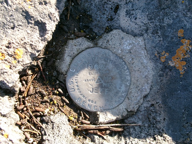
The USGS benchmark atop Cedar Butte. Livingston Douglas Photo
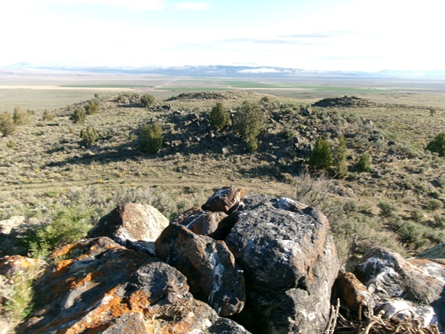
Summit view from atop Cedar Butte, looking north. Livingston Douglas Photo
Additional Resources