Elevation: 5,235 ft
Prominence: 105
This butte is not in the book. Published October 2025
I typically don’t recommend WSA HPs with minimal prominence. But this one is worthy of a climb. Cedar Butte WSA HP offers an exciting, rocky scramble on much more rugged terrain than you would expect. This peak is south-southeast of Cedar Butte and sits entirely on BLM land. USGS Rock Butte
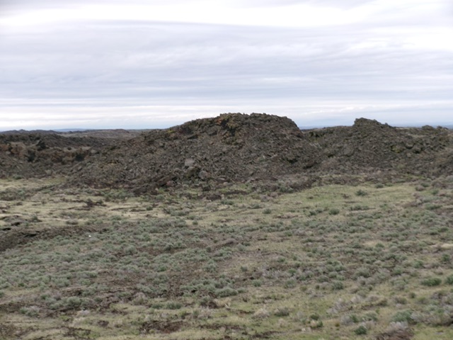
Cedar Butte WSA HP (dead center) as viewed from the west. The high point sits on the east rim of a crater. The crater is in the bottom half of the photo. Livingston Douglas Photo
Access
From the junction of US-20 and US-26, drive southeast on US-26 for 6.7 miles to a signed turnoff for Atomic City. Turn right/west and drive 1.3 miles to a road junction in Atomic City. Go left/south onto [signed] 2650W and drive 1.3 miles to a signed junction with Cedar Butte Road. Turn right/west onto Cedar Butte Road and drive 4.4 miles on this maintained gravel road to reach an unsigned junction with a 2-track dirt road heading left/south. This is Junction 5018 (map). Reset your odometer here and turn south onto the 2-track road.
At 0.5 miles, reach an unsigned, unmapped junction. Go left/south here. At 1.9 miles, reach an unsigned junction (Junction 5113 on maps). Go left/southeast here. At 3.1 miles, reach an unsigned junction (Junction 5124 on maps). Go right/southwest here. At 3.8 miles, reach a final unsigned junction. Park here [5,130 feet; 43°21’55”N, 112°53’49”W].
South Crater Rim, Class 3
The Climb
From the unsigned junction, hike south then east then southeast on a meandering 2-track to reach its end on a shoulder of sorts. Scramble southeast then east up a face of chunky lava rock to reach the west rim of the crater and a pole in a cairn. But this is not the high point. The obvious high point is an ugly, lava rock hump on the east crater rim. Scramble southeast then east on the chunky lava rock of the crater rim.
Descend about 20 feet and cross a gap on lava blocks. Climb north up lava rock and blocks to reach the summit area. A rock shelter (and boulder) is probably the high point. I also stood atop a point about 20 feet to the east with a small cairn. These two points are of very similar height. This climb requires a delicate, Class 2+/3 scramble up and down large, unstable blocks of lava rock, so be careful.
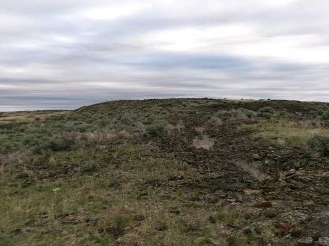
Looking at the west face of the crater rim from the end of the primitive 2-track. It is a lava scramble from here. Livingston Douglas Photo
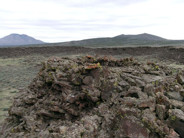
The summit of Cedar Butte WSA HP with its rock shelter. Livingston Douglas Photo
Additional Resources