Elevation: 3,567 ft
Prominence: 227
This butte is not in the book. Published October 2025
Chalky Butte/Benchmark is located just off Reynolds Creek Road in the Owyhee Mountains. It is a beautiful butte/ridge that is unofficially named by BLM. Chalky Butte is most easily climbed directly from Reynolds Creek Road to its west, not from the BLM parking area for “Chalky Butte.” USGS Reynolds
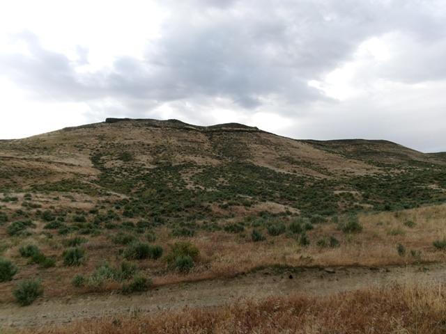
The Chalky Butte massif and its steep west face. This was my ascent route. Livingston Douglas Photo
Access
Reynolds Creek Road [(A)(1) on Page 346]. From ID-78 just southeast of its junction with ID-45, turn west onto [signed] Reynolds Creek Road and reset your odometer. At 1.9 miles, pass the Hemingway Butte Trailhead. After about two more miles, pass the “BLM Chalky Butte” parking area. After another 1.2 miles, park along Reynolds Creek Road at 3,162 feet and43°16’55.1”N, 116°39’53.3”W. This is the closest access point for a climb of Chalky Butte.
Map Updates
The USGS topo map shows many spurious roads in this area and fails to show the actual ATV/MC trails in this area. Don’t rely on it.
West Face/Northwest Ridge, Class 2
The Climb
From the improvised parking pullout, scramble east up the left/north side of a large gully. Angle diagonally upward across 1-2 side gullies to reach a large, grassy slope. Climb up this slope diagonally to skirt the [false] rocky northwest summit and reach a saddle on the high ridge where you will find an unmapped ATV trail.
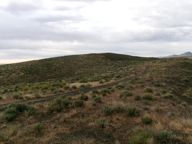
The summit hump of Chalky Butte. Livingston Douglas Photo
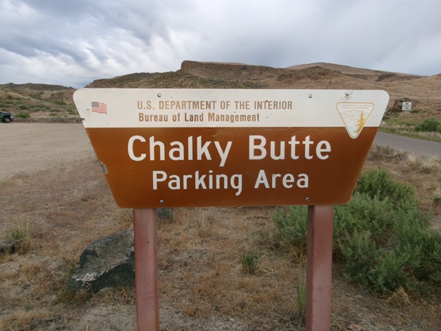
The BLM sign for Chalky Butte. Livingston Douglas Photo
Follow this ATV trail southeast then south to the obvious high point of Chalky Butte. The terrain on the west face is a somewhat tedious mix of field grass, scrub, and underlying loose talus. There is a lower summit hump to the south of the true high point. I built a decent summit cairn on the high point, which is next to the ATV trail on the ridge crest. There are numerous ATV trails on this peak, all of which are unmapped.
Additional Resources
Regions: Owyhee Mountains->SOUTHERN IDAHO
Mountain Range: Owyhee Mountains
Longitude: -116.6573 Latitude: 43.2787