Elevation: 5,030 ft
Prominence: 55
This butte is not in the book. Published October 2025
Emery Butte is located just southwest of Roseworth Road and west of the Cedar Creek Crossing in the southern Snake River Plain. It is a rather insignificant hump with only 55 feet of prominence and requires a canal fording early on. USGS Roseworth SE
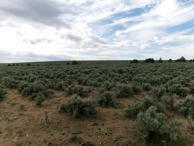
Emery Butte and its north face as viewed from the cattle gate (start of climb). Livingston Douglas Photo
Access
Same as for Pigtail Butte. From the signed junction of 2500N and 700E, drive south for a mile to [signed] 2400N. Go right/west here and jog west then left/south to quickly reach [unsigned] Roseworth Road in about 1.1 miles. Head southeast on Roseworth Road for 3.0 miles and find a so-so 2-track road heading diagonally right/south. Drive 0.8 miles south on this deep dirt, rutted 2-track to reach a gated fence row and park[4,854 feet; 42°19’01”N and 114°51’37”W]. Do NOT attempt to drive this final 2-track road in wet conditions.
Map Errors
There is an unmapped 2-track road that heads south from Roseworth Road (an excellent gravel county road) directly at Emery Butte. The road heading southeast along the northeast side of Emery Butte (shown on the USGS topo map) no longer exists.
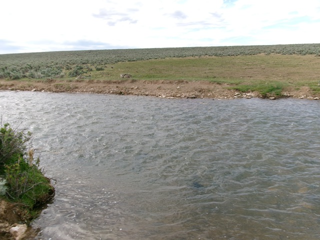
The canal crossing near the start of the climb. This is the crux. Livingston Douglas Photo
North Face, Class 2
The Climb
The crux of this climb is fording Cedar Mesa Canal early on. It’s somewhat wide, has a rocky bottom, and is knee-deep at worst. From the parking area, cross the cattle fence and bushwhack south to reach the canal. Ford the canal to reach its south side. Bushwhack south-southeast up through thick-ish sagebrush to reach the open summit area. Find the highest point. I built a small cairn there. The high point is in an open area with minimal sagebrush.
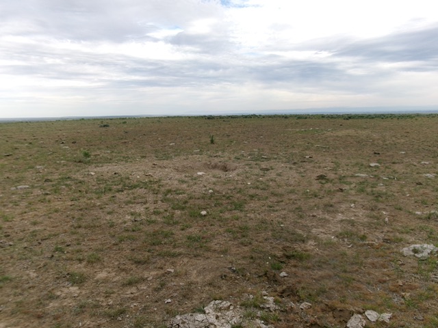
The open summit of Emery Butte. Livingston Douglas Photo
Additional Resources