Elevation: 5,820 ft
Prominence: 40
This peak is not in the book. Published October 2025
Flatiron is located along the west side of the Snake River and due west of the hamlet of Irwin, Idaho. It is most easily climbed from the Indian Creek trailhead to its west. This area is a mix of private and public land, so be careful. This peak can be climbed entirely on BLM land. USGS Swan Valley
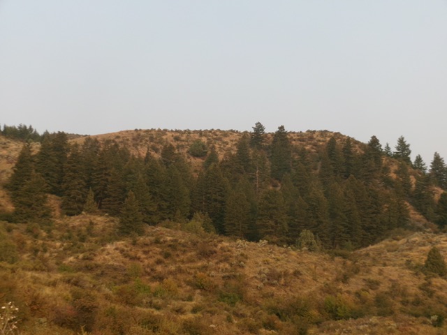
Flatiron as viewed from the Snake River Road to its east. Livingston Douglas Photo
Access
From the signed junction on the west side of the Snake River bridge crossing on US-26 (about two miles northwest of Swan Valley), drive southeast on the well-maintained Snake River Road for 5.9 miles to a signed junction with a spur road. This spur road leads a short distance to the Indian Creek ATV trailhead. Park in the large trailhead parking area [5,386 feet;43⁰24’18.4”N, 111⁰19’20.8”W].
West Face, Class 2
The Climb
From the trailhead parking area, bushwhack east up a steep sagebrush (and other brush) face with some loose underlying scree/gravel. Weave back and forth using any gaps/lanes or minor trails that you can find. Move left-ish/north for a bit easier going on less-steep terrain. Skirt underneath (or avoid) the ridge cliff band to the right/south. Once atop the sagebrush-covered summit plateau, head right/southeast all the way to the high point at the southeast end of the narrowing plateau.
The rocky high point had no cairn so I built a nice one with the ample loose dinner-plate shale there. The summit offers a beautiful view of the nearby Snake River and the hamlet of Irwin across the river. On the descent, I found an easier line from the plateau entry point down to the trailhead parking area. Stay farther to the south than my ascent line. This southern line has more rock but less brush and is less steep.
This ascent route crosses a section of unposted, unfenced private land—mostly on the summit plateau. To avoid this private land, you can climb the peak from the brushy gully just east of the parking area. Follow the gully south-southeast then scramble up a brushy face to reach the ridge crest at a saddle just south of the summit area. Scramble up the brushy, narrow ridge to the summit rocks. This route is less steep than my ascent route and is entirely on BLM land.
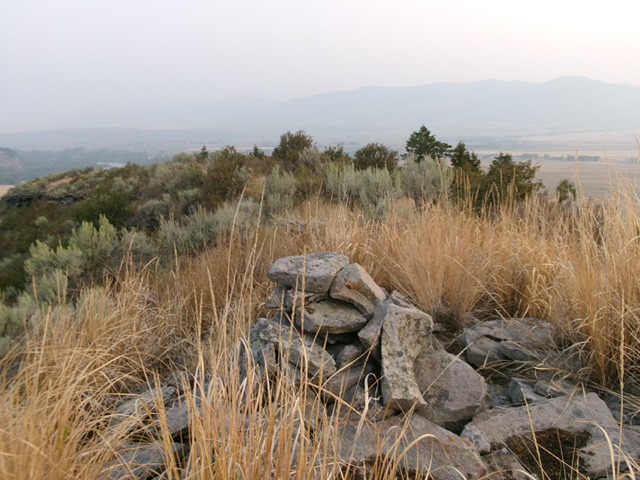
The summit cairn atop Flatiron, looking northwest across the tilted, brushy summit plateau. Livingston Douglas Photo
Additional Resources
Regions: Caribou Range->SOUTHERN IDAHO
Mountain Range: Caribou Range
Longitude: -111.3174 Latitude: 43.4028