Elevation: 8,933 ft
Prominence: 813
This peak is not in the book. Published October 2025
Fogg Hill is located above the headwaters of both the South Fork Rainey Creek and the North Fork Palisades Creek in the Snake River Range. FST-051 gets you close to the summit area. USGS Victor

Fogg Hill as viewed from the southwest. Livingston Douglas Photo
Access
From ID-31 at Pine Creek Pass (14.2 miles up from Swan Valley), drive south on [signed] FSR-253 for 4.9 miles to an unsigned junction with FSR-051 in the North Fork Rainey Creek drainage. Drive east on FSR-051 (a 2-track road) for a short distance to a parking area. There is a trail sign for FST-051 on a large pine tree on the east side of the North Fork Rainey Creek. Park here [6,568 feet; 43°31’47.3”N, 111°11’05.9”W].
Northwest Ridge, Class 2
The Climb
This climb is mostly Class 1. From the parking area, cross the shallow North Fork Rainey Creek to reach the foot trail (FST-051) on the east side of the creek. Follow this trail as it heads steeply uphill into the pine forest. The trail then flattens and rises very steeply in loose scree/gravel in a pine forest to skirt the left/north side of Fourth of July Peak (7,496 feet). Continue east then southeast as the narrow trail heads downhill for about 100 vertical feet. The trail then turns left-ish/northeast then right-ish/southeast, descending another 70 vertical feet along the way.
This trail is difficult to follow at times in this section. It stays mostly in open scrub (with forest nearby) and climbs left-ish/northeast up onto the northwest ridge of Fogg Hill, which is still not visible and is a long ways off. Follow the ridge crest (or in open terrain on its left/north side) up to a very open area where the peak is now visible dead ahead. Beware that there are some open humps to the right/south that appear to be higher. The trail bends right/south and skirts the semi-forested hill that is Fogg Hill. The summit is hiding behind the trees.
Leave the trail and bushwhack southeast then east to the summit. The terrain is a mix of thick-ish sagebrush and pine forest initially. The terrain then opens up and is a much easier mix of short scrub and scattered pines. The summit is at the east end of a lengthy series of rocky outcrops/boulders. I built a cairn atop the highest boulder.
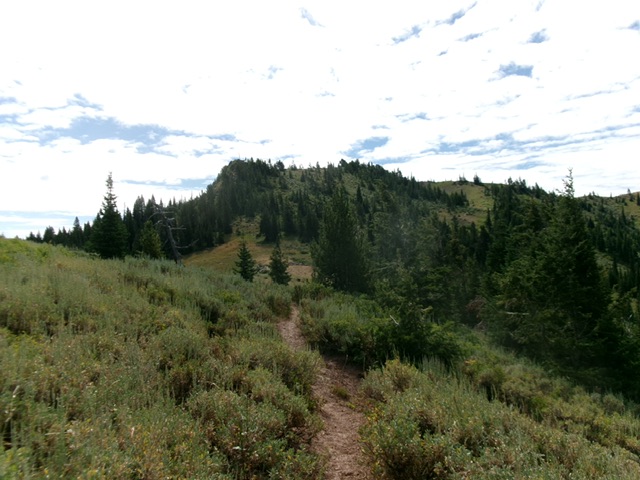
Fogg Hill as viewed from FST-051 to its northwest. Livingston Douglas Photo
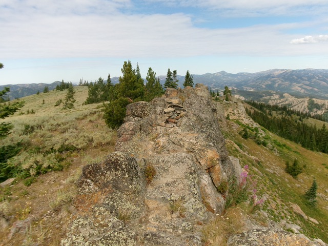
The rocky summit crest of Fogg Hill. Livingston Douglas Photo
Additional Resources
Mountain Range: Big Hole and Snake River Mountains
Longitude: -111.1174 Latitude: 43.5088