Elevation: 5,215 ft
Prominence: 120
This butte is not in the book. Published October 2025
Gerber Butte is one of four buttes on the south side of 2600N and east of I-15. The other buttes are Sheepherder Monument Butte (inaccessible), Little Grassy Butte, and Big Grassy Butte (inaccessible). Gerber Butte sits just west of Sand Mountain and the Saint Anthony Sand Dunes. It is on private land but there is no fencing or signage to prohibit entry. USGS Market Lake NE
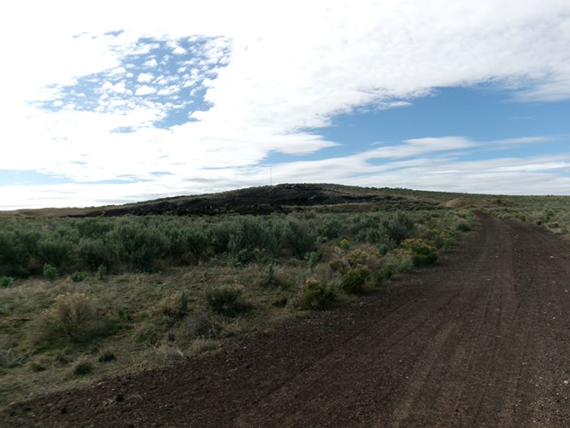
Gerber Butte as viewed from the north (start of climb). Livingston Douglas Photo
Access
From Exit 150/Hamer on I-15 north of Idaho Falls, drive 5.7 miles north on the excellent frontage road to reach a signed junction with 2650N. Turn right/east onto 2650E and drive 0.5 miles to a sharp right/south bend. Continue south for 0.5 miles to a signed junction with 2600N. Go left/east on 2600N and drive 8.4 miles to a signed “T” junction with 550E. Go right/south on 550E and drive 1.0 miles to an unsigned junction with a spur road to the right/south that goes into a gravel pit. Park at this junction [5,102 feet; 43°59’08”N, 112°02’25”W].
Northwest Ridge, Class 2
The Climb
From the road junction, hike south along the cinder spur road to its end at a small gravel pit area. Scramble right-ish up onto the northwest ridge. Bushwhack up through thick-ish sagebrush to the antenna-clad summit. Walk around the fenced-in antenna area to its east side to reach the high point, which is a collection of ground boulders that sit outside the antenna fencing.
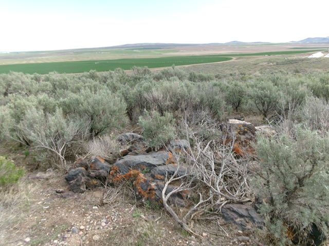
The summit boulders atop Gerber Butte. The antenna installation is nearby. Livingston Douglas Photo
Additional Resources