Elevation: 10,838 ft
Prominence: 1,221
Climbing and access information for this peak is on Page 301 of the book. The elevation and prominence figures are based on recent LiDAR updates. The USGS quad shows an elevation of 10,835 feet. Livingston Douglas provided the access update found below and two new photos. Updated October 2025
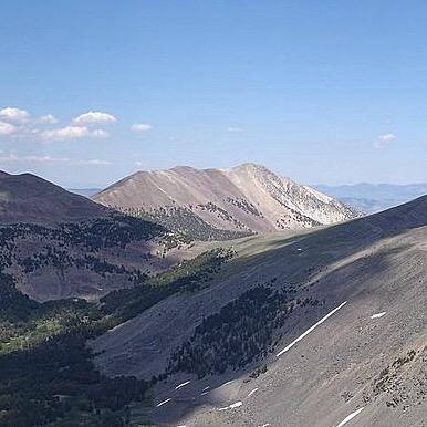
Gunsight Peak is located east of the main Lemhi Range Crest. It is the northernmost summit on a ridgeline that begins on the main crest at U Mountain and includes Ray Lode Peak, Peak 10624 and Gunsight Peak. This ridge divides Big Eightmile Creek from the North Fork Timber Creek. USGS Yellow Peak.
Gunsight Peak (summit is right of center) and its magnificent southwest ridge (skyline in center and left of center). Livingston Douglas Photo
Access Update by Livingston Douglas
FSR-106/North Fork Little Timber Creek Road (Page 314 in the book) is no longer accessible and has been closed for years. It is blocked by posted, private land with “aerial surveillance.” FSR-106 no longer shows up on the MVUM as a result. So FST-627/North Fork Little Timber Creek Trail (Page 314 in the book) is no longer accessible either unless you do an arduous cross-country trek across a ridge from the Little Timber Creek Road to skirt the private ranch land.
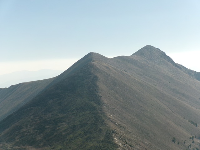
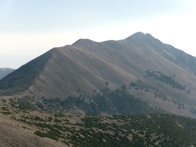
Gunsight Peak (summit is right of center) as viewed from Peak 10623 to its southwest. Livingston Douglas Photo
Additional Resources
Regions: EASTERN IDAHO->Lemhi Range
Mountain Range: Lemhi Range
Longitude: -113.52279 Latitude: 44.59309