Elevation: 8,051 ft
Prominence: 391
This peak is not in the book. Published October 2025
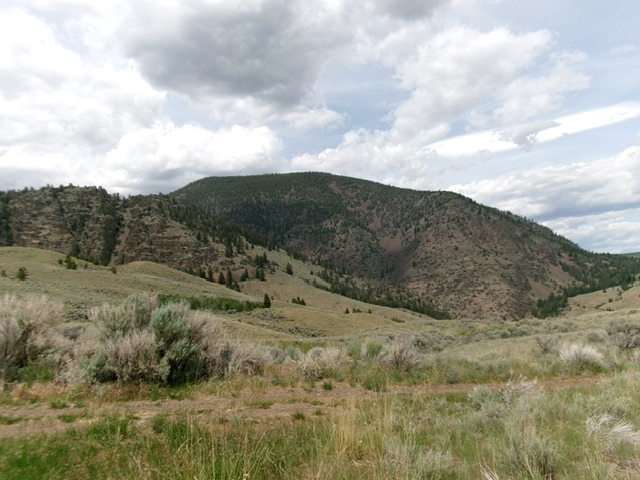
K Mountain earns its name. It has a magnificent “K”-shaped talus/scree field on its northeast side that is quite visible from ID-28 to its northeast. K Mountain is most easily climbed from its north side. USGS Sal Mountain
K Mountain as viewed from the southeast. Livingston Douglas Photo
Access
From ID-28 at virtual MM 120.4 (about 15 miles south of the US-93/ID-28 junction in Salmon), turn west onto [signed] Haynes Creek Road/FSR-350. Drive 4.1 miles to a signed junction with Baldy Basin Road/FSR-152 (left). Continue straight on FSR-427 (signed for Kadletz Creek). Reset your odometer at this junction. FSR-427 soon bends right/north and begins a series of steep switchbacks. At 1.6 miles, FSR-427 crosses a cattle guard with a nice, grassy parking area. After this point, the road gets much rougher.
At 3.0 miles, reach a saddle crossing at 6,340 feet and park [45°01’17.4”N, 113°44’45.7”W]. After this point, the 2-track road gets very muddy/rutted and steeper (ridiculously so) and has many ups and downs. It is only suited for ATVs and MCs from here. Thankfully, this saddle sits at the base of the thickly forested north ridge of nearby K Mountain
North Ridge, Class 2
The Climb
From the saddle, hike southwest up into the forest on remnants of an old, unmapped 2-track road. The old 2-track soon becomes a cattle/game trail in the grassy old roadbed. This trail leads up onto the forested crest of the north ridge. The cattle trail bends left/south to follow the ridge crest briefly then ends. Bushwhack up the forested ridge in a mix of pines, downed timber, and rocky outcrops—a bit tedious. The ridge is rounded but is easy to follow uphill. It is persistently steep. At about 7,080 feet, the terrain suddenly changes to easy, open pine forest with a short, grassy base.
Higher up, the terrain has a rockier base and the pine forest is thicker with much more blowdown. The slope eases considerably and the ridge bends right-ish/southwest. The forested summit plateau begins here. Scramble through endless blowdown, heading southwest then curling right-ish/west then northwest to reach the highest hump. I found a liquor bottle and a small cairn on the high point. I built a nice summit cairn here. Due to the pine forest, there are no views from the top.
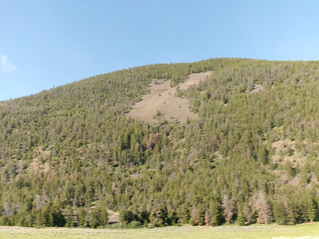
K Mountain and its K-shaped talus/scree field as viewed from the northeast. Livingston Douglas Photo
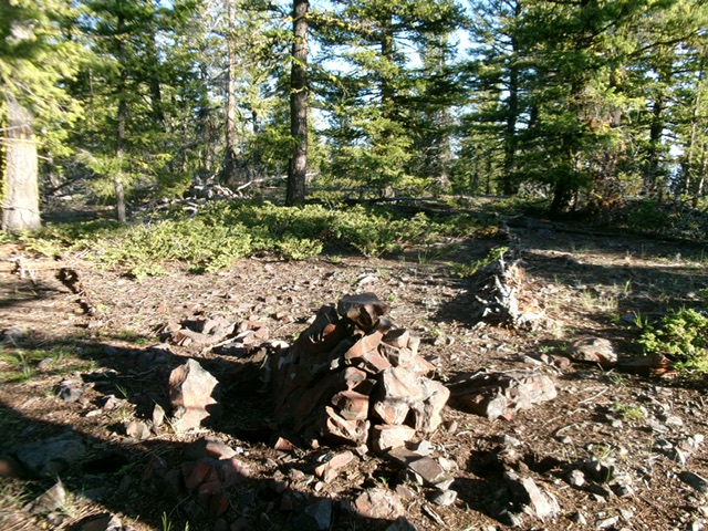
The forested summit with its newly-built summit cairn. Livingston Douglas Photo
Additional Resources
Regions: EASTERN IDAHO->Lemhi Range
Mountain Range: Lemhi Range
Longitude: -123.7564 Latitude: 45.0063