Elevation: 5,577 ft
Prominence: 407
This butte is not in the book. Published October 2025
Kettle Butte is a ranked summit on the Snake River Plain on the north side of US-20, west of Idaho Falls. The northwest summit (5600+) is the high point, according to maps. However, in actuality, the Pinhead Benchmark (5,571 feet on maps) is the actual high point according to LOJ. I confirmed this in visiting both potential high points. USGS Kettle Butte
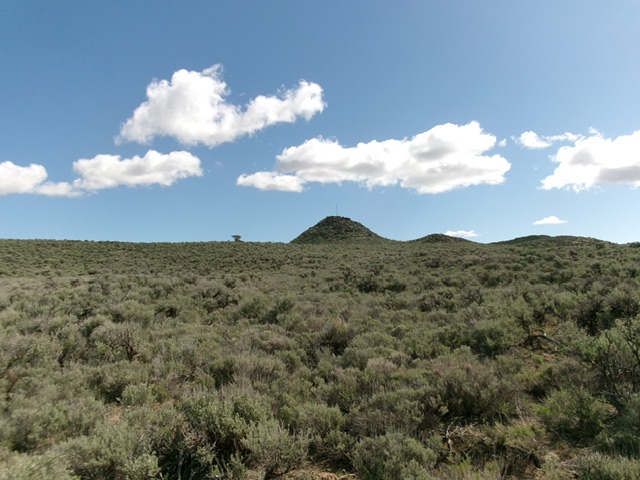
Kettle Butte/Pinhead Benchmark as viewed from the southwest. Livingston Douglas Photo
Access
This area is a mix of private and public land, so be careful. Kettle Butte itself is on BLM land. Reaching the BLM land is the trick. There are two alternative access routes. To climb the southwest face (as I did), use this access route. From US-20 at virtual MM288.8, drive north on an unsigned 2-track road (a rutted dirt road with a few rocky spots) for 2.3 miles. Access is allowed through this private land and you will go through three cattle gates. Stay on the road. Reach an unsigned junction with a weaker 2-track road that heads directly east (then east-northeast) at Pinhead Benchmark. Park at this junction (5,244 feet; 43°35’06”N, 112°24’03”W). This route provides the shortest, most direct route to the summit.
The alternative access route is on much better roads and provides access to the northeast side of Kettle Butte. Leave US-20 at a signed junction with 135th West (at MM294). Drive north on this well-maintained county road for 4.2 miles to a signed junction with 113th North. Drive west on 113th North (another well-maintained county road) for 2.0 miles to a sharp right/north bend at 5,184 feet (map). The road now becomes 155th West and heads north. Park at this bend. There is a 2-track road heading west from this bend, directly at the north side of Kettle Butte. Foot access is allowed by the private landowner to reach the BLM land that surrounds Kettle Butte.
Map Errors
The USGS map shows the first access road (a 2-track) as heading straight north for its first mile, but it is actually a weaving affair. The USGS map fails to show all of the old 2-track roads in the area surrounding Kettle Butte.
Southwest Face, Class 2
The Climb
From the unsigned road junction, follow the 2-track road east then east-northeast. Bear left at a junction early on. A much better 2-track road heads right/southeast from here and is shown on maps. Follow an unmapped 2-track northeast as it approaches the Kettle Butte massif. Leave the road where it starts to move away from Kettle Butte. Stay on a direct line to the cairned hump that is the Pinhead Benchmark.
Bushwhack through reasonable, sometimes tall, sagebrush in cattle trails to get underneath the rocky crater rim. Scramble up onto the ridge (crater rim) on the east/southeast side of Pinhead Benchmark to reach the blocky summit. A pole and wind gauge sits on the summit block. The primary Pinhead Benchmark is gone but a secondary benchmark is still there. From this official LOJ summit (the southeast summit) of Kettle Butte, descend northwest to a 2-track road in the crater area and follow it briefly left/north (this road is shown on the USGS map).
Leave the road and scramble up onto the narrow, scrub-and-rock ridge that leads northwest then west to the [lower] northwest summit. The USGS map shows this summit above a higher contour line (5,600 feet) than the southeast summit. However, the northwest summit look, and measures, LOWER than the official, benchmarked southeast summit. Stand atop both potential summits to be sure that you have captured the actual high point of Kettle Butte.
From the northwest summit, descend southwest then south-southwest through reasonable, gapped sagebrush to intercept the 2-track ascent road near an open, cattle-gathering area. Follow a side road south briefly to find the main 2-track road that leads west back to the junction and your parked vehicle.
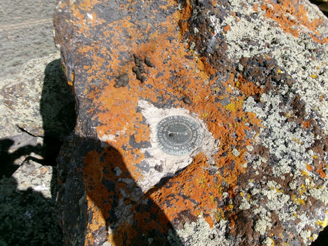
The Pinhead Benchmark atop Kettle Butte. Livingston Douglas Photo
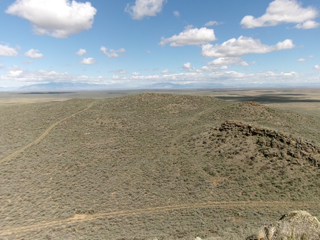
Looking at the northwest summit from Pinhead Benchmark. Livingston Douglas Photo
Additional Resources