Elevation: 3,614 ft
Prominence: 124
This butte is not in the book. Updated October 2025
Kings Crown is a magnificent block of rock that sits above King Hill Creek at the southwest end of a massive bench. This area is a mix of private and public land, so be careful. This climb is entirely on BLM land. USGS King Hill

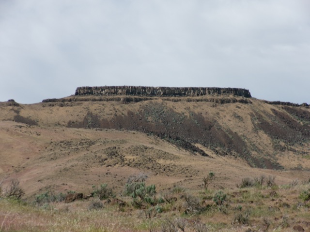
Kings Crown as viewed from the southwest. Point 3568 is just left of center. The summit is the elongated block right of center. Livingston Douglas Photo
Access
Please refer to Page 106 of Sheldon Bluestein’s Exploring Idaho’s High Desert (2nd Edition, 1991). Here is a more detailed description based on my experience in climbing Kings Crown. Reach Montgomery Road from either Exit 121/Glenns Ferry or Exit 125/Paradise Valley on I-84. Montgomery Road goes north from the King Hill Loop Road on the north side of I-84. You can also use Sugar Bowl Road (west of Montgomery Road) to reach a signed junction with Montgomery Road. Either way, drive up the well-maintained, gravel Montgomery Road to its end at a large public (BLM) parking/turnaround area where the road continues as a private driveway to a ranch.
South Shoulder/Southwest Ridge, Class 3+
The Climb
From Montgomery Road (just below the parking/turnaround area), bushwhack across willow-shrouded King Hill Creek. Once across the creek, cross an aqueduct then climb the southwest ridge in open terrain. I was fortunate to get permission from the local rancher (Presley) to drive up a series of dirt roads on the east side of King Hill Creek to reach the base of the south shoulder, which leads up to the southwest ridge.
The south shoulder is broad and is an easy scramble up short field grass. The shoulder merges into the southwest ridge at a fence row at Point 3342. The terrain becomes much more challenging now. Follow the right/southeast side of the fence row from Point 3342 up the steep, rocky ridge. The fence row soon ends. Scramble northeast up the narrow ridge to reach the cliffs of Point 3568. Find an easy Class 2 chute to climb up onto the summit plateau of Point 3568. It is harder to skirt its south side in angled, large boulders, so avoid that option.
Cruise east across Point 3568 then descend about 75 feet in rocky, but not difficult, terrain. Cross a narrow rocky (then grassy) ridge section to reach the base of the ominous cliff band of the summit cap of Kings Crown. The crux of this climb is to surmount this wicked cliff band. Follow the base of this cliff band on the north side of Kings Crown, first heading northeast then heading right-ish/southeast, searching for any feasible chute to climb up onto the summit plateau. The easiest, and only feasible, spot to climb up the cliff band is about 2/3 of the way to the east end of the summit block.
Scramble up onto a narrow, exposed ledge and walk across it very carefully for about 20-25 feet to reach much easier ground. This ledge is the key to reaching easier ground higher up. I built a cairn at the top of this ledge so that I could find it on the descent. From the end of the ledge, head up and right on a narrow ramp at the base of the final summit cliffs. Turn left and do a final climb of about 10 feet of easy face rock to reach the summit plateau. The summit high point is left/southeast from this entry point onto the summit plateau.
There is no USGS benchmark atop the high point but I found a few old fire rings in the high point area. Finding the spot to climb up onto the summit plateau is not easy. I walked all the way to the east end of the summit cliff band and then returned to find it. It is not obvious but it is the area where there are some breaks (of sorts) in the cliff band. Most of the cliff band is sheer and is impossible to surmount, so that narrows down your choices (and your search) significantly.
Kings Crown as viewed from the south. Livingston Douglas Photo
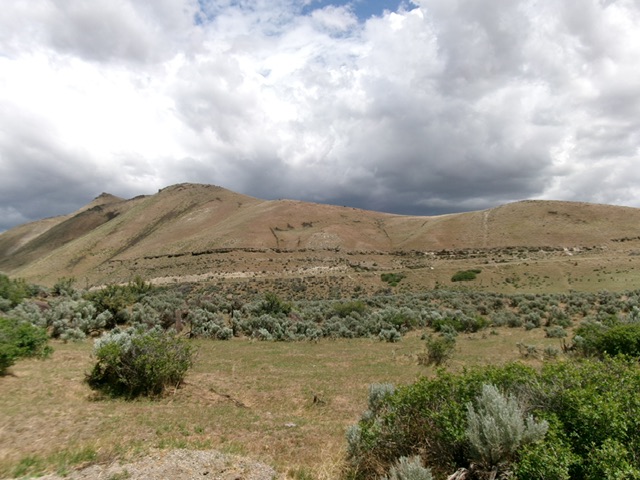
The southwest ridge of Kings Crown as viewed from the valley floor. This was the first leg of my ascent route. Livingston Douglas Photo
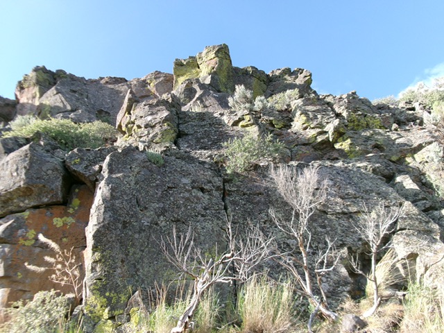
Looking up at the weakness in the north cliff band of Kings Crown. This is the crux of the climb. Livingston Douglas Photo
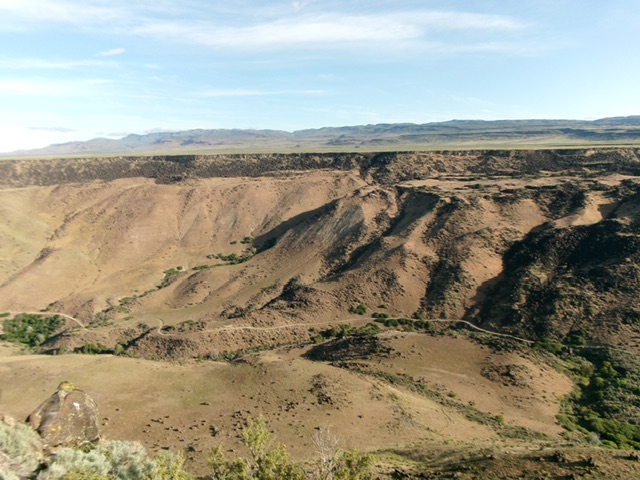
Summit view from atop Kings Crown, looking north. The King Hill Creek drainage sits far below. Livingston Douglas Photo
Additional Resources