Elevation: 7,006 ft
Prominence: 186
This peak is not in the book. Published October 2025
Mahogany Butte is located along a frontage road in the southern foothills of the Lemhi Range. It is most easily climbed from a BLM road on its south side in Tyler Canyon. This area is a mix of INL land, private land, and public land. Be very careful where you drive and where you hike here. USGS Eightmile Canyon
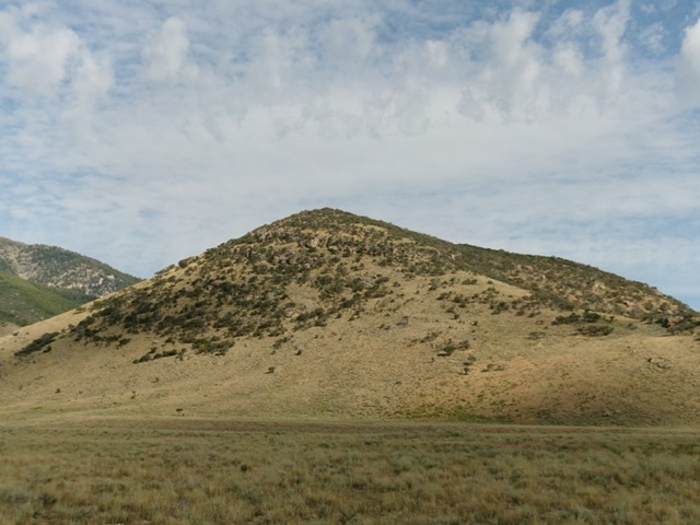
Mahogany Butte as viewed from the southeast. Livingston Douglas Photo
Access
Eightmile Canyon Road is located along ID-28 at virtual MM38.6. The large parking area at the signed road junction is at 5,674 feet and 44°04’19.0”N, 112°50’27.5”W. This road junction is not shown accurately on the USGS topo map. Reset your odometer at this junction and drive west on EightmileCanyon Road. At 1.6 miles, jog left then right at an unsigned “T” junction.
At 3.0 miles, go left/south at an unsigned junction. At 4.2 miles, reach an unsigned 4-way road junction with a good north-south road. This road is the “South Foothills Road” on the USGS topo map. It will soon be signed as BLM-789. Reset your odometer at this junction. The South Foothills Road is the key road to reach Mahogany Butte, Peak 7415, and Peak 6082. Go left/south onto the South Foothills Road. At 0.8 miles, reach a signed junction with BLM-539/Surrett Canyon Road (right). At 2.5 miles, reach a signed junction with BLM-787/Big Dry Canyon Road.
At 3.9 miles, reach an unsigned junction with a 2-track BLM road heading right/southwest then west up Tyler Canyon. Go right/southwest onto this 2-track road. You can also drive another 0.1 miles farther south to reach BLM-540, which is a 2-track also heading up into Tyler Canyon. These two side roads merge in Tyler Canyon. Drive 0.6 miles southwest then west up the 2-track BLM road to reach a signed junction with BLM-794 (left). Park at this junction [6,404 feet; 43°59’52.6”N, 112°55’12.6”W]. This road junction and BLM-794 are not shown on the USGS topo map.
Map Errors
There are numerous road errors on the USGS topo map for this area. Don’t trust it.
South Face/Southeast Ridge, Class 2
The Climb
From the road junction, scramble north up a dry gully briefly. Move onto a scrub-and-rock shoulder on its left/west side. This shoulder stays in open terrain and avoids the mountain mahogany trees higher up. It leads directly to the open summit.This is the southwest shoulder but was not the route that I took. I mistakenly kept going northeast up the face to reach a saddle just southeast of the high point.
From the saddle, bushwhack northwest up the ridge through mountain mahogany to reach the open summit. This forest bushwhack is not too bad and has gaps. The summit of Mahogany Butte has two pieces of rebar protruding from the ground and triangulation posts/wiring on the ground. I built a summit cairn on the high point, next to the highest piece of rebar. The summit is open and there is not question that this is the high point.
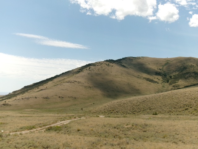
Mahogany Butte as viewed from the north. The beautiful, bare north ridge rises from the lower left to the summit (right of center). Livingston Douglas Photo
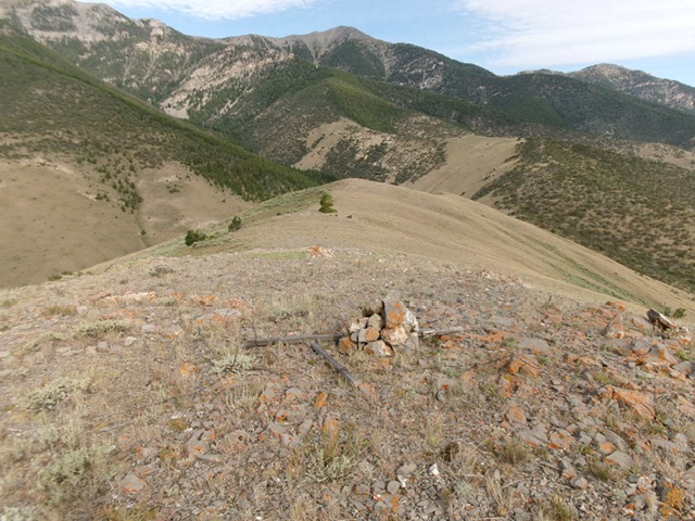
The open summit of Mahogany Butte. Livingston Douglas Photo
Additional Resources
Regions: EASTERN IDAHO->Lemhi Range
Mountain Range: Lemhi Range
Longitude: -122.9191 Latitude: 44.0021