Elevation: 3,942 ft
Prominence: 200
This butte is not in the book. Published October 2025
McKinney Butte is located northwest of Gooding in a remote section of the Snake River Plain. It is most easily reached via maintained county roads from ID-46 to the east. USGS McKinney Butte
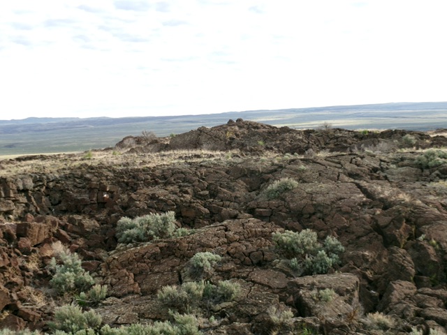
McKinney Butte as viewed from the spur road to its south-southeast. Livingston Douglas Photo
Access
From the intersection of ID-46 and US-26 at a traffic light in downtown Gooding, drive north on ID-46 for 5.9 miles to an unsigned junction with 1300S. Reset your odometer here. Drive west on well-maintained 1300S for 3.4 miles. Upon reaching a “T” junction, turn left/south and drive a final 0.5 miles to an unsigned junction with a 2-track BLM road heading right/west.Drive 1.7 miles west on this decent 2-track road as it does substantial weaving around to get to a weaker, rougher 2-track road (shown on maps) heading right/north at McKinney Butte. Drive 0.4 miles up this rocky, rutted spur road and park [3,387feet; 43°00’47.6”N and 114°48’51.3”W].
South Face/South Ridge, Class 2
The Climb
From the parking spot on the spur road, hike north up the spur road for about ½ mile. Leave the road and bushwhack northwest to reach the crater rim at Bray Benchmark. There is a cairn and pole here. The terrain to this point is easy field grass and scrub. From Bray Benchmark, descend into the crater and cross it. Scramble up Class 2 lava rock between the west-northwest tower (potential high point) and the easier northwest summit area (official summit). The actual high point is a bit farther north than the LOJ placement suggests. The northwest summit has two cairns atop it and is visually the high point of McKinney Butte.
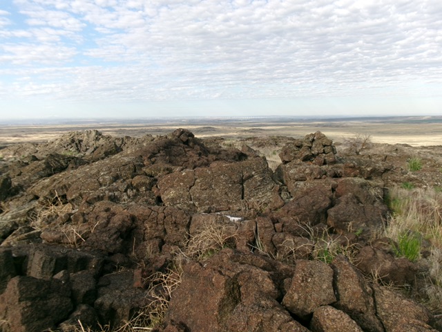
The summit of McKinney Butte as viewed from the west crater rim. Livingston Douglas Photo
The two summit cairns atop McKinney Butte. Livingston Douglas Photo
South Ridge/West Crater Rim, Class 3
The Descent
From the northwest summit, I decided to investigate the more rugged west-northwest tower on the crater rim to see if it is the actual high point. Scramble south along the west rim of the crater and drop off it onto easy grass. Scramble up the Class 3 west face of the west-northwest tower. I measured it and it is clearly lower than the northwest summit. From this tower, drop off the west rim into easy grass in the crater. Cross the bottom of the crater then re-climb close to Bray Benchmark. From there, descend southeast through sagebrush and field grass to intercept the rocky, 2-track spur road and follow it back to your parked vehicle.
Additional Resources