Elevation: 7,093 ft
Prominence: 303
This peak is not in the book. Published October 2025
Mollies Nipple is a rocky hump that is located on Sheep Mountain (7,451 feet) between Cranes Flat and Homer Valley in the foothills of the Caribou Mountains. It is most easily reached from Cranes Flat Road to its south. This area is a mix of private and public land, so be careful. This route crosses two sections of unposted private land. The summit is on unposted private land. USGS Long Valley
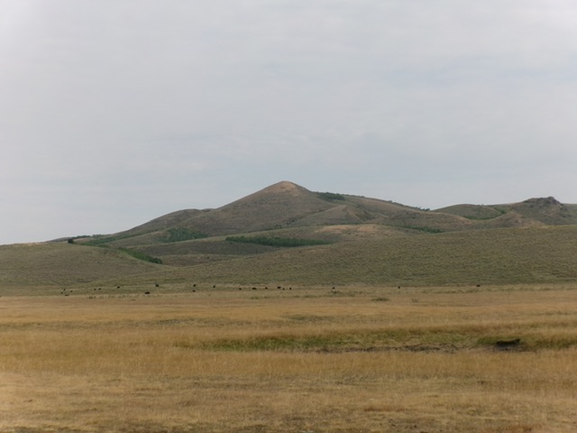
Mollies Nipple as viewed from the short grass in Cranes Flat to its south-southwest. Livingston Douglas Photo
Access
From Exit 116 (Sunnyside Road) on I-15 in Idaho Falls, drive east on Sunnyside Road to its end at a signed “T” junction with Bone Road. This junction is 9.1 miles east of Ammon Road. Turn right/south onto Bone Road and drive 8.5 miles south to a signed junction with Blackfoot Reservoir Road, 0.3 miles south of Bone. Turn right/west onto Blackfoot Reservoir Road.
The road quickly bends left/south and begins its journey to Blackfoot Reservoir. Drive 15.6 miles on Blackfoot Reservoir Road to a signed junction with Cranes Flat Road at Four Corners. Turn left/east onto Cranes Flat Road and drive 4.9 miles to the mouth of a wide gulch to the north (Cranes Flat). Park between two culverts here [6,465 feet; 43⁰06’12.8”N, 111⁰38’20.2”W].
Southwest Gully/Southwest Shoulder, Class 2
The Climb
From Cranes Flat Road, hike north in short field grass that has been mowed down by heavy cattle grazing in this area. You will probably encounter some bovines as you hike up wide, flattish Cranes Flat. Cross marshy, muddy Cranes Creek then skirt past the west side of Point 6610. Cross a cattle fence and bushwhack through sagebrush northward to reach the mouth of a prominent gully on the southwest side of [obvious] Mollies Nipple. You will cross a 2-track road at the mouth of the gully.
Hike northeast up the middle of this dry gully in almost-bare grass until the good terrain ends and the forest begins. Either continue east up the gully on a cattle trail into the forest and then up onto the south ridge (my descent route; the preferred way to go) or be foolish and leave the gully to bash north-northeast up through wickedly-thick sagebrush and other brush to reach the southwest shoulder. Once on the southwest shoulder, bushwhack up through more sagebrush (not as difficult) to reach much easier terrain high up and capture the rocky summit of Mollies Nipple. There is a large cairn on the small summit.
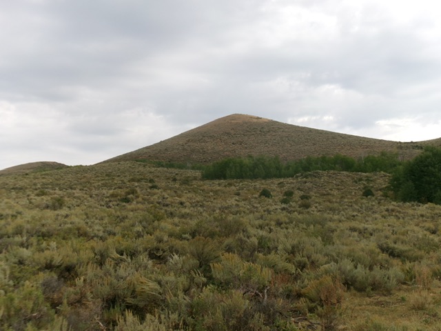
Mollies Nipple as viewed from the gully to its southwest. The southwest shoulder (my ascent route) is the skyline left of center. Livingston Douglas Photo
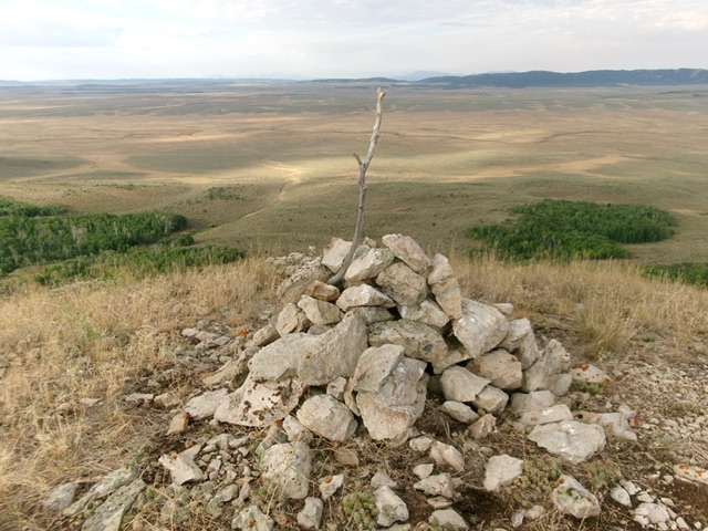
The large cairn atop Mollies Nipple, looking southwest down the ascent route. The critical southwest gully is left of center. Livingston Douglas Photo
South Ridge/Southwest Gully, Class 2
The Descent
From the summit, descend the less-thick scrub (with some game trails) on the south ridge. The ridge soon bends right-ish/southwest and has thicker sagebrush. Find a cattle/game trail here and enter the pine forest. Follow a good cattle trail through the forest and down into the southwest gully. Cruise west then southwest down the short grass in the center of the gully to reach the mouth of the gully and a road crossing. Bushwhack south through sagebrush then cross a cattle fence and continue south past the west side of Point 6610. Cruise south through the short grass of Cranes Flat to return to your parked vehicle along Cranes Flat Road.
Additional Resources
Regions: Caribou Range->SOUTHERN IDAHO
Mountain Range: Caribou Range
Longitude: -111.6319 Latitude: 43.1427