Elevation: 6,460 ft
Prominence: 120
This peak is not in the book. Published October 2025
Morning Glory Peak is a ridge bump on the long south ridge of Wallace Peak (8,780 feet). It sits above the west side of Salmon, Idaho and offers a magnificent view of the city. This area is a mix of private land and public land, so be careful. This climb is entirely on public land. USGS Salmon
Morning Glory Peak as viewed from the southeast. Livingston Douglas Photo
Access
From Salmon, Idaho, drive west on Fulton Street to 9th Street. Drive north on 9th Street to Roosevelt Avenue to its end at a water treatment facility. Go right/north onto a rocky, narrow 2-track road that follows the right/east side of the fenced enclosure of the water treatment facility. Drive 0.1 mile on this spur road to a parking area amongst several ATV trails just above this point. Park here [4,387 feet; 45°11’01.5”N, 113°55’44.0”W].
Map Updates
The USGS topo map fails to show all of the ATV trails in this area.
Northeast Face, Class 2
The Climb
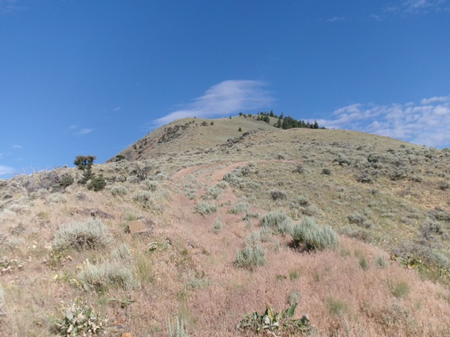
From the parking area, walk briefly east on the 2-track spur road to reach an ATV trail that goes steeply up a hill. Follow this ATV trail as it weaves its way north into an obvious gully that sits left/southwest of power lines that are on a ridge to the right. You could also head up that ridge immediately and follow the power lines. Continue up an ATV trail to reach a small saddle at the head of the dry gully This gully bends left/west as you head up it.
Follow a weak 2-track right/north to quickly reach the ridge crest and the power lines. Drop slightly north to quickly reach a BLM cattle guard/fence and a jeep road coming up from the north end of Salmon [this road goes down from here, crossing private land with BLM access, to reach Salmon]. Follow this good jeep road northwest as it follows a ridge crest that is separated from the southeast ridge of Morning Glory Peak by a large gully. The power lines soon cross that gully to climb the southeast ridge and the move off the ridge to its north side.
Continue hiking up the jeep road up to where the large gully ends. From here, leave the road and follow an unmapped, weak, steep 2-track up to the power lines. Once at the power lines, cross a 2-track road and scramble southwest directly up a slope of easy grass/veg to reach the summit ridge (the southeast ridge). Go right/northwest up the ridge and quickly reach the summit. The summit had a torn-down cairn so I rebuilt it. The summit offers a magnificent view of nearby Salmon, Idaho.
Southeast Ridge, Class 2
The Descent
From the summit, follow the rock-and-sagebrush ridge crest southeast then east. The ridge terrain is a tedious mix of rock and sagebrush. The ridge heads downward in open terrain to meet the power lines. Follow the power lines on an old, overgrown, rocky access road (not shown on maps). Leave the power lines as they are about to cross a deep gully. Descend left/north to quickly reach an ATV trail and follow it down the ridge.
This ATV trail becomes a foot trail and descends into a minor gully where the ridge ends. Continue east up a foot trail to quickly reach the saddle at the head of the original ascent gully. Descent an ATV trail back to the parking area. I am quite surprised that there is not an unofficial foot trail heading up the southeast ridge all the way to the summit.
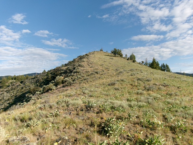
The summit hump of Morning Glory Peak as viewed from high on the southeast ridge. This was my descent route. Livingston Douglas Photo
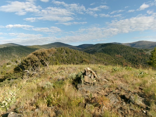
The summit of Morning Glory Peak with is newly-built summit cairn. Livingston Douglas Photo
Additional Resources
Mountain Range: Eastern Salmon River Mountains
Longitude: -113.9600 Latitude: 45.1902