Elevation: 9,085 ft
Prominence: 385
This peak is not in the book. Published October 2025
Moyer Peak is a ridgeline summit in a burnt area of the Eastern Salmon River Mountains. It can be easily approached on an old 2-track road that skirts its south side. Moyer Peak is a most uninspiring mess. USGS Taylor Mountain
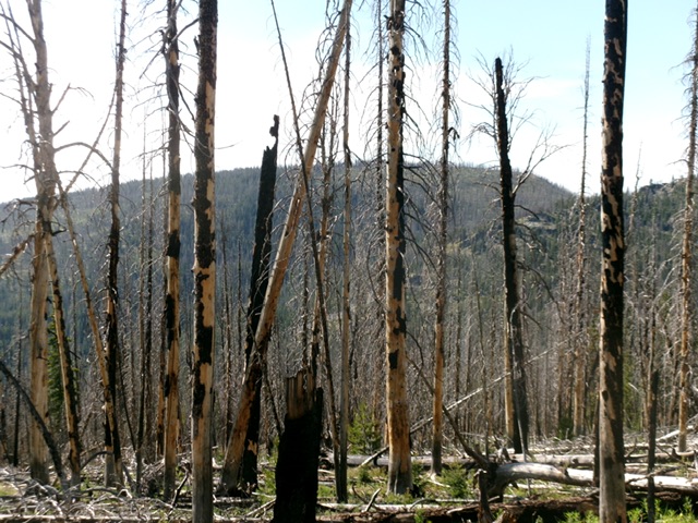
Moyer Peak (in center and left of center in distance) as viewed from FSR-020 to its south. Livingston Douglas Photo
Access
From US-93 about five miles south of Salmon, turn west onto Williams Creek Road (signed for Williams Lake) and drive 13.5 miles up this well-maintained county road to Williams Creek Summit. Reset your odometer here. From Williams Creek Summit, head south on FSR-020, a rocky ridge road. A sign here says “China Spring 7 miles; Iron Lake 19 miles.”
At 6.2 miles, reach a signed junction with Degan Mountain Road/FSR-045 (left). Continue straight on FSR-020. At 8.2 miles, reach an unsigned junction with FSR-025 (right). Continue straight on FSR-020. At 10.1 miles, reach a signed junction with FSR-099. Continue straight on FSR-020. At 13.9 miles, reach an unsigned junction (right). Park here [8,880 feet; 44°57’42.1”N, 114°11’45.4”W]. A massive fallen pine tree blocks any vehicles from driving on this side road.
East Ridge, Class 2
The Climb
From the road junction, follow the side road north as it skirts the left/west side of a ridge hump. The road then bends left/west and drops almost 200 feet to its low point at Saddle #1. The road then rises to skirt the right/north side of Point 8935 and drops slightly to Saddle #2. It then heads west up the left/south side of the east ridge of Moyer Peak and then bends left/southwest to continue past the peak’s south side.
Leave the road in the final area where it crests and bends left/southwest. Bushwhack right/northwest up through a steep burn area (not too bad) to reach a flattish, open summit area. There is no obvious bump as the USGS topo map suggests. I continued southwest to a forested area with a lots of deadfall because it appeared to be [possibly] higher. The open, non-forested eastern area seems to be the high point, as LOJ’s placement confirms. Moyer Peak is a hidden, charred, uninspiring ridge that is hard to see due to the endless standing snags.
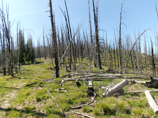
Looking up the east ridge of Moyer Peak. A burn area with lots of blowdown. This was my ascent route. Livingston Douglas Photo
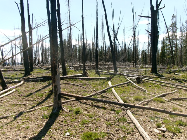
The charred, semi-open summit of Moyer Peak. The forested area in the distance (to the west) is slightly lower. Livingston Douglas Photo
Additional Resources
Mountain Range: Eastern Salmon River Mountains
Longitude: -114.2194 Latitude: 44.9721