Elevation: 8,124 ft
Prominence: 104
This peak is not in the book. Updated October 2025
Muldoon Ridge is a bump on the long south ridge of Scorpion Mountain (see Page 256 of the book). This ridgeline separates Muldoon Creek from Copper Creek. This area is a mix of private and public land, so be careful. Most of the private land is fenced and is rigorously posted. The East Rib Route is entirely on National Forest land. USGS Muldoon
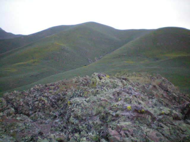
Muldoon Ridge (hump in dead center) as viewed from the summit of Smelter Butte. Livingston Douglas Photo
Access
Muldoon Creek Road/FSR-126 [(E)(1.1) on Page 261]. From Copper Creek Road, drive east then northeast up [unsigned] Muldoon Creek Road/FSR-126 for 2.4 miles to a minor pullout at the base of the east face of Muldoon Ridge. Park here [6,925 feet; 43°35’31.3”N, 113°53’11.3”W].
East Rib, Class 2
The Climb
From the improvised, rocky pullout, scramble diagonally southwest upward to skirt the east edge of the pine forest and stay in open scrub. Once on the south edge of the forest, you are now on the [obvious] east rib. Scramble west up a steep-ish ridge of scrub and gravel. The nearby pine forest soon ends but a few pines remain on the rounded ridge crest. The pines soon disappear entirely. Continue climbing westward up scrub with a gravel base.
Some weaving is required but nothing difficult. Higher up, the slope eases and the final push to the summit ridge is in firm, easy scrub. The high point is on a ridge bump and is obvious. The east rib tops out just right/north of the high point by less than 50 yards. The summit had no cairn so I built one. The summit offers a nice view of Scorpion Mountain to the north. There is a larger, wider rib to the south of my chosen one that you could also climb to reach the summit area.
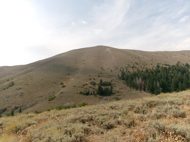
Muldoon Ridge (summit is in dead center) and its east rib (on the left edge of the pine forest). This was my ascent route. Livingston Douglas Photo
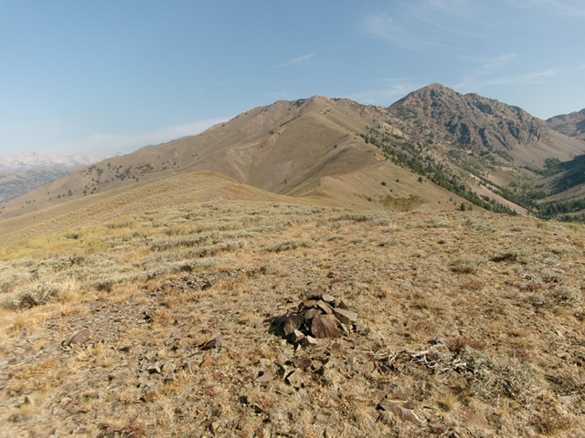
The open summit of Muldoon Ridge with Scorpion Mountain in the distance (right of center). Livingston Douglas Photo
Additional Resources
Regions: EASTERN IDAHO->Pioneer Mountains
Mountain Range: Pioneer Mountains
Longitude: -113.89519 Latitude: 43.59159