Elevation: 10,603 ft
Prominence: 768
Climbing and access information for this peak is on Page 300 of the book. The elevation and prominence figures are based on recent LiDAR updates. The USGS quad shows an elevation of 10,602 feet. Updated October 2025
Patterson Peak is the high point on a ridgeline located just east of Patterson Creek in the northern Lemhis. It sits just north of Annies Peak (10,289 feet) and just south of Peak 10482. The most direct line to the summit is up its east side. USGS Yellow Peak
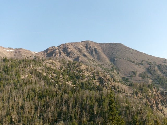
Patterson Peak as viewed from the southeast. Livingston Douglas Photo
Access
Patterson Creek Trail/FST-185 [(A)(9.1)(a) on Page 315]. This is the first leg of a 2-peak adventure that includes Patterson Peak and Peak 10482. It covers 7.5 miles with 3,420 feet of elevation gain round trip.
Southeast Spur/East Ridge, Class 3
The Ascent
Hike up Patterson Creek Trail for about 1-1/2 miles to find a talus slope on the right/west side of the trail. This spot is about 75-100 yards before reaching the crossing of a major feeder stream at 8,100 feet. Leave the trail and scramble west up the talus slope. Follow it up to the mouth of a dry gully. Leave the gully and climb right/north up the talus slope to reach the rounded, forested beginnings of the southeast spur ridge. It is a steep, loose scree/gravel scramble (Class 3) up into the pine forest.
Once in the pine forest, head left/west as the southeast spur gains definition. The bushwhack up this spur is steep and rocky in areas but, overall, is not bad. The ridge bends right-ish/northwest higher up. Scramble up a final, steep talus slope to reach Point 9862. You have now reached the juncture with the east ridge.
The pines are gone now. Scramble up a lengthy section of boulders and talus on the steep-ish east ridge. It is a rocky, blocky endeavor but it leads you directly to the gentle summit hump of Patterson Peak. I rebuilt the torn-down summit cairn. There is a lot of triangulation wiring and a few posts laying on the ground.

Patterson Peak and its rugged north face. Livingston Douglas Photo
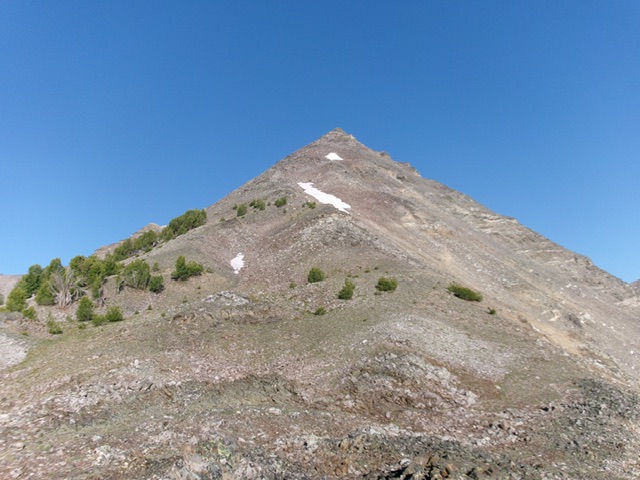
Looking up the upper east ridge from Point 9862. This was the upper leg of my ascent route. The summit is hiding behind the pyramidal-shaped point dead ahead. Livingston Douglas Photo
Northwest Ridge, Class 2
The Descent
From the summit, descend northwest on steep, loose boulders and talus (not fun) to reach a gentler, easier mix of talus and scree below. Cruise north-northwest across a tundra and talus/scree humped saddle area. This is the 10,140-foot connecting saddle with Peak 10482. It concludes the first leg of today’s 2-peak journey. Peak 10482 is up next.
Additional Resources
Regions: EASTERN IDAHO->Lemhi Range
Mountain Range: Lemhi Range
First Ascent Information:
- Other First Ascent: Southeast Spur/East Ridge
- Year: 2025
- Season: Summer
- Party: Livingston Douglas
Longitude: -113.61769 Latitude: 44.59649