Elevation: 10,020 ft
Prominence: 320
This peak is not in the book. Rick Baugher was the first person to record a climb of this peak. He suggested the name. Published October 2025
Peak 10020 is an overlooked, ranked summit that sits above the Left Fork Fall Creek and is due southeast of Rosencrance Peak (10,380 feet). It has some wicked, rocky cliffs on its south side that must be avoided. USGS Standhope Peak
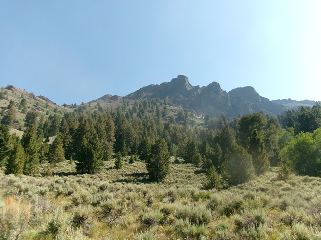
Peak 10020 (in distance in center) as viewed from the Highline Trail/FST-059. This rocky peak is an intimidating sight from here. Livingston Douglas Photo
Access
Fall Creek Trail/FST-045 [(C)(2)(a) on Page 260]
Map Errors
Maps fail to show a few long switchbacks in the Highline Trail early on.
South Face/Southeast Ridge, Class 3
The Ascent
Hike about two miles up the well-beaten Fall Creek Trail to a poorly-signed trail junction at a fork in the canyon, just after crossing the Left Fork Fall Creek on logs. Go left/east onto FST-059/Highline Trail. This trail follows the Left Fork Fall Creek. Unlike the Fall Creek Trail, the Highline Trail is a narrow, poorly-maintained, overgrown foot trail that is difficult to follow at times. Hike about 2-1/2 miles up the Highline Trail.
Leave the trail at the foot of a semi-open shoulder that heads left/north up toward Point 9970. This spot is just before the trail enters a large meadow. You could also continue into the meadow and climb up onto the aforementioned shoulder from there. Scramble north up the steep, but easy shoulder (with some areas of loose gravel). Find a game trail on the left/west side of the shoulder early on. This shoulder joins a larger shoulder to the right/east higher up. This larger shoulder ends at a talus/scree slope underneath Point 9970.
Your objective now is to reach a saddle to the left/west of Point 9970. This 9,780-foot saddle sits underneath the southeast face of Peak 10020. To reach the saddle, head diagonally left/northwest. But there is much steep, loose scree/gravel in this upward traverse to the saddle. From the top of the broad shoulder, scramble up and left to reach some rocky ribs/outcrops to retain some degree of footing in the otherwise very loose terrain. The best strategy is to get as high as possible early on and then contour northwest at the base of the summit cliffs on the southwest side of Point 9970.
Ironically, the minor gully crossings are on more stable scree than the face/minor shoulder areas. The scree/gravel is easier and more stable as you approach the saddle. Once on the forested saddle, bushwhack west up through easy pine forest (with gravel and blowdown too) to reach open, pure rock terrain higher up. Scramble up over an easy headwall and face the final push up the steep rock face to the top. The east ridge now becomes a series of pinnacles/towers to navigate over or around.
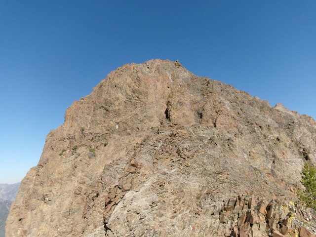
The final push up the steep, rocky east face is intimidating. But it is not as bad as it initially appears. Once at the base of the east face, scramble directly up a face section (just right of center). Avoid the left side of the face, which is impossibly steep and exposed. Head up a steep chute. This chute gets too steep and narrow. Thankfully, there is an easier side chute (to the right). Climb up this 8-10 foot chute (Class 3 with solid holds and no exposure) then head left/west from there. Climb up Class 2+/3 face rock from here. Stay to the right for the easiest going. You will quickly reach the cairned, rocky high point of Peak 10020. My route does not have the “ledge” or “overhanging” anything that the Baugher route (linked below) has.
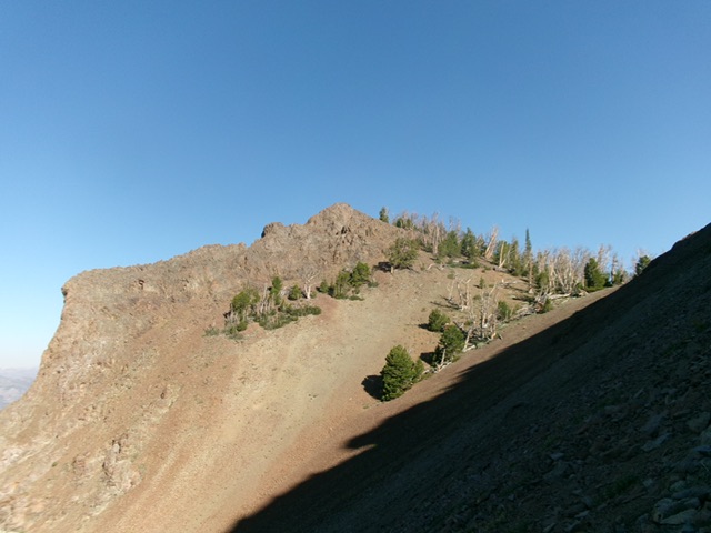
Peak 10020 and the critical ridge saddle (well right of center) as viewed from the southeast on the upward traverse on the south side of Point 9970. Livingston Douglas Photo
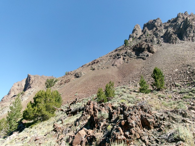
Looking at the crux of the climb: the upward traverse from the lower shoulder. Skirt past rocky Point 9970 (right of center) on angled, loose terrain to reach the high ridge saddle. Peak 10020 is at far left in the distance. Livingston Douglas Photo
The final push up the rocky east face to the summit. Livingston Douglas Photo
Northwest Ridge, Class 3
This route may be a much shorter, better option to reach the summit of Peak 10020 from the Highline Trail. I wish I had attempted to descend it to confirm its difficulty level. Leave the Highline Trail at an obvious, large gully that separates Peak 10020 from Point 9781 to its northwest. Scramble up reasonable terrain to a saddle at 9,700 feet. Scramble southeast up the narrow, rocky ridge crest to the summit. Based on my observations, this route should go at Class 3. It cuts about 1-1/2 miles off the round trip hiking distance.
Additional Resources
Regions: EASTERN IDAHO->Pioneer Mountains
Mountain Range: Pioneer Mountains
Longitude: -114.0172 Latitude: 43.8517