Elevation: 10,259 ft
Prominence: 195
Climbing and access information for this peak is on Page 173 of the book where it is identified as Mount Heyburn’s east summit. The elevation and prominence figures are based on recent LiDAR updates. Published November 2025
Mount Heyburn has three distinct high points: the West Pinnacle, the actual summit, and the east summit which is also known as the East Pinnacle. The east summit is of equal historical importance to its neighboring towers and, for a while, was thought to be the actual high point of Mount Heyburn. It is as impressive a granite tower as any found in the range. It is also it a prized climbing destination in its own right. There are two routes described in the book: the South Rib (Class II, 5.2) and the Northeast Ridge (Class 4). Undoubtedly, there are other routes and lines that will interest climbers. USGS Mount Cramer
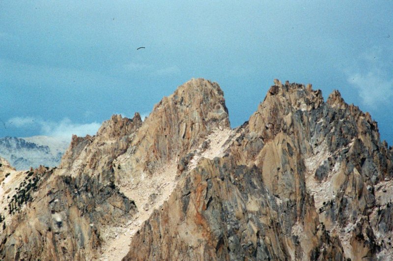
From left to right: the West Pinnacle, Mount Heyburn, and the East Pinnacle as viewed from the Grand Mogul.
Northeast Ridge Route Derek Photos and Commentary by Derek Percoski
While there is no doubt that the West Pinnacle is not as high as Mount Heyburn or the East Pinnacle the elevation difference between Mount Heyburn and the East Pinnacle is still at issue. In fact, they are so close in elevation that even LiDAR data which shows the East Pinnacle at only five inches lower is within the LiDAR margin of error. It’s going to take a GPS survey to end the dispute.

Midway up the northeast ridge, looking down at Redfish Lake. Derek Percoski Photo

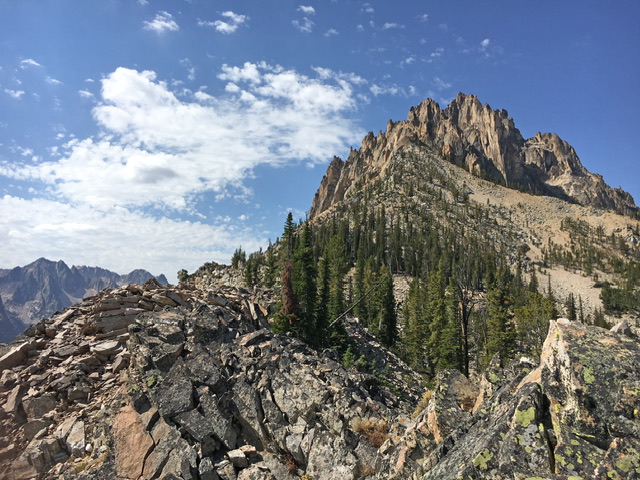
Saint Peters Pinnacle, as mentioned in the book. Derek Percoski Photo
[Editor’s Note: Although Saint Peter’s Pinnacle is an impressive formation, I have not found any reports of ascents.]
Following the upper sections of this route requires above-average route finding skills. In other words, a bit of luck. The route beta in the book is accurate but the terrain is complex and time consuming. Getting off route would be easy.
Looking up the northeast ridge to the summit. Derek Percoski Photo

East Pinnacle as viewed from Heyburn’s west summit. Derek Percoski Photo
Additional Resources
Regions: Heyburn Divide->Sawtooth Range->WESTERN IDAHO
Mountain Range: Sawtooth Range
Longitude: -114.9810 Latitude: 44.09106