Elevation: 10,332 ft
Prominence: 472
Climbing and access information for this peak is on Page 303 of the book. This peak is not named in the book. The name was suggested by Rick Baugher. The elevation and prominence figures are based on recent LiDAR updates. The USGS quad shows an elevation of 10,332 feet. Also see The Deer Creek Foursome by Livingston Douglas for additional information. Updated October 2025
Peak 10336 separates the West Fork of Deer Creek from the main fork. It can be climbed in combination with nearby Smithie Peak (10,263 feet) or Peak 10177. USGS Gilmore

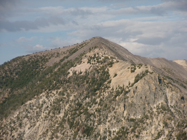
Peak 10336 and its rugged north face. Livingston Douglas Photo
Access
Same as for Negro Peak (10,573 feet). This is the third leg of a 4-peak adventure that includes Negro Peak, Smithie Peak(10,263 feet), Peak 10336, and Peak 10177. It covers 11.5 miles with 4,600 feet of elevation gain round trip.
Map Errors
The USGS topo map fails to show the old road (now a foot trail) that continues up Deer Creek well past the two old cabins where the jeep/ATV trail ends at about 8,360 feet.
Northwest Ridge, Class 2
The Climb
From the 9,859-foot connecting saddle with Smithie Peak, scramble southeast in a mix of ridge pines and rock to reach a left/east-southeast bend in the ridge high up. Scramble across open talus/scree and easy tundra to reach the forested summit of Peak 10336. The cairned high point is at the east end, a ridge corner in an open spot.
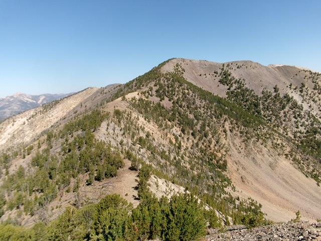
Peak 10336 as viewed from the northeast. Livingston Douglas Photo
Peak 10336 and its southeast ridge (left of center). This was my descent route. Livingston Douglas Photo
Southeast Ridge, Class 2
The Descent
From the summit, descend south then southeast in a mix of rock and pines to reach a small, semi-forested connecting saddle with Peak 10177. This 9,860-foot saddle concludes the third leg of today’s 4-peak journey. Peak 10177 is up next.
Additional Resources
Regions: EASTERN IDAHO->Lemhi Range
Mountain Range: Lemhi Range
Longitude: -113.36011 Latitude: 44.46309