Elevation: 10,428 ft
Prominence: 304
This peak is not in the book. Published October 2025
Thanks to recent LiDAR updates, Peak 10428 is now a ranked summit. It sits southwest of Slate Roof Peak and northwest of magnificent, rocky Yellow Peak (10,971 feet). Peak 10428 is most easily climbed in combination with nearby Slate Roof Peak. USGS Yellow Peak
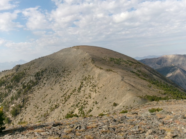
Peak 10428 as viewed from the northeast. The northeast ridge (diagonal in center) was my ascent route. Livingston Douglas Photo
Access
Middle Fork Little Timber Creek Trail/FST-187 [(A)(8.2)(a) on Page 314]. This is the second leg of a 2-peak adventure that includes Slate Roof Peak (10,519 feet) and Peak 10428. It covers 12.0 miles with 3,275 feet of elevation gain round trip.
Map Errors
The USGS topo map fails to show the very useful FST-183-02 which traverses the south face of Slate Roof Peak and crosses the southwest ridge. The National Forest map mis-positions FST-183-02; the trail does NOT initially drop into a valley on the north side of Yellow Peak.
Northeast Ridge, Class 2
The Climb
From the 10,140-foot connecting saddle with Slate Roof Peak (10,519 feet), scramble south-southwest up an easy, open rock ridge. Skirt the right/west side of a few rocky outcrops early on. The ridge terrain is mostly embedded talus/scree and, higher up, is a mix of tundra and embedded scree/gravel. It goes quickly. The high point of Peak 10428 has a small cairn and sits in the middle of a large, bare summit hump. There is a large cairn at a lower spot to the northeast of the high point. Not sure why it’s there.
From the summit, descend back to the 10,140-foot connecting saddle with Slate Roof Peak and follow the South Face Route of Slate Roof Peak to return to FST-187/Middle Fork Little Timber Creek Trail.

Slate Roof Peak (left) and Peak 10428 (right) in mid-ground as viewed from “U” Mountain to the north. Livingston Douglas Photo
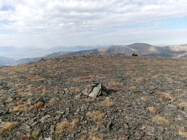
The bare summit and small cairn atop Peak 10428. Livingston Douglas Photo
Additional Resources
Regions: EASTERN IDAHO->Lemhi Range
Mountain Range: Lemhi Range
Longitude: -113.54942 Latitude: 44.53568